Kenwick, Western Australia
| Kenwick Perth, Western Australia | |||||||||||||
|---|---|---|---|---|---|---|---|---|---|---|---|---|---|
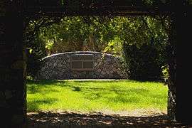 Memorial at Kenwick Pioneer Cemetery | |||||||||||||
 Kenwick | |||||||||||||
| Coordinates | 32°01′44″S 115°58′55″E / 32.029°S 115.982°ECoordinates: 32°01′44″S 115°58′55″E / 32.029°S 115.982°E | ||||||||||||
| Population | 5,147 (2006 census)[1] | ||||||||||||
| • Density | 525.2/km2 (1,360/sq mi) | ||||||||||||
| Postcode(s) | 6107 | ||||||||||||
| Area | 9.8 km2 (3.8 sq mi) | ||||||||||||
| Location | 18 km (11 mi) from Perth, Western Australia | ||||||||||||
| LGA(s) | City of Gosnells | ||||||||||||
| State electorate(s) | Forrestfield | ||||||||||||
| Federal Division(s) | Swan | ||||||||||||
| |||||||||||||
Kenwick, Western Australia is a mixed residential, light industrial and semi-rural suburb located in the south-east of Perth, Western Australia, located within the City of Gosnells. A large portion of the suburb is composed of remnant agricultural land organized as smallholdings of several acres, as well as relatively pristine native wetlands, including the Brixton Street Wetlands which are of significant conservation value. It also contains several sites of historical significance relating to its status as one of the early farming communities of the Swan River Colony.
Kenwick is bounded on the south-west by the Canning River and on the north-west by the Roe Highway. Albany Highway, the main south-east arterial transport route, runs through the western part of the suburb.
Amenities
Historic sites
Commercial and retail
Kenwick contains a small local shopping centre in the main residential area, a mixed retail and commercial centre at the major highway intersection adjacent to the railway station, and numerous light industrial businesses located along Albany Highway.
Sporting and community
Lawn bowls, tennis courts, a skate park, a library and community centre, and an oval for cricket and football are all available for community usage. A significant sporting complex incorporating most of these activities is located at Mills Park in the north-west of the suburb.
Schools
- East Kenwick Primary School [4]
- Kenwick School [4]
- Rehoboth Christian College [5]
See also
References
- ↑ Australian Bureau of Statistics (25 October 2007). "Kenwick (State Suburb)". 2006 Census QuickStats. Retrieved 2008-10-05.
- ↑ City of Gosnells. Kenwick Pioneer Cemetery Retrieved 19 August 2009.
- ↑ City of Gosnells. Liddelow Homestead Retrieved 19 August 2009.
- 1 2 ALPHABETICAL LISTING OF WESTERN AUSTRALIAN SCHOOLS BY EDUCATION DISTRICT Retrieved 19 August 2009.
- ↑ Rehoboth Christian College Retrieved 19 August 2009.