Kale, Žalec
| Kale | |
|---|---|
 | |
 Kale Location in Slovenia | |
| Coordinates: 46°18′11.3″N 15°7′42.22″E / 46.303139°N 15.1283944°ECoordinates: 46°18′11.3″N 15°7′42.22″E / 46.303139°N 15.1283944°E | |
| Country |
|
| Traditional region | Styria |
| Statistical region | Savinja |
| Municipality | Žalec |
| Area | |
| • Total | 2.68 km2 (1.03 sq mi) |
| Elevation | 448.4 m (1,471.1 ft) |
| Population (2002) | |
| • Total | 168 |
| [1] | |
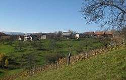
Kale (pronounced [ˈkaːlɛ]) is a village in the Municipality of Žalec in east-central Slovenia. It lies in the Ložnica Hills (Slovene: Ložniško gričevje) north of Šempeter v Savinjski Dolini. The area is part of the traditional region of Styria. The municipality is now included in the Savinja Statistical Region.[2]
A small chapel-shrine in the settlement dates to the late 19th century.[3]
References
External links
| Settlements | Administrative centre: Žalec
|  | ||||||
|---|---|---|---|---|---|---|---|---|
| Landmarks | ||||||||
This article is issued from Wikipedia - version of the 11/10/2016. The text is available under the Creative Commons Attribution/Share Alike but additional terms may apply for the media files.