Jurubatiba Sandbank National Park
| Jurubatiba Sandbank National Park | |
|---|---|
| Parque Nacional da Restinga de Jurubatiba | |
|
IUCN category II (national park) | |
|
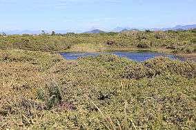
Park in 2014 | |
 | |
| Nearest city | Campos dos Goytacazes, Rio de Janeiro |
| Coordinates | 22°12′04″S 41°29′35″W / 22.201°S 41.493°WCoordinates: 22°12′04″S 41°29′35″W / 22.201°S 41.493°W |
| Designation | National park |
| Created | 29 July 1998 |
| Administrator | ICMBio |
The Jurubatiba Sandbank National Park (Portuguese: Parque Nacional da Restinga de Jurubatiba) is a national park in the Brazilian state of Rio de Janeiro. The park has approximately 44 kilometres of sandbank coast.
History
The park was created on 29 July 1998. It spreads along the coast of Quissamã, Carapebus and Macaé municipalities. More than 60% of its area are inside the Quissamã municipality, around 30% inside Carapebus and the rest in Macaé.
Geography
Area: 148.6 km²
Notes
External links
| Wikimedia Commons has media related to Jurubatiba Sandbank National Park. |
- Jurubatiba Localization Map
- Project Sustainable Jurubatiba - Photos
- Quissamã Municipality - Jurubatiba's Photo Gallery
This article is issued from Wikipedia - version of the 11/19/2016. The text is available under the Creative Commons Attribution/Share Alike but additional terms may apply for the media files.