Jermuk
| Jermuk Ջերմուկ | ||
|---|---|---|
|
From top left: Jermuk skyline • Arpa River Spa resorts • Jermuk Forest Sanctuary Jermuk ropeway • Jermuk Waterfall Panoramic view of Jermuk | ||
| ||
 Jermuk Ջերմուկ | ||
| Coordinates: 39°50′30″N 45°40′20″E / 39.84167°N 45.67222°ECoordinates: 39°50′30″N 45°40′20″E / 39.84167°N 45.67222°E | ||
| Country |
| |
| Marz | Vayots Dzor | |
| First mentioned | 13th century | |
| Government | ||
| • Mayor | Vartan Hovhannisyan | |
| Area | ||
| • Total | 5 km2 (2 sq mi) | |
| Elevation | 2,080 m (6,820 ft) | |
| Population (2011 census) | ||
| • Total | 4,628 | |
| • Density | 930/km2 (2,400/sq mi) | |
| Time zone | GMT +4 (UTC+4) | |
| Website | Official web | |
| Population:[1] | ||


Jermuk (Armenian: Ջերմուկ) is a mountain spa town in the southern Armenian province of Vayots Dzor Province, 53 km east of the provincial capital Yeghegnadzor. It was a popular destination during the Soviet era and nowadays is still famous for its hot springs and mineral water brands bottled in the town. It is attractive for its fresh air, waterfalls, artificial lakes, walking trails, the surrounding forests and mineral water pools. The town is being redeveloped to become a modern centre of tourism and health services. Jermuk is also being set up to become a major Chess centre, with numerous chess international tournaments scheduled in the town.[2]
As of the 2011 census, the population of the town is 4,628. The nearby village of Kechut (pop. 1,083) is also part of the municipality (community) of Jermuk.
Etymology
The name of the town is derived from the Armenian word of "jermuk" (ջերմուկ) or "jermook", in Western Armenian "chermoug" meaning "warm mineral spring", first mentioned during the 13th century by historian Stepanos Orbelian in his work "History of the Province of Sisakan".
History

Jermuk occupies an area which is historically considered as part of the Vayots Dzor canton of the Syunik province of Ancient Armenia. It was first mentioned during the 13th century by historian Stepanos Orbelian in his work "History of the Province of Sisakan". The remains of an ancient cyclopean fortress and the ruins of an 8th-century basilica testify that the region around the fountains of Jermuk has been settled long before the 13th century.[3] The area of Jermuk has been ruled by the Siunia dynasty between the 10th and 13th centuries, when Vayots Dzor was part of the Kingdom of Syunik. The princes of Syunik regarded the mineral springs of Jermuk as healing and built several pools filled with it, thereby making the little town their holiday destination. During the Middle Ages, the Silk Road passed through the area of Vayots Dzor, particularly the road that currently links the town of Martuni with Yeghegnadzor to the northwest of Jermuk.
However, the period between the 15th and 17th centuries is considered to be the darkest period in the history of Vayots Dzor. The region became a frequent battlefield between the invading troops of the Turkic and Iranian tribes. As a result, many significant monuments and prosperous villages were destroyed and the population was displaced.

During the 1st half of the 19the century, Jermuk became part of the Sharur-Daralagezsky Uyezd of the Erivan Governorate of the Russian Empire. Under the Russian rule, the town of Jermuk witnessed a significant growth and development. During the 1830s, the Russian geologist G. Voskoboynikov arrived in Armenia and began explorations on Jermuk's geographical depth as well as the contents and characteristics of Jermuk waters. His observations on Jermuk were published in the "Mountain Magazine" journal in 1831, and later in 1855, in the "Caucasian Calenda" magazine. Voskoboynikov’s works were the first scientific talks on Jermuk.
In 1860s, all the historic pools of Jermuk built by the Orbelian princes of Syunik were renovated by "Gevorg Khanagyan", following a resolution by the Russian government. Today, those baths which are called "Pristav Pools" and preserved as historical monuments.
.jpg)
Between 1918 and 1920 Jermuk was included in the short-lived Republic of Armenia. After the Sovietization of Armenia, Jermuk and the surrounding territories became one of the regions that resisted against the Soviet rule and formed the unrecognized Republic of Mountainous Armenia under the leadership of Garegin Nzhdeh. However, after falling to the Bolsheviks in July 1921, Jermuk became part of the Armenian SSR.
The first development plan of the town was introduced in 1940, when the first sanatorium was opened to the public, thus setting for the fertile activity of the Jermuk health resort centre. Development programmes were implemented to turn Jermuk into a modern resort for all Soviet nationals. In 1980 the population of Jermuk reached 10,000. After the collapse of the Soviet Union and as a result of the economic crisis in Armenia during the 1990s, the population had dropped to 7,000 in the beginning of the 21st century. However, starting from 2000, the Armenian authorities took steps in order to further develop the Jermuk town-resort including the nearby village of Kechut and the defunct airfield of Jermuk. As a result of the new resolutions, the town has witnessed unprecedented success as a tourist destination.
Geography and climate
.jpg)
The town is located at a height of 2080 meters above sea level, within the mountains of Vayots Dzor, among thick forests, on a plateau divided into two parts by the gorge of Arpa River, 170 km south-east of Yerevan. The town is dominated by the Vardenis mountains fro the north and the Vayk range from the south. The height of the surrounding mountains ranges between 2500 and 3500 meters, all covered with forests and alpine meadows.
The forests of Jermuk are rich with oak and hornbeam trees, as well as with dog rose, wild pear, plum and juniper plants. Animals like foxes, rabbits, badgers and bears could be found there.
However, the town is mainly famous with its hot springs (geysers). Its name itself is derived from this fact, as the word "jermuk" means "geyser" in the Armenian language. The waterfall of Jermuk on Arpa river has a height of 70 meters.
The town is characterized with alpine climate providing mild weather during the summers with cold and snowy climate during the long-lasting winters. The annual precipitation level is 800 mm (31.50 in).
| Climate data for Jermuk | |||||||||||||
|---|---|---|---|---|---|---|---|---|---|---|---|---|---|
| Month | Jan | Feb | Mar | Apr | May | Jun | Jul | Aug | Sep | Oct | Nov | Dec | Year |
| Average high °C (°F) | −2.5 (27.5) |
−1.7 (28.9) |
2.0 (35.6) |
7.1 (44.8) |
13.4 (56.1) |
17.7 (63.9) |
21.6 (70.9) |
22.9 (73.2) |
19.3 (66.7) |
13.4 (56.1) |
5.6 (42.1) |
0.4 (32.7) |
9.9 (49.8) |
| Average low °C (°F) | −12.1 (10.2) |
−11.5 (11.3) |
−7.4 (18.7) |
−1.4 (29.5) |
3.0 (37.4) |
5.7 (42.3) |
8.7 (47.7) |
8.8 (47.8) |
5.2 (41.4) |
1.9 (35.4) |
−3.9 (25) |
−8.6 (16.5) |
−1.0 (30.2) |
| Average rainfall mm (inches) | 64 (2.52) |
74 (2.91) |
83 (3.27) |
103 (4.06) |
97 (3.82) |
71 (2.8) |
42 (1.65) |
26 (1.02) |
24 (0.94) |
65 (2.56) |
63 (2.48) |
67 (2.64) |
779 (30.67) |
| Average rainy days | 13.1 | 13.4 | 15.7 | 16.2 | 17.9 | 12.9 | 7.7 | 5.8 | 5.8 | 9.6 | 10.1 | 12.3 | 140.5 |
| Source: World Meteorological Organization[4] | |||||||||||||
Demographics

Until 1988, the town had a small Azerbaijani community among a majority of Armenians. However, after the breakout of the Nagorno-Karabakh War in 1988-1989, the Azeris of the town left for Azerbaijan. Simultaneously, the town received 1,154 Armenian refugees from Azerbaijan, mainly escaping the Sumgait massacres.
Here is the population timeline of Jermuk since 1959:
| Year | 1959 | 1968 | 1980 | 1989 | 2001 | 2011 |
|---|---|---|---|---|---|---|
| Population | 2,063 | 3,700 | 5,492 | 9,014 | 5,394 | 4,628 |
Currently, the town is almost entirely populated by ethnic Armenians who belong to the Armenian Apostolic Church. The regulating body of the church is the Diocese of Vayots Dzor, seated in Yeghegnadzor. The church of Surp Gayane opened in 2007 is the town's church.
Transportation
Jermuk is connected with the M-2 Motorway through the regional H-42 Road.
The town has a small airstrip at its southern edge, near the Kechut Reservoir.
Economy

.jpg)
Industry
The natural water bottling industry has its deep roots in the town as the first factory was founded in 1951. Nowadays, Jermuk is home to many giant factories which produce bottled mineral water. The sparkling water of Jermuk is largely exported to markets around the world.
The main water producers of Jermuk are the Jermuk Mineral Water Factory founded in 1951 and the Jermuk Group company founded in 1999.
Tourism
Another key sector in the economy of Jermuk is tourism. The town is home to several high-quality health resorts and spas, and is one of the main touristic destinations for those who visit Armenia. Visitors could enjoy the beautiful nature of Jermuk and the mountains of Vayots Dzor (3000 meters), the waterfalls, the curing water pools, hotels and health spas, sanatoriums, the ropeway and alpine sports facilities. It is considered the centre of medical tourism in Armenia.
Gndevank Monastery dating back to the 10th century, is one of the most attractive nearby destinations. It is located just 10 km west of Jermuk.
The town is home to more than 10 high-quality resorts and sanatoriums, including:
- Hyatt Place Jermuk,
- Olympia Sanatorium,
- Jermuk Armenia Resort & Spa,
- Ararat Hotel Jemruk,
- Nairi Hotel & Sanatorium,
- Jermuk Ashkharh Hotel & Spa,
- Jermuk Moscow Health Resort,
- Gladzor Hotel & Spa,
- Yeghnik Hotel & Spa,
- Jermuk Resort & Spa,
- Verona Resort,
- Hotel Anush.
Sport
During the month of August of each year, Jemruk hosts the FIDE Grand Prix Jermuk chess tournament.
Sister cities
-
 Saint-Raphaël, France, since 1997.
 -
 Shchuchinsk, Kazakhstan
Gallery
- Jermuk
-

Nagorno-Karabakh War memorial
-

Spa resort in Jermuk
-

Mineral water gallery and sanatorium of Jermuk
-
.jpg)
Square with bus stop in the city center
-
.jpg)
Statue in the park
References
- ↑ Vayots Dzor
- ↑ Jermuk economy
- ↑ "Jermuk Group: Jermuk city".
- ↑ "World Weather Information Service – Jermuk". World Meteorological Organization. Retrieved 24 September 2016.
External links
| Wikivoyage has a travel guide for Jermuk. |
| Wikimedia Commons has media related to Jermuk. |
- Jermuk article on Armeniapedia
- Jermuk guide on Haykland
- Jermuk FIDE Grand Prix 2009
- Jarmuk Ashkhar resort
- Jermuk Armenia resort
- Jermuk Moscow health resort
- VisitArm.com - All hotels and resorts in Jermuk
- Jermuk
Capital: Yeghegnadzor | ||
| Towns | 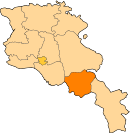 | |
| Villages |
| |
| Non-community villages | ||
| Former villages | ||

