Jennings Township, Crawford County, Indiana
| Jennings Township | |
|---|---|
| Township | |
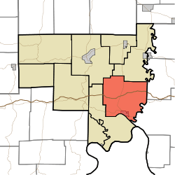 Location of Jennings Township in Crawford County | |
| Coordinates: 38°14′06″N 86°21′04″W / 38.23500°N 86.35111°WCoordinates: 38°14′06″N 86°21′04″W / 38.23500°N 86.35111°W | |
| Country | United States |
| State | Indiana |
| County | Crawford |
| Government | |
| • Type | Indiana township |
| Area | |
| • Total | 45.12 sq mi (116.9 km2) |
| • Land | 44.92 sq mi (116.3 km2) |
| • Water | 0.2 sq mi (0.5 km2) |
| Elevation[1] | 748 ft (228 m) |
| Population (2010) | |
| • Total | 1,436 |
| • Density | 32/sq mi (12/km2) |
| FIPS code | 18-38394[2] |
| GNIS feature ID | 453506 |
Jennings Township is one of nine townships in Crawford County, Indiana. As of the 2010 census, its population was 1,436 and it contained 676 housing units.[3]
Geography
According to the 2010 census, the township has a total area of 45.12 square miles (116.9 km2), of which 44.92 square miles (116.3 km2) (or 99.56%) is land and 0.2 square miles (0.52 km2) (or 0.44%) is water.[3] Spring Lake is in this township.
Cities and towns
Unincorporated towns
(This list is based on USGS data and may include former settlements.)
Adjacent townships
- Whiskey Run Township (northeast)
- Harrison Township, Harrison County (east)
- Spencer Township, Harrison County (east)
- Ohio Township (southwest)
- Sterling Township (northwest)
Major highways
Cemeteries
The township contains three cemeteries: Everton, Leavenworth Memorial Garden and Old Leavenworth.
References
- "Jennings Township, Crawford County, Indiana". Geographic Names Information System. United States Geological Survey. Retrieved 2009-09-24.
- United States Census Bureau cartographic boundary files
- ↑ "US Board on Geographic Names". United States Geological Survey. 2007-10-25. Retrieved 2008-01-31.
- ↑ "American FactFinder". United States Census Bureau. Retrieved 2008-01-31.
- 1 2 "Population, Housing Units, Area, and Density: 2010 - County -- County Subdivision and Place -- 2010 Census Summary File 1". United States Census. Retrieved 2013-05-10.
External links
Municipalities and communities of Crawford County, Indiana, United States | ||
|---|---|---|
| Towns | ||
| Townships | ||
| Unincorporated communities | ||
| Footnotes | ‡This populated place also has portions in an adjacent county or counties | |
This article is issued from Wikipedia - version of the 7/29/2014. The text is available under the Creative Commons Attribution/Share Alike but additional terms may apply for the media files.