Jarčja Dolina
| Jarčja Dolina | |
|---|---|
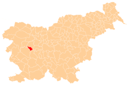
 Jarčja Dolina Location in Slovenia | |
| Coordinates: 46°3′53.08″N 14°4′31.47″E / 46.0647444°N 14.0754083°ECoordinates: 46°3′53.08″N 14°4′31.47″E / 46.0647444°N 14.0754083°E | |
| Country |
|
| Traditional region | Upper Carniola |
| Statistical region | Upper Carniola |
| Municipality | Žiri |
| Area | |
| • Total | 2.46 km2 (0.95 sq mi) |
| Elevation | 687 m (2,254 ft) |
| Population (2002) | |
| • Total | 72 |
| [1] | |
Jarčja Dolina (pronounced [ˈjaːɾtʃa dɔˈliːna]) is a dispersed settlement in a small valley west of Selo in the Municipality of Žiri in the Upper Carniola region of Slovenia.[2] Rupe, in the eastern part of the settlement, was formerly an independent settlement known as Rupe pri Selu.[3][4]
References
- ↑ Statistical Office of the Republic of Slovenia
- ↑ Žiri municipal site
- ↑ Snoj, Marko. 2009. Etimološki slovar slovenskih zemljepisnih imen. Ljubljana: Modrijan and Založba ZRC, p. 363.
- ↑ Leben Seljak, Petra. 2007. "Zgodovina hiš v Jarčji Dolini." Žirovski občasnik 29(37): 59–124. (Slovene)
External links
| Settlements | Administrative centre: Žiri
|  | ||||||
|---|---|---|---|---|---|---|---|---|
| Landmarks |
| |||||||
| Notable people | ||||||||
This article is issued from Wikipedia - version of the 11/20/2016. The text is available under the Creative Commons Attribution/Share Alike but additional terms may apply for the media files.