Isle, Minnesota
| Isle, Minnesota | |
|---|---|
| City | |
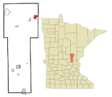 Location of Isle within Mille Lacs County | |
| Coordinates: 46°8′26″N 93°28′0″W / 46.14056°N 93.46667°W | |
| Country | United States |
| State | Minnesota |
| County | Mille Lacs |
| Area[1] | |
| • Total | 2.55 sq mi (6.60 km2) |
| • Land | 2.12 sq mi (5.49 km2) |
| • Water | 0.43 sq mi (1.11 km2) |
| Elevation | 1,276 ft (389 m) |
| Population (2010)[2] | |
| • Total | 751 |
| • Estimate (2012[3]) | 745 |
| • Density | 354.2/sq mi (136.8/km2) |
| Time zone | Central (CST) (UTC-6) |
| • Summer (DST) | CDT (UTC-5) |
| ZIP code | 56342 |
| Area code(s) | 320 |
| FIPS code | 27-31472[4] |
| GNIS feature ID | 0645530[5] |
Isle is a city in Mille Lacs County, Minnesota, United States. The population was 751 at the 2010 census.[6]
History
A post office called Isle has been in operation since 1896.[7] The city was named for the island near its harbor on Mille Lacs Lake.[8]
Geography
According to the United States Census Bureau, the city has a total area of 2.55 square miles (6.60 km2), of which 2.12 square miles (5.49 km2) is land and 0.43 square miles (1.11 km2) is water.[1]
Locally known as the "walleye capital of the world", because of its location on the southeastern shore of Mille Lacs Lake.
Minnesota Highway 27 and Minnesota Highway 47 are two of the main routes in the community.
Demographics
| Historical population | |||
|---|---|---|---|
| Census | Pop. | %± | |
| 1920 | 328 | — | |
| 1930 | 523 | 59.5% | |
| 1940 | 567 | 8.4% | |
| 1950 | 674 | 18.9% | |
| 1960 | 529 | −21.5% | |
| 1970 | 551 | 4.2% | |
| 1980 | 573 | 4.0% | |
| 1990 | 566 | −1.2% | |
| 2000 | 707 | 24.9% | |
| 2010 | 751 | 6.2% | |
| Est. 2015 | 788 | [9] | 4.9% |
2010 census
As of the census[2] of 2010, there were 751 people, 352 households, and 195 families residing in the city. The population density was 354.2 inhabitants per square mile (136.8/km2). There were 501 housing units at an average density of 236.3 per square mile (91.2/km2). The racial makeup of the city was 73.8% White, 22.6% Native American, 0.1% Asian, 0.8% from other races, and 2.7% from two or more races. Hispanic or Latino of any race were 3.1% of the population.
There were 352 households of which 23.9% had children under the age of 18 living with them, 39.5% were married couples living together, 11.1% had a female householder with no husband present, 4.8% had a male householder with no wife present, and 44.6% were non-families. 39.2% of all households were made up of individuals and 21.6% had someone living alone who was 65 years of age or older. The average household size was 2.13 and the average family size was 2.84.
The median age in the city was 47.5 years. 23.4% of residents were under the age of 18; 4.7% were between the ages of 18 and 24; 20% were from 25 to 44; 23.9% were from 45 to 64; and 28.2% were 65 years of age or older. The gender makeup of the city was 45.5% male and 54.5% female.
2000 census
As of the census[4] of 2000, there were 707 people, 323 households, and 198 families residing in the city. The population density was 336.0 people per square mile (130.0/km²). There were 414 housing units at an average density of 196.8 per square mile (76.1/km²). The racial makeup of the city was 87.13% White, 11.74% Native American, 0.14% Asian, and 0.99% from two or more races. Hispanic or Latino of any race were 0.42% of the population.
There were 323 households out of which 23.2% had children under the age of 18 living with them, 46.4% were married couples living together, 10.5% had a female householder with no husband present, and 38.4% were non-families. 35.3% of all households were made up of individuals and 21.1% had someone living alone who was 65 years of age or older. The average household size was 2.19 and the average family size was 2.81.
In the city the population was spread out with 22.2% under the age of 18, 7.4% from 18 to 24, 21.4% from 25 to 44, 24.2% from 45 to 64, and 24.9% who were 65 years of age or older. The median age was 44 years. For every 100 females there were 91.6 males. For every 100 females age 18 and over, there were 87.1 males.
The median income for a household in the city was $32,375, and the median income for a family was $37,250. Males had a median income of $27,083 versus $21,731 for females. The per capita income for the city was $19,609. About 3.2% of families and 5.6% of the population were below the poverty line, including 2.8% of those under age 18 and 9.4% of those age 65 or over.
References
- 1 2 "US Gazetteer files 2010". United States Census Bureau. Retrieved 2012-11-13.
- 1 2 "American FactFinder". United States Census Bureau. Retrieved 2012-11-13.
- ↑ "Population Estimates". United States Census Bureau. Retrieved 2013-05-28.
- 1 2 "American FactFinder". United States Census Bureau. Retrieved 2008-01-31.
- ↑ "US Board on Geographic Names". United States Geological Survey. 2007-10-25. Retrieved 2008-01-31.
- ↑ "2010 Census Redistricting Data (Public Law 94-171) Summary File". American FactFinder. U.S. Census Bureau, 2010 Census. Retrieved 23 April 2011.
- ↑ "Mille Lacs County". Jim Forte Postal History. Retrieved 21 July 2015.
- ↑ Upham, Warren (1920). Minnesota Geographic Names: Their Origin and Historic Significance. Minnesota Historical Society. p. 344.
- ↑ "Annual Estimates of the Resident Population for Incorporated Places: April 1, 2010 to July 1, 2015". Retrieved July 2, 2016.
- ↑ "Census of Population and Housing". Census.gov. Retrieved June 4, 2015.
External links
- City of Isle website - City of Isle information
- Mille Lacs Messenger - newspaper site serving Isle, Minnesota
- Hunter Winfield's Resort & Guide Service on Mille Lacs - resort located in Isle, Minnesota
- Chapman's Mille Lacs Resort & Guide Service - resort located in Isle, Minnesota
- Isle Photo Gallery - recent and historic photos of the Isle area
- Mille Lacs Area Tourism Council website - resource for all your Mille Lacs Area information
Coordinates: 46°08′17″N 93°28′15″W / 46.13806°N 93.47083°W
Municipalities and communities of Mille Lacs County, Minnesota, United States | ||
|---|---|---|
| Cities |  | |
| Townships | ||
| CDP | ||
| Unincorporated communities | ||
| Indian reservation | ||
| Footnotes | ‡This populated place also has portions in an adjacent county or counties | |