Iowa Township, Sherman County, Kansas
| Iowa Township | |
|---|---|
| Township | |
 Location in Sherman County | |
| Coordinates: 39°12′00″N 101°30′17″W / 39.20000°N 101.50472°WCoordinates: 39°12′00″N 101°30′17″W / 39.20000°N 101.50472°W | |
| Country |
|
| State |
|
| County | Sherman |
| Area | |
| • Total | 107.56 sq mi (278.59 km2) |
| • Land | 107.56 sq mi (278.59 km2) |
| • Water | 0 sq mi (0 km2) 0% |
| Elevation | 3,497 ft (1,066 m) |
| Population (2000) | |
| • Total | 44 |
| • Density | 0.4/sq mi (0.2/km2) |
| ZIP code | 67735 |
| GNIS feature ID | 0471251 |
Iowa Township is one of the thirteen townships of Sherman County, Kansas, United States. The population was 44 at the 2000 census.[1]
Geography
Located in the southeastern corner of the county, it borders the following townships:[2]
- Washington Township — north
- Union Township — northeast
- Kingery Township, Thomas County — east
- McAllester Township, Logan County — southeast
- Wallace Township, Wallace County — south
- Smoky Township — west
- Itasca Township — northwestern corner
It lies southeast of the county seat of Goodland. There are no communities in the township.[3]
The north fork of the Smoky Hill River flows through the southwestern part of Iowa Township, and the source of the south fork of the Solomon River is located in the northeastern part of the township.[3]
Transportation
Only local roads are located in Iowa Township.[3]
Government
Iowa Township is currently inactive;[4] by Kansas law, when a township becomes inactive, its powers and duties revert to the county government.[5]
References
- ↑ "Subcounty population estimates: Kansas 2000-2007" (CSV). United States Census Bureau, Population Division. 2009-03-18. Retrieved 2009-03-23.
- ↑ Detailed Kansas map, United States Census Bureau, 2000. Accessed 2009-03-23.
- 1 2 3 DeLorme. Kansas Atlas & Gazetteer. 4th ed. Yarmouth: DeLorme, 2009, p. 28-29. ISBN 0-89933-342-7.
- ↑ U.S. Geological Survey Geographic Names Information System: Iowa Township, Sherman County, Kansas
- ↑ §80-120, Kansas Statutes. Accessed 2009-03-23.
External links
Municipalities and communities of Sherman County, Kansas, United States | ||
|---|---|---|
| Cities | 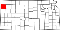 | |
| Unincorporated communities | ||
| Townships | ||
This article is issued from Wikipedia - version of the 11/11/2013. The text is available under the Creative Commons Attribution/Share Alike but additional terms may apply for the media files.