Ice Age Floods National Geologic Trail

The Ice Age Floods National Geologic Trail or Ice Age Floods Trail is designated as the first National Geologic Trail in the United States. It will consist of a network of routes connecting facilities that will provide interpretation of the geological consequences of the Glacial Lake Missoula floods of the last glacial period that began about 110,000 years ago.
History of "Ice Age Floods Trail" creation
The National Park Service (NPS) commissioned an Environmental Assessment, which concluded that Option 3 - creation of a "National Geologic Trail—designating the Floods pathways managed by the National Park Service, with an Interagency Technical Committee representing the federal, tribal, and state agencies and a Trail Advisory Committee to assist the Trail Manager and staff" was the preferred option. As a result, the Ice Age Floods Trail was established by the Omnibus Public Land Management Act of 2009, in which Congress authorized establishing the Ice Age Floods National Geologic Trail in parts of Montana, Idaho, Washington, and Oregon states, and established NPS administration of the Trail.[1]
Geologic basis for the trail

At the end of the last Ice Age (the Wisconsonian Ice Age), a branch of the Cordilleran ice sheet moved out of Canada into the Idaho panhandle region. There it formed a 2,000 ft (610 m)-high ice dam that blocked the mouth of the Clark Fork River, creating glacial Lake Missoula, which impounded greater than 2,000 km3 (480 cu mi) of water. The lake extended up the valleys eastward for over 200 miles (320 km). The periodic rupturing of the ice dam resulted in the Missoula Floods – cataclysmic floods that swept across Idaho and Eastern Washington, and then down the Columbia River Gorge approximately 40 times during a 2,000 year period. The flood front swept in a wave across Idaho and Washington at speeds approaching 100 km/h (62 mph), and Glacial Lake Missoula drained in periods as short as 2 days.[2]
The Columbia River channel downstream was blocked by the Okanogan lobe of the Cordilleran, impounding water in Glacial Lake Columbia. As a result, the floods could not continue down the Columbia River, being forced instead to flood over the highlands of Eastern Washington, vastly transforming the landscape by forming the Grand Coulee, Moses Coulee, the Channeled Scablands, Dry Falls, Palouse Falls and many similar features. The cumulative effect of the floods was to excavate 210 km3 (50 cu mi) of loess, sediment and basalt from the channeled scablands of eastern Washington and to transport it downstream.[2] Over a period of 2,000 to 2,500 years, the repetition of ice dam failure and flood was repeated 40-60 times, leaving a lasting mark on the landscape.
There are a number of characteristic features that illustrate the effect of these ice dams and power of the resulting floods:
- Large portions of the scabland region of Eastern Washington were stripped bare of topsoil and left as the base basalt rock.
- The landscape is extensively eroded, with deep sheer-walled canyons in the Grand Coulee, Moses Coulee, the Wallula Gap, and the Columbia River Gorge.
- There are giant ripple marks 30 ft (9.1 m) high and gravel bars over 4 mi (6.4 km) long and 300 ft (91 m) high, which would have required extreme currents to form.
- There are 200 short tons (180,000 kg) erratic boulders which originated in Canada and Montana, found well up valleys such as the Willamette River valley far south of any evidence of glacial activity; these boulders were ice rafted in and depositied as the ice was stranded & melted in backwaters of temporary lakes.
- The scablands formed include deep kolks formed by local turbulence, which plucked basalt boulders out and excavated pits in the middle of relatively smooth plains.
- Backwaters of temporary lakes formed during the floods show extensive & periodic deposits of silt and sand.
Probable features of the trail

The trail, which is now being developed, will comprise routes throughout the Pacific Northwest region where the Ice Age Floods left a lasting impact. Features likely to be included are:
- The Glacial Lake Missoula region in Montana in which the waters were initially impounded
- The Lake Coeur d'Alene area and Clark Fork river of Idaho through which the flood waters periodically flowed
- The Withrow Moraine and Jameson Lake Drumlin Field, Boulder Park and Sims Corner Eskers and Kames on the Waterville Plateau in Washington state where the Okanagon lobe impounded Glacial Lake Columbia and diverted the flow through Moses Coulee, Grand Coulee and Dry Falls
- Erosion features from the floods such as the Channeled Scablands, Drumheller Channels, Crab Creek, Corfu Slide and Palouse Falls in Washington state
- Temporary lakes such as Lake Lewis in Washington as well as Lake Condon and Lake Allison in Oregon and the evidence for these temporary lakes as seen in the ice rafted erratics and in the deposits of the Touchet Formation
- Erosion features such as the Wallula Gap through the Horse Heaven Hills in southern Washington, the Columbia River Gorge on the border between Oregon and Washington and Alameda Ridge in Portland.
See also
References
- ↑ Ice Age Floods - Study of Alternatives and Environmental Assessment - Following the Pathways of the Glacial Lake Missoula Floods, U.S. Department of the Interior, National Park Service, 2001, retrieved 29 July 2013
|first1=missing|last1=in Authors list (help) - 1 2 Allen, John Eliot; Burns, Marjorie; Sargent, Sam C. (c. 1986). Cataclysms on the Columbia : a layman's guide to the features produced by the catastrophic Bretz floods in the Pacific Northwest. Portland, OR: Timber Press. p. 104. ISBN 0-88192-067-3.
External links
| Ice Age Glacial Floods | 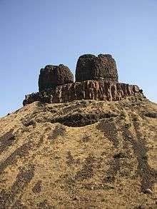 | |
|---|---|---|
| Glacial Lakes | ||
| Temporary Lakes | ||
| Ice Age Floods Glacial Residue | ||
| Ice Age Floods Erosion & Deposition Features | ||
| Related contemporaneous events | ||