Huehuetán
| Huehuetán | |
|---|---|
| Municipality | |
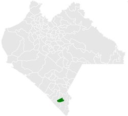 Municipality of Huehuetán in Chiapas | |
|
Huehuetán Location in Mexico | |
| Coordinates: 15°1′55″N 92°23′4″W / 15.03194°N 92.38444°WCoordinates: 15°1′55″N 92°23′4″W / 15.03194°N 92.38444°W | |
| Country |
|
| State | Chiapas |
| Area | |
| • Total | 121 sq mi (313 km2) |
| Population (2010) | |
| • Total | 33,444 |
Huehuetán is a town and one of the 119 Municipalities of Chiapas, in southern Mexico. It covers an area of 313 km².
As of 2010, the municipality had a total population of 33,444,[1] up from 31,464 as of 2005.[2]
As of 2010, the town of Huehuetán had a population of 7,755.[1] Other than the town of Huehuetán, the municipality had 114 localities, the largest of which (with 2010 populations in parentheses) were: Ignacio Zaragoza (2,464), and Texcaltic (1,743), classified as rural.,[1] Huehuetán Estación FFCC (6,314), classified as urban, and Guadalupe (1,687), Plan de Ayala (1,443), and Chamulapita (1,337), classified as rural.[1]
References
- 1 2 3 4 "Huehuetán". Catálogo de Localidades. Secretaría de Desarrollo Social (SEDESOL). Retrieved 23 April 2014.
- ↑ "Huehuetán". Enciclopedia de los Municipios de México. Instituto Nacional para el Federalismo y el Desarrollo Municipal Gobierno del Estado de Chiapas. Retrieved July 25, 2008.

This article is issued from Wikipedia - version of the 5/9/2014. The text is available under the Creative Commons Attribution/Share Alike but additional terms may apply for the media files.