Hrastje, Kranj
| Hrastje | |
|---|---|
 | |
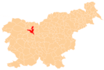
 Hrastje Location in Slovenia | |
| Coordinates: 46°13′25.85″N 14°22′53.14″E / 46.2238472°N 14.3814278°ECoordinates: 46°13′25.85″N 14°22′53.14″E / 46.2238472°N 14.3814278°E | |
| Country |
|
| Traditional region | Upper Carniola |
| Statistical region | Upper Carniola |
| Municipality | Kranj |
| Area | |
| • Land | 2.92 km2 (1.13 sq mi) |
| Elevation | 374.6 m (1,229.0 ft) |
| Population (2002) | |
| • Total | 1,040 |
| [1] | |
Hrastje (pronounced [ˈxɾaːstjɛ]; German: Hrastie[2]) is a village on the left bank of the Sava River just south of Kranj in the Upper Carniola region of Slovenia.[3] Until June 2002, the settlement was part of the City Municipality of Kranj.
Name
The name Hrastje is derived from the Slovene common noun hrast 'oak', referring to the local vegetation.[4] The settlement was known as Hrastie in German in the past.[2]
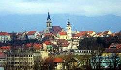
Church

Saint Matthew's Church
The local church is dedicated to Saint Matthew. It was built in 1508 in a Gothic style and altered in the 17th century. Its greatest treasure is a 17th-century gilded wooden altar. The belfry was built in 1723.[5]
References
- ↑ Statistical Office of the Republic of Slovenia
- 1 2 Leksikon občin kraljestev in dežel zastopanih v državnem zboru, vol. 6: Kranjsko. 1906. Vienna: C. Kr. Dvorna in Državna Tiskarna, p. 52.
- ↑ Kranj municipal site
- ↑ Snoj, Marko. 2009. Etimološki slovar slovenskih zemljepisnih imen. Ljubljana: Modrijan and Založba ZRC, p. 163.
- ↑ Šenčur parish site (Slovene)
External links
 Media related to Hrastje, Kranj at Wikimedia Commons
- Hrastje at Geopedia.si
This article is issued from Wikipedia - version of the 6/23/2015. The text is available under the Creative Commons Attribution/Share Alike but additional terms may apply for the media files.