Hozelec
| Hozelec | |
| Municipality | |
| Country | Slovakia |
|---|---|
| Region | Prešov |
| District | Poprad |
| Elevation | 683 m (2,241 ft) |
| Coordinates | 49°02′03″N 20°20′48″E / 49.03417°N 20.34667°ECoordinates: 49°02′03″N 20°20′48″E / 49.03417°N 20.34667°E |
| Area | 3.998248 km2 (2 sq mi) |
| Population | 867 (31 December 2010) |
| Density | 217/km2 (562/sq mi) |
| Founded | 1243 |
| Postal code | 059 11 |
| Area code | +421-52 |
| Car plate | PP |
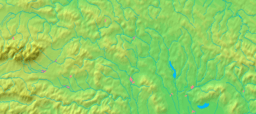
  Location of Hozelec in Slovakia | |
  Location of Hozelec in the Prešov Region | |
| Wikimedia Commons: Hozelec | |
| Statistics: | |
| Website: www.hozelec.e-obce.sk | |
Hozelec is a village and municipality in Poprad District in the Prešov Region of northern Slovakia.[1]
Geography
The municipality lies at an altitude of 695 metres and covers an area of 4.011 km². It has a population of about 830 people.
History
In historical records the village was first mentioned in 1248.
Economy and infrastructure
Hozelec is a typical touristic village in High Tatras with good touristic infrastructure. In the village is Children amusement park FunVille.
See also
References
- ↑ "Statistical Office of the Slovak Republic" (PDF). Výsledky SODB 2011. Štatistický úrad SR. Retrieved 9.8.2012. Check date values in:
|access-date=(help)
Genealogical resources
The records for genealogical research are available at the state archive "Statny Archiv in Levoca, Slovakia"
- Roman Catholic church records (births/marriages/deaths): 1731-1896 (parish B)
- Lutheran church records (births/marriages/deaths): 1710-1910 (parish B)
External links
- http://www.funville.sk/ FunVille homepage
- Surnames of living people in Hozelec
Municipalities of Poprad District | ||
|---|---|---|
This article is issued from Wikipedia - version of the 3/22/2016. The text is available under the Creative Commons Attribution/Share Alike but additional terms may apply for the media files.