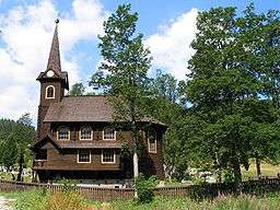
Tatranská Javorina
| Tatranská Javorina | ||
| Municipality | ||
 | ||
|
||
| Name origin: Slovak name of maple | ||
| Country | Slovakia | |
|---|---|---|
| Region | Prešov | |
| District | Poprad | |
| Elevation | 1,000 m (3,281 ft) | |
| Coordinates | 49°16′0″N 20°8′0″E / 49.26667°N 20.13333°ECoordinates: 49°16′0″N 20°8′0″E / 49.26667°N 20.13333°E | |
| Area | 94.021 km2 (36 sq mi) | |
| Population | 229 (2010-12-31) | |
| Postal code | 059 56 | |
| Area code | +421-52 | |
| Car plate | PP | |
  Location of Tatranská Javorina in Slovakia | ||
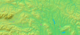  Location of Tatranská Javorina in the Prešov Region | ||
| Wikimedia Commons: Tatranská Javorina | ||
| Statistics: | ||
| Website: www.tjavorina.eu | ||
Tatranská Javorina is a village in Poprad District in the Prešov Region of northern Slovakia.
Geography
The municipality lies at an altitude of 1000 metres and covers an area of 94.041 km². It has a population of about 230 people. It is located by the Javorová Valley in the Tatra Mountains at the Polish border.
History
The beginnings of the municipality are in the 18th century. The name of the village stems from the former maple (Slovak: javor) forests, after which some geographical objects were named (brook Javorinka, Javorová Valley and Javorový štít). Between 1918 and 1921 the Polish government several times wanted to make the village as well as adjacent Tatra valleys part of Poland, later on the Poles negotiated with Czechoslovakia about change of the border, but unsuccessfully. On November 1, 1938, after the Munich Agreement, Poland took control over the village. It was captured by the Slovaks in September 1939 (see: Polish September Campaign and Field Army Bernolák) and it has been part of Slovakia ever since.
See also
External links
- http://tatranskajavorina.e-obce.sk/
- http://www.vysoketatry.com/obce/tjavorina/tjavorina.html Information on vysoketatry.com portal
- http://panoramy.sme.sk/panorama/1004/tatranska-javorina/ Panoramas of Tatranská Javorina

Municipalities of Poprad District | ||
|---|---|---|