Hora Svaté Kateřiny
| Hora Svaté Kateřiny | |||
|---|---|---|---|
| Town | |||
| |||
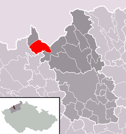 Location in Most District | |||
 Hora Svaté Kateřiny Location in the Czech Republic | |||
| Coordinates: 50°35′45″N 13°26′17″E / 50.59583°N 13.43806°ECoordinates: 50°35′45″N 13°26′17″E / 50.59583°N 13.43806°E | |||
| Country |
| ||
| Region | Ústí nad Labem | ||
| District | Most | ||
| Area | |||
| • Total | 18.45 km2 (7.12 sq mi) | ||
| Elevation | 645 m (2,116 ft) | ||
| Population (2006) | |||
| • Total | 402 | ||
| • Density | 22/km2 (56/sq mi) | ||
| Postal code | 435 46 | ||
| Website | http://www.horasvatekateriny.cz/ | ||


Hora Svaté Kateřiny is a town in Most District in the Ústí nad Labem Region of the Czech Republic.
The town covers an area of 18.45 square kilometres (7.12 sq mi), and has a population of 402 (as at 28 August 2006).
Hora Svaté Kateřiny lies approximately 18 kilometres (11 mi) north-west of Most, 44 km (27 mi) west of Ústí nad Labem, and 90 km (56 mi) north-west of Prague.
References
| Wikimedia Commons has media related to Hora Svaté Kateřiny. |
This article is issued from Wikipedia - version of the 4/4/2016. The text is available under the Creative Commons Attribution/Share Alike but additional terms may apply for the media files.