Holton, Kansas
| Holton, Kansas | |
|---|---|
| City | |
|
Downtown Holton (2007) | |
 Location within Jackson County and Kansas | |
 KDOT map of Jackson County (legend) | |
| Coordinates: 39°28′1″N 95°44′13″W / 39.46694°N 95.73694°WCoordinates: 39°28′1″N 95°44′13″W / 39.46694°N 95.73694°W | |
| Country | United States |
| State | Kansas |
| County | Jackson |
| Area[1] | |
| • Total | 2.78 sq mi (7.20 km2) |
| • Land | 2.70 sq mi (6.99 km2) |
| • Water | 0.08 sq mi (0.21 km2) |
| Elevation | 1,093 ft (333 m) |
| Population (2010)[2] | |
| • Total | 3,329 |
| • Estimate (2012[3]) | 3,302 |
| • Density | 1,200/sq mi (460/km2) |
| Time zone | Central (CST) (UTC-6) |
| • Summer (DST) | CDT (UTC-5) |
| ZIP code | 66436 |
| Area code | 785 |
| FIPS code | 20-32825 [4] |
| GNIS feature ID | 0478194 [5] |
| Website | City Website |

Holton is a city in and the county seat of Jackson County, Kansas, United States.[6] As of the 2010 census, the city population was 3,329.[7]
History
The party that chose the site of Holton started at Milwaukee, Wisconsin, in May 1856. A train of six covered wagons, each drawn by two yoke of oxen, started the long trek to take Free State settlers to Kansas. They were financed by the Kansas Society of Milwaukee which was headed by Edward Dwight Holton, the Milwaukee abolitionist. They met General James H. Lane with two hundred men at Nebraska City, Nebraska, a rendezvous for Free State men. They followed the Jim Lane Road into Kansas approximately thirty miles. They came to Elk Creek, 2½ miles west of Holton, where they cut timbers to make a bridge, crossed it and made camp where Central School now stands. They liked the two streams (later named Banner Creek and Elk Creek) and the pleasant grassy hills, so they decided to stay. A company was organized and a civil engineer who was with them commenced the survey. They named the new town in honor of Holton.[8]
A log house 20 by 20 feet (6.1 m × 6.1 m) was erected; it was so planned that is could be used for a fort and was known as Jim Lane's Fort.[9] In the spring of 1857, J. B. Ingerson surveyed the townsite lots.[10]
The county that contains Holton was previously named Calhoun County until 1859 when the name was changed to Jackson County. Holton was chosen as the county seat in 1858. A frame building served as the first courthouse on the east side of the square, near the middle of the block. The first courthouse was built in the center of the square in 1872. The present courthouse was completed in 1921.[10]
In 1859, the abolitionist John Brown took a group of escaped slaves through Holton, leading to an incident known as the "Battle of the Spurs".[11]
In 1859, Holton had seven dwellings, one store, a blacksmith shop and a steam saw mill. The census taken in April, 1857, gave Holton 291 people; in 1860 the population was 1,936. In 1859 the city was incorporated.[10]
In 1879, the residents of Jackson County, Kansas decided to form a university in Holton. It was funded by mining magnate, A. C. Campbell, a former resident who had moved to Utah, and thus named Campbell University. In 1902 it merged with Lane University and became Campbell College.[12] In 1913, it merged with Kansas City University, then later closed in 1933.
Geography
Holton is located at 39°28′1″N 95°44′13″W / 39.46694°N 95.73694°W (39.466935, -95.736869).[13] According to the United States Census Bureau, the city has a total area of 2.78 square miles (7.20 km2), of which, 2.70 square miles (6.99 km2) is land and 0.08 square miles (0.21 km2) is water.[1]
Climate
The climate in this area is characterized by hot, humid summers and generally mild to cool winters. According to the Köppen Climate Classification system, Holton has a humid subtropical climate, abbreviated "Cfa" on climate maps.[14]
Demographics
| Historical population | |||
|---|---|---|---|
| Census | Pop. | %± | |
| 1890 | 2,727 | — | |
| 1900 | 3,082 | 13.0% | |
| 1910 | 2,842 | −7.8% | |
| 1920 | 2,703 | −4.9% | |
| 1930 | 2,705 | 0.1% | |
| 1940 | 2,885 | 6.7% | |
| 1950 | 2,705 | −6.2% | |
| 1960 | 3,028 | 11.9% | |
| 1970 | 3,063 | 1.2% | |
| 1980 | 3,132 | 2.3% | |
| 1990 | 3,196 | 2.0% | |
| 2000 | 3,353 | 4.9% | |
| 2010 | 3,329 | −0.7% | |
| Est. 2015 | 3,263 | [15] | −2.0% |
| U.S. Decennial Census | |||
Holton is part of the Topeka, Kansas Metropolitan Statistical Area.
2010 census
As of the census[2] of 2010, there were 3,329 people, 1,442 households, and 832 families residing in the city. The population density was 1,233.0 inhabitants per square mile (476.1/km2). There were 1,652 housing units at an average density of 611.9 per square mile (236.3/km2). The racial makeup of the city was 89.7% White, 1.1% African American, 3.4% Native American, 0.6% Asian, 2.0% from other races, and 3.2% from two or more races. Hispanic or Latino of any race were 4.9% of the population.
There were 1,442 households of which 29.6% had children under the age of 18 living with them, 41.9% were married couples living together, 12.3% had a female householder with no husband present, 3.5% had a male householder with no wife present, and 42.3% were non-families. 37.9% of all households were made up of individuals and 20.3% had someone living alone who was 65 years of age or older. The average household size was 2.23 and the average family size was 2.95.
The median age in the city was 40.2 years. 24.5% of residents were under the age of 18; 8.1% were between the ages of 18 and 24; 22.9% were from 25 to 44; 23.8% were from 45 to 64; and 20.5% were 65 years of age or older. The gender makeup of the city was 46.6% male and 53.4% female.
2000 census
As of the census[4] of 2000, there were 3,353 people, 1,396 households, and 862 families residing in the city. The population density was 1,369.2 people per square mile (528.4/km²). There were 1,522 housing units at an average density of 621.5 per square mile (239.9/km²). The racial makeup of the city was 93.14% White, 1.13% African American, 2.89% Native American, 0.21% Asian, 0.54% from other races, and 2.09% from two or more races. Hispanic or Latino of any race were 2.18% of the population.
There were 1,396 households out of which 28.6% had children under the age of 18 living with them, 47.6% were married couples living together, 11.0% had a female householder with no husband present, and 38.2% were non-families. 34.8% of all households were made up of individuals and 19.8% had someone living alone who was 65 years of age or older. The average household size was 2.24 and the average family size was 2.88.
In the city the population was spread out with 23.3% under the age of 18, 8.0% from 18 to 24, 25.0% from 25 to 44, 19.3% from 45 to 64, and 24.4% who were 65 years of age or older. The median age was 41 years. For every 100 females there were 80.6 males. For every 100 females age 18 and over, there were 76.6 males.
The median income for a household in the city was $31,866, and the median income for a family was $44,591. Males had a median income of $32,241 versus $24,006 for females. The per capita income for the city was $17,459. About 8.1% of families and 11.3% of the population were below the poverty line, including 17.9% of those under age 18 and 11.9% of those age 65 or over.
Notable people
- Case Broderick, politician
- Bill James, baseball writer and statistician
- Lynn Jenkins, U.S. Congresswoman and House Republican Conference Vice-Chair, graduate of Holton High School.
- Kendall McComas, child actor, Our Gang.
- Pat Roberts, U.S. Senator and 1954 graduate of Holton High School.
- Matt Mattox, Football Coach and 2000 graduate of Holton High School.
References
- 1 2 "US Gazetteer files 2010". United States Census Bureau. Retrieved 2012-07-06.
- 1 2 "American FactFinder". United States Census Bureau. Retrieved 2012-07-06.
- ↑ "Population Estimates". United States Census Bureau. Retrieved 2013-05-29.
- 1 2 "American FactFinder". United States Census Bureau. Retrieved 2008-01-31.
- ↑ "US Board on Geographic Names". United States Geological Survey. 2007-10-25. Retrieved 2008-01-31.
- ↑ "Find a County". National Association of Counties. Retrieved 2011-06-07.
- ↑ "2010 City Population and Housing Occupancy Status". U.S. Census Bureau. Retrieved March 27, 2011.
- ↑ "Honorable E. D. Holton: He Visits our Young City Amid the Firing of Cannon, The Ringing of Bells, Playing of Bands, And Rejoicing Generally". Holton Recorder. Holton, Kansas. December 11, 1879. Retrieved February 18, 2013.
- ↑ Blackmar, Frank Wilson (1912). Kansas: A Cyclopedia of State History, Embracing Events, Institutions, Industries, Counties, Cities, Towns, Prominent Persons, Etc. Standard Publishing Company. p. 865.
- 1 2 3 "History of Holton". City of Holton, Kansas. Retrieved 11 June 2014.
- ↑ The Battle of the Spurs and the Underground Railroad in Jackson County
- ↑ Campbell College Early History
- ↑ "US Gazetteer files: 2010, 2000, and 1990". United States Census Bureau. 2011-02-12. Retrieved 2011-04-23.
- ↑ Climate Summary for Holton, Kansas
- ↑ "Annual Estimates of the Resident Population for Incorporated Places: April 1, 2010 to July 1, 2015". Retrieved July 2, 2016.
Further reading
- History of the State of Kansas; William G. Cutler; A.T. Andreas Publisher; 1883. (Online HTML eBook)
- Kansas : A Cyclopedia of State History, Embracing Events, Institutions, Industries, Counties, Cities, Towns, Prominent Persons, Etc; 3 Volumes; Frank W. Blackmar; Standard Publishing Co; 944 / 955 / 824 pages; 1912. (Volume1 - Download 54MB PDF eBook),(Volume2 - Download 53MB PDF eBook), (Volume3 - Download 33MB PDF eBook)
External links
| Wikimedia Commons has media related to Holton, Kansas. |
- City
- Schools
- USD 336, local school district
- Newspaper
- Weather
- Maps
- Holton City Map, KDOT
Municipalities and communities of Jackson County, Kansas, United States | ||
|---|---|---|
| Cities | 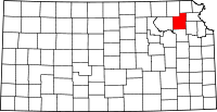 | |
| Unincorporated communities | ||
| Indian reservations | ||
| Townships | ||
| Footnotes | ‡This populated place also has portions in an adjacent county or counties | |