Hillsboro, New Mexico
| Hillsboro, New Mexico | |
|---|---|
| Unincorporated community | |
|
Hillsboro New Mexico Community Center | |
 Hillsboro, New Mexico Location in the United States | |
| Coordinates: 32°55′N 107°34′W / 32.917°N 107.567°W | |
| Country | United States |
| State | New Mexico |
| County | Sierra |
| Area | |
| • Total | 2.13 sq mi (5.5 km2) |
| Population (2010) | |
| • Total | 124 |
| • Density | 58/sq mi (22/km2) |
| Time zone | Mountain |
| • Summer (DST) | Mountain (UTC) |
| ZIP code | 88042 |
| Area code(s) | 575 |


Hillsboro is a small unincorporated community in Sierra County, New Mexico, United States, located in the southwestern part of the state. It was founded in 1877, following the discovery of gold. The community was the county seat of Sierra County from 1884 until 1936 when Hot Springs (now called Truth or Consequences) became the county seat.
The town was named Hillsborough by the prospectors in Dec. 1877, but later shortened to Hillsboro. By 1880 the town had 4 companies of soldiers and 400 miners, but the population soon grew to 700. A county courthouse was built in 1892. By 1907 the population was 1200. A flood on 10 June 1914 caused considerable damage to many town buildings.[1]
Geology
The first house was built in August 1877 after two prospectors, Dan Dugan and Dave Stitzel, working in the area of the future Opportunity Mine, collected loose pieces of rock (float is the geologic term) assayed at $160 per ton in gold and silver.[2] Soon, ore was discovered at the nearby Rattlesnake vein (geology) by Dugan and Frank Pitcher,[1] and a placer deposit of gold was found in November at the Rattlesnake and Wicks gulches. Ore was pulverized with arrastres located in Hillsboro, including a 10-stamp mill built in 1878. Total production prior to 1904 was about $6,750,000. Between 1911 and 1931, total production of gold ore was 836 tons, gold-copper-silver ore was 5,470 tons, and copper ore was 200 tons.[3] In his report, Harley wrote, "The ore deposits of the Hillsboro or Las Animas mining district are of four general types as follows: (1) fissure veins in andesite flows, (2) disseminated deposits in monzonite porphyry, (3) replacement deposits in limestone, and (4) placer gold deposits."[4]
The Copper Flat volcano to the northeast of Hillsboro is the source of the gold in the area. The 4 mile wide volcano is characterized by a Cretaceous quartz monzonite stock within a topographic depression, surrounded by surface andesite flows at least 2,300 feet thick, and radial quartz latite or rhyolite dikes. The stock generated the porphyry copper deposits, gold-bearing veins, and gold placers. There are about 26 major veins forming a radial pattern from the stock. The Golddust Camp placer deposits are found in the alluvium of the dry gulches radiating off Copper Flat and the andesite flows. The fissure veins produced 51,000 ounces of gold, while the placer deposits produced 110,000 ounces.[5]
The Sternberg Mine at Copper Flat produced 200 tons of copper ore between 1911 and 1934. By 1959, Bear Creek Mining Company had discovered a mineralized breccia pipe within the stock. Quintana Minerals Corporation started open-pit mining in 1980, averaging 0.45 per cent copper. Ore minerals include pyrite, chalcopyrite, sphalerite and galena.[5]
Notable people
- Physician and American Civil War veteran C.C. Crews
- Future justice of the New Mexico Supreme Court Frank W. Parker. He presided over the 1899 murder trial of Albert J. Fountain.[6]
Popular Culture
- Mentioned in Eugene Manlove Rhodes' 1920 novel Stepsons of Light
- About 1986, the film Lewis & Clark & George was filmed in the vicinity.
Notes
- 1 2 Sherman, James E.; Sherman, Barbara H. (1975). Ghost Towns and Mining Camps of New Mexico. Norman: University of Oklahoma Press. pp. 112–115. ISBN 0806111062.
- ↑ Florin, Lambert (1970). Ghost Towns of the West. Superior Publishing Company. pp. 624–625. ISBN 0883940132.
- ↑ Harley, pp 139-140
- ↑ Harley, p 133)
- 1 2 Hedlund, D.C. (1985). Economic geology of some selected mines in the Hillsboro and San Lorenzo quadrangles, Grant and Sierra Counties, New Mexico. Denver: US Dept. of the Interior, USGS Report 85-0456. pp. 4–13.
- ↑ Hillsboro Historical Society (2011). Around Hillsboro. Charleston: Arcadia Publishing. pp. 21–28. ISBN 9780738579528.
See also
References
- Harley, George Townsend, The Geology and Ore Deposits of Sierra County, New Mexico, New Mexico State Bureau of Mines and Mineral Resources Bulletin 10, 1934.
External links
| Wikimedia Commons has media related to Hillsboro, New Mexico. |
- http://hillsborohistory.blogspot.com
- Hillsboro on the Sierra County Tourism website
- Hillsboro as a ghost town
- Hillsboro features and attractions
- Hillsboro A Walking Tour Map City map showing locations of many historic buildings
Coordinates: 32°55′15″N 107°34′01″W / 32.92083°N 107.56694°W
Municipalities and communities of Sierra County, New Mexico, United States | ||
|---|---|---|
| Cities | 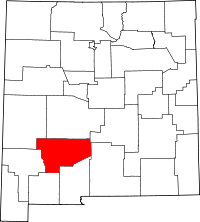 | |
| Villages | ||
| CDPs | ||
| Other communities | ||
| Ghost towns | ||