Hepzibah, Harrison County, West Virginia
| Hepzibah, West Virginia | |
|---|---|
| Census-designated place | |
 Hepzibah, West Virginia | |
| Coordinates: 39°19′57″N 80°20′07″W / 39.33250°N 80.33528°WCoordinates: 39°19′57″N 80°20′07″W / 39.33250°N 80.33528°W | |
| Country | United States |
| State | West Virginia |
| County | Harrison |
| Area[1] | |
| • Total | 0.922 sq mi (2.39 km2) |
| • Land | 0.922 sq mi (2.39 km2) |
| • Water | 0 sq mi (0 km2) |
| Elevation | 1,027 ft (313 m) |
| Population (2010)[2] | |
| • Total | 566 |
| • Density | 610/sq mi (240/km2) |
| Time zone | Eastern (EST) (UTC-5) |
| • Summer (DST) | EDT (UTC-4) |
| ZIP code | 26369 |
| Area code(s) | 304 & 681 |
| GNIS feature ID | 1554686[3] |
Hepzibah is a census-designated place (CDP) and coal town in Harrison County, West Virginia, USA. It is located on U.S. Route 19 and West Virginia Route 20 3.5 miles (5.6 km) north of Clarksburg.
Hepzibah has a post office with ZIP code 26369.[4] As of the 2010 census, its population was 566.[2]
References
- ↑ "US Gazetteer files: 2010, 2000, and 1990". United States Census Bureau. 2011-02-12. Retrieved 2011-04-23.
- 1 2 "American FactFinder". United States Census Bureau. Retrieved 2011-05-14.
- ↑ U.S. Geological Survey Geographic Names Information System: Hepzibah, Harrison County, West Virginia
- ↑ ZIP Code Lookup
Municipalities and communities of Harrison County, West Virginia, United States | ||
|---|---|---|
| Cities | 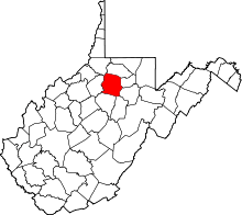 | |
| Towns | ||
| CDPs | ||
| Unincorporated communities |
| |
This article is issued from Wikipedia - version of the 9/22/2016. The text is available under the Creative Commons Attribution/Share Alike but additional terms may apply for the media files.