Hendrum, Minnesota
| Hendrum, Minnesota | |
|---|---|
| City | |
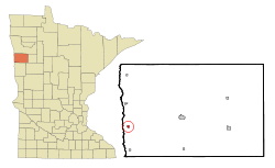 Location of Hendrum, Minnesota | |
| Coordinates: 47°15′51″N 96°48′38″W / 47.26417°N 96.81056°W | |
| Country | United States |
| State | Minnesota |
| County | Norman |
| Area[1] | |
| • Total | 0.33 sq mi (0.85 km2) |
| • Land | 0.33 sq mi (0.85 km2) |
| • Water | 0 sq mi (0 km2) |
| Elevation | 873 ft (266 m) |
| Population (2010)[2] | |
| • Total | 307 |
| • Estimate (2013[3]) | 292 |
| • Density | 930.3/sq mi (359.2/km2) |
| Time zone | Central (CST) (UTC-6) |
| • Summer (DST) | CDT (UTC-5) |
| ZIP code | 56550 |
| Area code(s) | 218 |
| FIPS code | 27-28484 |
| GNIS feature ID | 0644871[4] |
Hendrum is a city in Norman County, Minnesota, United States, in the Red River Valley between the Red River of the North and the Wild Rice River. The population was 307 as of the 2010 census.[5]
History
Hendrum was laid out in 1881, and named after a place in Norway.[6]
Geography
According to the United States Census Bureau, the city has a total area of 0.33 square miles (0.85 km2), all of it land.[1]
Demographics
| Historical population | |||
|---|---|---|---|
| Census | Pop. | %± | |
| 1910 | 355 | — | |
| 1920 | 354 | −0.3% | |
| 1930 | 326 | −7.9% | |
| 1940 | 341 | 4.6% | |
| 1950 | 352 | 3.2% | |
| 1960 | 305 | −13.4% | |
| 1970 | 311 | 2.0% | |
| 1980 | 336 | 8.0% | |
| 1990 | 309 | −8.0% | |
| 2000 | 315 | 1.9% | |
| 2010 | 307 | −2.5% | |
| Est. 2015 | 300 | [7] | −2.3% |
| U.S. Decennial Census[8] 2013 Estimate[9] | |||
2010 census
As of the census[2] of 2010, there were 307 people, 124 households, and 82 families residing in the city. The population density was 930.3 inhabitants per square mile (359.2/km2). There were 143 housing units at an average density of 433.3 per square mile (167.3/km2). The racial makeup of the city was 94.8% White, 0.7% Native American, and 4.6% from other races. Hispanic or Latino of any race were 8.1% of the population.
There were 124 households of which 30.6% had children under the age of 18 living with them, 53.2% were married couples living together, 8.1% had a female householder with no husband present, 4.8% had a male householder with no wife present, and 33.9% were non-families. 31.5% of all households were made up of individuals and 12.1% had someone living alone who was 65 years of age or older. The average household size was 2.48 and the average family size was 3.12.
The median age in the city was 37.3 years. 27.7% of residents were under the age of 18; 7.7% were between the ages of 18 and 24; 23.2% were from 25 to 44; 27.7% were from 45 to 64; and 13.7% were 65 years of age or older. The gender makeup of the city was 49.5% male and 50.5% female.
2000 census
As of the census of 2000, there were 315 people, 120 households, and 84 families residing in the city. The population density was 1,112.3 people per square mile (434.4/km²). There were 139 housing units at an average density of 490.8 per square mile (191.7/km²). The racial makeup of the city was 95.24% White, 1.59% Native American and 2.86% from other races. Hispanic or Latino of any race were 4.44% of the population.
There were 120 households out of which 37.5% had children under the age of 18 living with them, 57.5% were married couples living together, 7.5% had a female householder with no husband present, and 30.0% were non-families. 27.5% of all households were made up of individuals and 15.0% had someone living alone who was 65 years of age or older. The average household size was 2.63 and the average family size was 3.24.
The city's age distribution was 31.1% under the age of 18, 7.6% from 18 to 24, 29.2% from 25 to 44, 23.8% from 45 to 64, and 8.3% who were 65 years of age or older. The median age was 34 years. For every 100 females there were 99.4 males. For every 100 females age 18 and over, there were 99.1 males.
The median income for a household in the city of Hendrum was $35,000, and the median income for a family was $44,167. Males had a median income of $32,000 versus $21,458 for females. The per capita income for the city was $14,530. About 6.3% of families and 9.7% of the population were below the poverty line, including 14.7% of those under age 18 and 7.1% of those age 65 or over.
References
- 1 2 "US Gazetteer files 2010". United States Census Bureau. Retrieved 2012-11-13.
- 1 2 "American FactFinder". United States Census Bureau. Retrieved 2012-11-13.
- ↑ "Population Estimates". United States Census Bureau. Retrieved 2014-06-09.
- ↑ "US Board on Geographic Names". United States Geological Survey. 2007-10-25. Retrieved 2008-01-31.
- ↑ "2010 Census Redistricting Data (Public Law 94-171) Summary File". American FactFinder. U.S. Census Bureau, 2010 Census. Retrieved 23 April 2011.
- ↑ Upham, Warren (1920). Minnesota Geographic Names: Their Origin and Historic Significance. Minnesota Historical Society. p. 382.
- ↑ "Annual Estimates of the Resident Population for Incorporated Places: April 1, 2010 to July 1, 2015". Retrieved July 2, 2016.
- ↑ United States Census Bureau. "Census of Population and Housing". Retrieved February 12, 2014.
- ↑ "Annual Estimates of the Resident Population: April 1, 2010 to July 1, 2013". Retrieved June 9, 2014.
External links
Municipalities and communities of Norman County, Minnesota, United States | ||
|---|---|---|
| Cities | 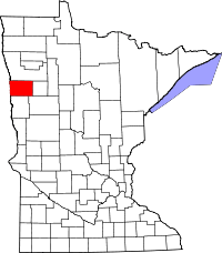 | |
| Townships | ||
| Unincorporated communities | ||
Coordinates: 47°15′52″N 96°48′41″W / 47.26444°N 96.81139°W