Heathfield, South Australia
| Heathfield South Australia | |||||||||||||
|---|---|---|---|---|---|---|---|---|---|---|---|---|---|
 Heathfield | |||||||||||||
 Heathfield | |||||||||||||
| Coordinates | 35°01′0″S 138°43′0″E / 35.01667°S 138.71667°ECoordinates: 35°01′0″S 138°43′0″E / 35.01667°S 138.71667°E | ||||||||||||
| Population |
| ||||||||||||
| Postcode(s) | 5153 | ||||||||||||
| LGA(s) | Adelaide Hills Council | ||||||||||||
| Federal Division(s) | Mayo | ||||||||||||
| |||||||||||||
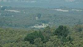
Heathfield is a township in the Adelaide Hills of South Australia near Stirling. It is home to Heathfield High School, Heathfield Primary School, Heathfield Oval, the Heathfield Waste Depot, Heathfield General Store, Mount Lofty Sand and Metal, Masonic homes (retirement Village), a biodynamic farm and a mechanic's workshop, along with numerous walking trails. Heathfield is also located within close proximity to Mount Lofty Ranges. The small country suburb of Heathfield also contains a small conservation park known as Woorabinda. This is used daily by residents to walk their dogs; and ducks to receive free food.
Heathfield is a mix of country living, while still being only 15 minutes from the Adelaide City centre. As such, it has a diverse mix of middle, to upper middle class residents seeking a secluded home, and farmers. At the 2006 census, Heathfield had a population of 1,000, and a median house price of $632,000.[2]
Transport
Heathfield has a disused a railway station, with an elevation of 1,370 feet (420 m).[3]
Heathfield is serviced by bus routes 865 and 894H. Route 865 (formerly 868) connects to the City in either Stirling or Aldgate, with most services continuing to Crafers as route 866. Some peak-hour services also continue to the City. Route 894H is a school bus to Blackwood interchange.
Education
Heathfield High School is situated in the Adelaide Hills and has a special focus on volleyball. The Special Interest Volleyball Program is aimed at developing young volleyball players and has become the most successful volleyball school in Australia.[4]
References
- ↑ Australian Bureau of Statistics (31 October 2012). "Heathfield (State Suburb)". 2011 Census QuickStats. Retrieved 3 February 2016.
- 1 2 Australian Bureau of Statistics (25 October 2007). "Heathfield (State Suburb)". 2006 Census QuickStats. Retrieved 30 July 2011.
- ↑ SAR Public Timetable 1954, pg96
- ↑ "Heathfield High School Special Interest Volleyball Newsletter" Archived 3 October 2009 at the Wayback Machine.