Hastings, Oklahoma
| Hastings, Oklahoma | |
|---|---|
| Town | |
 Location of Hastings, Oklahoma | |
| Coordinates: 34°13′39″N 98°06′31″W / 34.2275°N 98.1086°WCoordinates: 34°13′39″N 98°06′31″W / 34.2275°N 98.1086°W | |
| Country | United States |
| State | Oklahoma |
| County | Jefferson |
| Area | |
| • Total | 0.5 sq mi (1 km2) |
| Elevation | 1,004 ft (306 m) |
| Population (2000) | |
| • Total | 155 |
| • Density | 310/sq mi (120/km2) |
| Time zone | Central (CST) (UTC-6) |
| • Summer (DST) | CDT (UTC-5) |
| ZIP code | 73548 |
| Area code(s) | 580 |
| FIPS code | 40-33000[1] |
| GNIS feature ID | 1093597[2] |
Hastings is a town in Jefferson County, Oklahoma, United States. The population was 143 at the 2010 census, a decline from 155 at the 2000 census.[3]
History
A community called Bayard existed at the site of present-day Hastings until the Kiowa, Comanche, and Apache Reservation was opened to new settlers on August 6, 1901. Since Indian Territory already had a post office named Baird, the postal department named the station it established at this location. A couple of residents had suggested naming it for their home town of Hastings, Nebraska. That was accepted by postal officials.[3]
In 1902, a railroad line called Enid and Anadarko built tracks through Hastings. The population was 560 in 1907 and 727 in 1910. The population has declined continuously from 1910 until the present.[3]
Geography
Hastings is located at 34°13′39″N 98°06′31″W / 34.2275°N 98.1086°W.[4] It is 9 miles (14 km) northwest of Waurika and 5 miles (8.0 km) north of the Red River.[3]
According to the United States Census Bureau, the town has a total area of 0.5 square miles (1.3 km2), all of it land.
Demographics
| Historical population | |||
|---|---|---|---|
| Census | Pop. | %± | |
| 1910 | 727 | — | |
| 1920 | 629 | −13.5% | |
| 1930 | 379 | −39.7% | |
| 1940 | 352 | −7.1% | |
| 1950 | 285 | −19.0% | |
| 1960 | 200 | −29.8% | |
| 1970 | 184 | −8.0% | |
| 1980 | 246 | 33.7% | |
| 1990 | 164 | −33.3% | |
| 2000 | 155 | −5.5% | |
| 2010 | 143 | −7.7% | |
| Est. 2015 | 138 | [5] | −3.5% |

As of the census[1] of 2000, there were 155 people, 72 households, and 50 families residing in the town. The population density was 310/sq mi (120/km2). There were 87 housing units at an average density of 174/sq mi (67/km2). The racial makeup of the town was 93.55% White, 1.29% African American, 3.87% Native American, and 1.29% from two or more races.
There were 72 households out of which 16.7% had children under the age of 18 living with them, 61.1% were married couples living together, 6.9% had a female householder with no husband present, and 29.2% were non-families. 25.0% of all households were made up of individuals and 15.3% had someone living alone who was 65 years of age or older. The average household size was 2.15 and the average family size was 2.57.
In the town the population was spread out with 14.8% under the age of 18, 4.5% from 18 to 24, 20.0% from 25 to 44, 32.9% from 45 to 64, and 27.7% who were 65 years of age or older. The median age was 53 years. For every 100 females there were 96.2 males. For every 100 females age 18 and over, there were 97.0 males.
The median income for a household in the town was $22,969, and the median income for a family was $23,281. Males had a median income of $25,357 versus $17,083 for females. The per capita income for the town was $13,017. About 14.8% of families and 19.1% of the population were below the poverty line, including 40.0% of those under the age of eighteen and 17.5% of those sixty five or over.
Notable native
John Green - football player.
References
- 1 2 "American FactFinder". United States Census Bureau. Retrieved 2008-01-31.
- ↑ "US Board on Geographic Names". United States Geological Survey. 2007-10-25. Retrieved 2008-01-31.
- 1 2 3 4 Jon D. May, "Hastings," Encyclopedia of Oklahoma History and Culture Accessed March 27, 2015.
- ↑ "US Gazetteer files: 2010, 2000, and 1990". United States Census Bureau. 2011-02-12. Retrieved 2011-04-23.
- ↑ "Annual Estimates of the Resident Population for Incorporated Places: April 1, 2010 to July 1, 2015". Retrieved July 2, 2016.
- ↑ "Census of Population and Housing". Census.gov. Retrieved June 4, 2015.
External links
Municipalities and communities of Jefferson County, Oklahoma, United States | ||
|---|---|---|
| City | 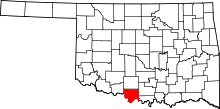 | |
| Towns | ||
| Unincorporated communities | ||