Harmony Township, Union County, Indiana
| Harmony Township | |
|---|---|
| Township | |
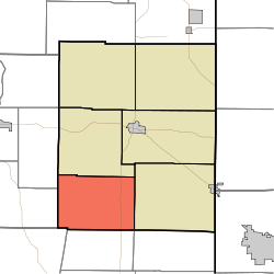 Location in Union County | |
| Coordinates: 39°33′17″N 84°59′07″W / 39.55472°N 84.98528°WCoordinates: 39°33′17″N 84°59′07″W / 39.55472°N 84.98528°W | |
| Country | United States |
| State | Indiana |
| County | Union |
| Government | |
| • Type | Indiana township |
| Area | |
| • Total | 22.99 sq mi (59.5 km2) |
| • Land | 20.65 sq mi (53.5 km2) |
| • Water | 2.34 sq mi (6.1 km2) 10.18% |
| Elevation | 748 ft (228 m) |
| Population (2010) | |
| • Total | 543 |
| • Density | 26.3/sq mi (10.2/km2) |
| ZIP codes | 47331, 47353 |
| GNIS feature ID | 453375 |
Harmony Township is one of six townships in Union County, Indiana, United States. As of the 2010 census, its population was 543 and it contained 233 housing units.[1]
Geography
According to the 2010 census, the township has a total area of 22.99 square miles (59.5 km2), of which 20.65 square miles (53.5 km2) (or 89.82%) is land and 2.34 square miles (6.1 km2) (or 10.18%) is water.[1]
Unincorporated towns
Adjacent townships
- Liberty Township (north)
- Union Township (east)
- Bath Township, Franklin County (southeast)
- Fairfield Township, Franklin County (south)
- Blooming Grove Township, Franklin County (southwest)
- Jackson Township, Fayette County (west)
- Jennings Township, Fayette County (northwest)
Cemeteries
The township contains these two cemeteries: New Hope and Old Bath Springs.
School districts
- Union County-College Corner Joint School District
Political districts
- Indiana's 6th congressional district
- State House District 55
- State Senate District 43
References
- United States Census Bureau 2007 TIGER/Line Shapefiles
- United States Board on Geographic Names (GNIS)
- IndianaMap
- 1 2 "Population, Housing Units, Area, and Density: 2010 - County -- County Subdivision and Place -- 2010 Census Summary File 1". United States Census. Retrieved 2013-05-10.
External links
Municipalities and communities of Union County, Indiana, United States | ||
|---|---|---|
| Towns | ||
| Townships | ||
| Unincorporated communities | ||
This article is issued from Wikipedia - version of the 7/22/2016. The text is available under the Creative Commons Attribution/Share Alike but additional terms may apply for the media files.