Harkaway, Victoria
| Harkaway Melbourne, Victoria | |||||||||||||
|---|---|---|---|---|---|---|---|---|---|---|---|---|---|
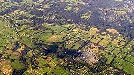 Aerial view | |||||||||||||
 Harkaway | |||||||||||||
| Coordinates | 37°59′56″S 145°20′38″E / 37.999°S 145.344°ECoordinates: 37°59′56″S 145°20′38″E / 37.999°S 145.344°E | ||||||||||||
| Population | 772 (2011 census)[1] | ||||||||||||
| Established | 1860s | ||||||||||||
| Postcode(s) | 3806 | ||||||||||||
| Location | 40 km (25 mi) from Melbourne | ||||||||||||
| LGA(s) | City of Casey | ||||||||||||
| State electorate(s) | |||||||||||||
| Federal Division(s) | La Trobe | ||||||||||||
| |||||||||||||
Harkaway is a suburb in Melbourne, Victoria, Australia, 40 km south-east of Melbourne's central business district. Its local government area is the City of Casey. At the 2011 census, Harkaway had a population of 772.[1]
The suburb is one which is home to many who wish to avoid the inner city clutter, yet remain relatively close to the city, and is characterised by its large distinguished homes and parkland.
Harkaway is located at the northeast corner of the City of Casey and is bounded by Robinson, Halleur and Harkaway Roads in the west, Boundary Road in the north, Cardinia Creek in the east, and by an irregular border with Berwick, Victoria below Dalton reserve in the south.[2]
History
Prior to European settlement, the area was home to the Bunurong and Wurundjeri indigenous peoples. They maintained a traditional hunting and gathering lifestyle with seasonal movements. A number of stone axe heads have been found in the Harkaway area in a location known as "Bald Hill", and some reports say that a corroboree was held there in 1858.[3] However, by 1840, reduction of their hunting grounds, draining of the swamps and introduction of European diseases such as smallpox and measles effectively ended their ability to maintain a traditional lifestyle.[4]
The area was settled by German immigrants in the 1850s. They initially bought land at Thomastown with the intention of subdividing a German settlement, but fresh from trying their luck at the Bendigo goldfields, found the fertile land at Harkaway south of King Road (originally Koenig Road, built as a stock route to water the cattle) and settled there instead. They typically built small timber cottages for themselves and practiced small-scale intensive agriculture on family lots, with the families primarily engaged in clearing the land and growing wheat, oats and potatoes, and "also very active in dairying".[5] However, a townsite was never actually declared. Harkaway Post Office opened on 1 January 1865.[6]
The settlers also constructed a number of other buildings - a Lutheran church (1869), the belfry of which is still intact and is located on Hessell Road; a single-room brick school (1876), a post office and a community hall (1909).
Notable people
Minnie a'Beckett, who married Arthur Merric Boyd, founder of the Boyd artistic dynasty, was based at "The Grange" in Harkaway in her early years, and Jessie Traill (1881-1967), a noted Australian painter, set up a studio in the 1920s.
Present day
The town can be reached from Melbourne and the Monash Freeway by exiting at Heatherton Road, which becomes King Road on entering Harkaway. Most services are provided from nearby Berwick and Narre Warren. With the exception of Harkaway Road, Marks Court, St Fort Court, and a portion of King Road and Noack Road, all roads outside the main town are unsealed.
Harkaway Primary School has an enrolment of about 200 students,[7] a community hall, tennis courts and numerous walking and equestrian trails.
The area is not served by Melbourne public transport.
It contains the pioneer Harkaway quarry on Noack Road.(closed)
References
- 1 2 "2011 Census QuickStats: Harkaway". Australia Bureau of Statistics. Retrieved 17 December 2012.
- ↑ Victorian Department of Sustainability and Environment. "Locality Names and Boundaries - City of Casey" (PDF). Retrieved 2008-10-30.
- ↑ Beaumont, Norman E.; Curran, James F.; Hughes, R.H. (2005) [1948]. Early days of Berwick and its surrounding districts (4 ed.). Berwick, VIC: Berwick-Pakenham Historical Society. pp. 69, 94–95. ISBN 0-9757802-2-0.
- ↑ Barwick, Diane E. (1984). "Mapping The Past: An Atlas of Victorian Clans". Aboriginal History. 8: 100–131. ISSN 0314-8769.
- ↑ Peel, Lynnette Jean (1974). Rural industry in the Port Phillip region, 1835-1880. Carlton, VIC: Melbourne University Press. p. 72. ISBN 0-522-84064-7.
- ↑ Premier Postal History. "Post Office List". Retrieved 2008-04-11.
- ↑ Schools Online listing, Department of Education (Victoria). Accessed 23 November 2006.