Haledon, New Jersey
| Haledon, New Jersey | |
|---|---|
| Borough | |
| Borough of Haledon | |
|
| |
 Map of Haledon in Passaic County. Inset: Location of Passaic County highlighted in the State of New Jersey. | |
 Census Bureau map of Haledon, New Jersey | |
| Coordinates: 40°56′13″N 74°11′20″W / 40.936989°N 74.188867°WCoordinates: 40°56′13″N 74°11′20″W / 40.936989°N 74.188867°W[1][2] | |
| Country |
|
| State |
|
| County | Passaic |
| Incorporated | May 21, 1908 |
| Government[3] | |
| • Type | Borough |
| • Body | Borough Council |
| • Mayor | Domenick Stampone (D, term ends December 31, 2018)[4][5] |
| • Administrator (acting) / clerk | Allan R. Susen[6] |
| Area[1] | |
| • Total | 1.156 sq mi (2.993 km2) |
| • Land | 1.155 sq mi (2.991 km2) |
| • Water | 0.001 sq mi (0.003 km2) 0.08% |
| Area rank |
491st of 566 in state 15th of 16 in county[1] |
| Elevation[7] | 217 ft (66 m) |
| Population (2010 Census)[8][9][10] | |
| • Total | 8,318 |
| • Estimate (2015)[11] | 8,451 |
| • Rank |
277th of 566 in state 14th of 16 in county[12] |
| • Density | 7,203.9/sq mi (2,781.4/km2) |
| • Density rank |
56th of 566 in state 5th of 16 in county[12] |
| Time zone | Eastern (EST) (UTC-5) |
| • Summer (DST) | Eastern (EDT) (UTC-4) |
| ZIP codes | 07508, 07538[13][14] |
| Area code(s) | 973[15] |
| FIPS code | 3403129070[1][16][17] |
| GNIS feature ID | 0885240[1][18] |
| Website |
www |

Haledon (pronounced HALE-dun[19]) is a borough in Passaic County, New Jersey, United States. As of the 2010 United States Census, the borough's population was 8,318,[8][9][10] reflecting an increase of 66 (+0.8%) from the 8,252 counted in the 2000 Census, which had in turn increased by 1,301 (+18.7%) from the 6,951 counted in the 1990 Census.[20]
Haledon was incorporated as a borough by an act of the New Jersey Legislature on April 8, 1908, replacing the now-defunct Manchester Township, based on the results of a referendum held on May 21, 1908.[21]
History
Haledon developed along the northern side of the industrial city of Paterson, New Jersey. It was settled by farmers with colonial Dutch heritage including the Van Riper, Berdan, Banta, Post and Zabriskie families. Prior to the Civil War they were joined by the Roe, Leonard and Stansfield families, who helped establish St. Mary's Episcopal Church and leading businesses including a general store and the Leonard Wax Company.
The area became a streetcar suburb of Paterson in the years following the Civil War, with the central area known as Haledon, while the area surrounding the large pond along High Mountain Road was called Oldham. The Paterson and Haledon Horse Rail Road Company, formed in 1871, laid trolley tracks from Paterson along the current-day Belmont Avenue, which were electrified by 1888. Many of the trolley company's owners were among the founders of the Cedar Cliff Land Company, which bought up large portions of the area, and the street names in the borough reflect these industrialists and businessmen: Morrissee, Hoxey, Van Dyke, John Ryle and Barbour. The flat, lower part of the community was laid out in city-sized lots of 25' by 100' while the hillsides were plated as sites for larger Victorian "villas" for such individuals as Vice President Garret A. Hobart (now the location of William Paterson University) and the Barbour family of linen flax manufacturers. Haledon's villa development was always rather limited and throughout much of the 20th century Haledon was a typical blue-collar community set by the small property sizes planned by the Cedar Cliff Land Company. A never-constructed grand hotel was planned for the highest point of the community above the intersection of the current day Central and West Haledon Avenues. The Cedar Cliff Land Company ran newspaper advertisements targeted at upwardly mobile immigrants who worked in Paterson's silk industry, offering the city-sized lots for sale at auctions (with free lunches and brass bands) held at St. Mary's Parish Hall, and also opened the Cedar Cliff Silk Mill, which became one of several silk mills in the community. The residential appeal of Haledon was to escape the crowded industrial city and still have access to the textile mills by using the trolley. As a result of the land sales of Cedar Cliff Land Company and also of independent landowner William Bushmann, the town was settled by immigrants who came as skilled workers from textile centers in Europe.[22]
Haledon was incorporated in 1908, having been the Oldham district of the former Passaic County municipality of Manchester Township.[21]
Socialist William Bruekmann was elected mayor in 1912 by the borough's immigrant resident base of skilled silk workers.[23] During the 1913 Paterson silk strike, Haledon's mayor offered the strikers the opportunity to hold meetings in Haledon, as worker meetings were prohibited in Paterson. The Pietro and Maria Botto House, located on the side of a hill surrounded by open spaces, provided a natural amphitheater for labor leaders of the day to address thousands of people who gathered to hear Big Bill Haywood, Carlo Tresca, Elizabeth Gurley Flynn and John Reed. The Botto House is now a National Historic Landmark and the home of the American Labor Museum.[24]
In 2008, Councilman Alan Souto, at the time an officer with the Passaic County Sheriff's Department, was arrested for stealing heroin and cocaine from the evidence room from the sheriff's department in order to distribute narcotics, amounting to over $250,000. After being found guilty, he was sentenced to 85 months in federal prison in May 2009.[25] Souto was replaced in April 2008 by Marc Battle, a commercial litigator and former civil rights attorney.[26]
Geography
According to the United States Census Bureau, the borough had a total area of 1.156 square miles (2.993 km2), including 1.155 square miles (2.991 km2) of land and 0.001 square miles (0.003 km2) of water (0.08%).[1][2] The borough is home of a Passaic River inlet known as Molly Ann Brook.
Unincorporated communities, localities and place names located partially or completely within the township include Bridges Pond and Valley View.[27]
The borough borders the Passaic County communities of North Haledon, Paterson, Prospect Park, Totowa and Wayne.[28]
Demographics
| Historical population | |||
|---|---|---|---|
| Census | Pop. | %± | |
| 1910 | 2,560 | — | |
| 1920 | 3,435 | 34.2% | |
| 1930 | 4,812 | 40.1% | |
| 1940 | 5,303 | 10.2% | |
| 1950 | 6,204 | 17.0% | |
| 1960 | 6,161 | −0.7% | |
| 1970 | 6,767 | 9.8% | |
| 1980 | 6,607 | −2.4% | |
| 1990 | 6,951 | 5.2% | |
| 2000 | 8,252 | 18.7% | |
| 2010 | 8,318 | 0.8% | |
| Est. 2015 | 8,451 | [11][29] | 1.6% |
| Population sources: 1910-1920[30] 1910[31] 1910-1930[32] 1930-1990[33] 2000[34][35] 2010[8][9][10] | |||
Census 2010
At the 2010 United States Census, there were 8,318 people, 2,778 households, and 2,028 families residing in the borough. The population density was 7,203.9 per square mile (2,781.4/km2). There were 2,932 housing units at an average density of 2,539.3 per square mile (980.4/km2). The racial makeup of the borough was 62.38% (5,189) White, 11.77% (979) Black or African American, 0.53% (44) Native American, 6.35% (528) Asian, 0.10% (8) Pacific Islander, 14.72% (1,224) from other races, and 4.16% (346) from two or more races. Hispanics or Latinos of any race were 41.60% (3,460) of the population.[8]
There were 2,778 households, of which 39.0% had children under the age of 18 living with them, 44.1% were married couples living together, 22.0% had a female householder with no husband present, and 27.0% were non-families. 21.2% of all households were made up of individuals, and 7.5% had someone living alone who was 65 years of age or older. The average household size was 2.98 and the average family size was 3.48.[8]
In the borough, 26.3% of the population were under the age of 18, 11.2% from 18 to 24, 28.0% from 25 to 44, 24.1% from 45 to 64, and 10.4% who were 65 years of age or older. The median age was 33.7 years. For every 100 females there were 91.4 males. For every 100 females age 18 and over, there were 88.3 males.[8]
The Census Bureau's 2006-2010 American Community Survey showed that (in 2010 inflation-adjusted dollars) median household income was $58,049 (with a margin of error of +/- $11,220) and the median family income was $65,833 (+/- $15,887). Males had a median income of $36,204 (+/- $9,406) versus $45,211 (+/- $6,778) for females. The per capita income for the borough was $20,317 (+/- $4,090). About 3.3% of families and 6.2% of the population were below the poverty line, including 7.3% of those under age 18 and 2.3% of those age 65 or over.[36]
Same-sex couples headed 20 households in 2010, an increase from the 13 counted in 2000.[37]
Census 2000
As of the 2000 United States Census[16] there were 8,252 people, 2,820 households, and 1,974 families residing in the borough. The population density was 7,111.4 people per square mile (2,746.7/km2). There were 2,906 housing units at an average density of 2,504.3 per square mile (967.3/km2). The racial makeup of the borough was 73.59% White, 7.09% African American, 0.17% Native American, 4.57% Asian, 0.02% Pacific Islander, 10.09% from other races, and 4.46% from two or more races. Hispanic or Latino of any race were 22.60% of the population.[34][35]
In the 2000 Census, 2.6% of Haledon's residents identified themselves as being of Arab American ancestry. This was the 11th-highest percentage of Arab American people in any place in the United States with 1,000 or more residents identifying their ancestry.[38]
There were 2,820 households out of which 35.2% had children under the age of 18 living with them, 50.6% were married couples living together, 15.2% had a female householder with no husband present, and 30.0% were non-families. 23.4% of all households were made up of individuals and 9.3% had someone living alone who was 65 years of age or older. The average household size was 2.83 and the average family size was 3.41.[34][35]
In the borough the population was spread out with 25.5% under the age of 18, 8.9% from 18 to 24, 31.9% from 25 to 44, 19.6% from 45 to 64, and 14.1% who were 65 years of age or older. The median age was 35 years. For every 100 females there were 89.4 males. For every 100 females age 18 and over, there were 85.4 males.[34][35]
The median income for a household in the borough is $45,599, and the median income for a family is $49,014. Males had a median income of $37,143 versus $29,830 for females. The per capita income for the borough was $19,099. About 6.2% of families and 10.6% of the population were below the poverty line, including 12.9% of those under age 18 and 20.8% of those age 65 or over.[34][35]
Government
Local government
Haledon is governed under the Borough form of New Jersey municipal government. The governing body consists of a Mayor and a Borough Council comprising six council members, with all positions elected at-large on a partisan basis as part of the November general election. A Mayor is elected directly by the voters to a four-year term of office. The Borough Council consists of six members elected to serve three-year terms on a staggered basis, with two seats coming up for election each year in a three-year cycle.[3] The Borough form of government used by Haledon, the most common system used in the state, is a "weak mayor / strong council" government in which council members act as the legislative body with the mayor presiding at meetings and voting only in the event of a tie. The mayor can veto ordinances subject to an override by a two-thirds majority vote of the council. The mayor makes committee and liaison assignments for council members, and most appointments are made by the mayor with the advice and consent of the council.[39][40]
As of 2016, the Mayor of the Borough of Haledon is Democrat Domenick Stampone, whose term of office ends on December 31, 2018, and who first came to office when he defeated incumbent Ken Pengitore in November 2006. Members of the Haledon Borough Council are Council President Mounir Almaita (D, 2016), Tahsina Ahmed (D, 2017), Michael Johnson (D, 2017), Nereyda Curiel (D, 2016; appointed to serve an unexpired term), Reynaldo Martinez (D, 2018) and Islam Sery (D, 2018).[4][41][42][43][44][45]
In December 2015, the Borough Council appointed Nereyda Curiel to fill the term expiring in December 2016 that had been held by Maha Kandis until her resignation in October after serving three terms on the council; Curiel will serve on an interim basis until the November 2016 general election, when voters will select a candidate to serve the balance of the term of office.[46]
In the 2014 general election, 22-year-old Tahsina Ahmed was elected to the Borough Council, making her the first Bangladeshi-American woman elected into office in the United States.[47]
Federal, state and county representation
Haledon is located in the 9th Congressional District[48] and is part of New Jersey's 35th state legislative district.[9][49][50] Prior to the 2010 Census, Haledon had been part of the 8th Congressional District, a change made by the New Jersey Redistricting Commission that took effect in January 2013, based on the results of the November 2012 general elections.[51]
New Jersey's Ninth Congressional District is represented by Bill Pascrell (D, Paterson).[52] New Jersey is represented in the United States Senate by Cory Booker (D, Newark, term ends 2021)[53] and Bob Menendez (D, Paramus, 2019).[54][55]
For the 2016–2017 session (Senate, General Assembly), the 35th Legislative District of the New Jersey Legislature is represented in the State Senate by Nellie Pou (D, North Haledon) and in the General Assembly by Shavonda E. Sumter (D, Paterson) and Benjie E. Wimberly (D, Paterson).[56] The Governor of New Jersey is Chris Christie (R, Mendham Township).[57] The Lieutenant Governor of New Jersey is Kim Guadagno (R, Monmouth Beach).[58]
Passaic County is governed by a seven-member Board of Chosen Freeholders, who are elected at-large to staggered three-year terms office on a partisan basis, with two or three seats coming up for election each year as part of the November general election in a three-year cycle. At a reorganization meeting held in January, the board selects a Director and Deputy Director from among its members to serve for a one-year term.[59] As of 2015, Passaic County's Freeholders are Freeholder Director Hector C. Lora (D, term ends December 31, 2015; Passaic),[60] Freeholder Deputy Director Bruce James (D, 2017; Clifton),[61] John W. Bartlett (D, 2015; Wayne),[62] Theodore O. Best, Jr. (D, 2017; Paterson),[63] Ronda Cotroneo (D, 2015; Ringwood),[64] Terry Duffy (D, 2016; West Milford),[65] and Pat Lepore (D, 2016; Woodland Park).[66][67][68] Constitutional officers elected on a countywide basis are County Clerk Kristin M. Corrado (R, 2019),[69] Sheriff Richard H. Berdnik (2016)[70] and Surrogate Bernice Toledo (2016).[71][72][73]
Politics
As of March 23, 2011, there were a total of 4,289 registered voters in Haledon, of which 1,763 (41.1% vs. 31.0% countywide) were registered as Democrats, 692 (16.1% vs. 18.7%) were registered as Republicans and 1,834 (42.8% vs. 50.3%) were registered as Unaffiliated. There were no voters registered to other parties.[74] Among the borough's 2010 Census population, 51.6% (vs. 53.2% in Passaic County) were registered to vote, including 70.0% of those ages 18 and over (vs. 70.8% countywide).[74][75]
In the 2012 presidential election, Democrat Barack Obama received 73.7% of the vote (2,142 cast), ahead of Republican Mitt Romney with 25.3% (735 votes), and other candidates with 1.0% (29 votes), among the 2,935 ballots cast by the borough's 4,689 registered voters (29 ballots were spoiled), for a turnout of 62.6%.[76][77] In the 2008 presidential election, Democrat Barack Obama received 1,973 votes (66.8% vs. 58.8% countywide), ahead of Republican John McCain with 858 votes (29.0% vs. 37.7%) and other candidates with 31 votes (1.0% vs. 0.8%), among the 2,955 ballots cast by the borough's 4,364 registered voters, for a turnout of 67.7% (vs. 70.4% in Passaic County).[78] In the 2004 presidential election, Democrat John Kerry received 1,666 votes (59.0% vs. 53.9% countywide), ahead of Republican George W. Bush with 1,047 votes (37.1% vs. 42.7%) and other candidates with 26 votes (0.9% vs. 0.7%), among the 2,825 ballots cast by the borough's 3,982 registered voters, for a turnout of 70.9% (vs. 69.3% in the whole county).[79]
In the 2013 gubernatorial election, Democrat Barbara Buono received 54.9% of the vote (858 cast), ahead of Republican Chris Christie with 43.8% (684 votes), and other candidates with 1.3% (20 votes), among the 1,609 ballots cast by the borough's 4,783 registered voters (47 ballots were spoiled), for a turnout of 33.6%.[80][81] In the 2009 gubernatorial election, Democrat Jon Corzine received 957 ballots cast (57.9% vs. 50.8% countywide), ahead of Republican Chris Christie with 598 votes (36.2% vs. 43.2%), Independent Chris Daggett with 63 votes (3.8% vs. 3.8%) and other candidates with 16 votes (1.0% vs. 0.9%), among the 1,653 ballots cast by the borough's 4,235 registered voters, yielding a 39.0% turnout (vs. 42.7% in the county).[82]
Education
The Haledon School District serves students in pre-Kindergarten through eighth grade at Haledon Public School. As of the 2011-12 school year, the district's one school had an enrollment of 1,038 students and 78.2 classroom teachers (on an FTE basis), for a student–teacher ratio of 13.27:1.[83]
For ninth through twelfth grades, public school students attend Manchester Regional High School, which serves students from Haledon, North Haledon, and Prospect Park.[84][85][86] The school is located in Haledon. The Manchester district participates in the Interdistrict Public School Choice Program, which allows non-resident students to attend the district's schools without cost to their parents, with tuition paid by the state. Available lots are announced annually by grade.[87] As of the 2013-14 school year, the high school had an enrollment of 911 students and 62.9 classroom teachers (on an FTE basis), for a student–teacher ratio of 14.5:1.[88]
Transportation
Roads and highways
As of May 2010, the borough had a total of 17.73 miles (28.53 km) of roadways, of which 11.71 miles (18.85 km) were maintained by the municipality and 6.02 miles (9.69 km) by Passaic County.[89]
Public transportation
New Jersey Transit provides local bus service on the 703, 744 and the 748 routes.[90][91]
Notable people
People who were born in, residents of, or otherwise closely associated with Haledon include:
- Bruce Baumgartner (born 1960), Gold Medalist in wrestling at the 1984 Summer Olympics.[92]
- Bennie Borgmann (1900–1978), early pro basketball player inducted into the Basketball Hall of Fame in 1961.[93]
- The Feelies, rock band.[94]
- Jennie Tuttle Hobart (1849–1941), wife of the former U.S. Vice President Garret Hobart.[95]
- Bruce Huther (born 1954), former NFL linebacker who won Super Bowl XII while with the Dallas Cowboys.[96]
Points of interest
- The Pietro and Maria Botto House has been listed on the National Register of Historic Places.[97] The house is home of the American Labor Museum, which tells the story of Italian immigration in the area, and of the Paterson Silk Strike of 1913.[98]
- Kossuth Street School, constructed in 1894, was added to the National Register of Historic Places in 1980.[99]
References
- 1 2 3 4 5 6 2010 Census Gazetteer Files: New Jersey County Subdivisions, United States Census Bureau. Accessed May 21, 2015.
- 1 2 US Gazetteer files: 2010, 2000, and 1990, United States Census Bureau. Accessed September 4, 2014.
- 1 2 2012 New Jersey Legislative District Data Book, Rutgers University Edward J. Bloustein School of Planning and Public Policy, March 2013, p. 151.
- 1 2 Elected Officials, Borough of Haledon. Accessed July 28, 2016.
- ↑ 2016 New Jersey Mayors Directory, New Jersey Department of Community Affairs. Accessed June 14, 2016.
- ↑ Borough Clerk/Acting Administrator, Borough of Haledon. Accessed July 28, 2016.
- ↑ U.S. Geological Survey Geographic Names Information System: Borough of Haledon, Geographic Names Information System. Accessed March 5, 2013.
- 1 2 3 4 5 6 DP-1 - Profile of General Population and Housing Characteristics: 2010 for Haledon borough, Passaic County, New Jersey, United States Census Bureau. Accessed August 14, 2012.
- 1 2 3 4 Municipalities Grouped by 2011-2020 Legislative Districts, New Jersey Department of State, p. 14. Accessed January 6, 2013.
- 1 2 3 Profile of General Demographic Characteristics: 2010 for Haledon borough, New Jersey Department of Labor and Workforce Development. Accessed August 14, 2012.
- 1 2 PEPANNRES - Annual Estimates of the Resident Population: April 1, 2010 to July 1, 2015 - 2015 Population Estimates for New Jersey municipalities, United States Census Bureau. Accessed May 22, 2016.
- 1 2 GCT-PH1 Population, Housing Units, Area, and Density: 2010 - State -- County Subdivision from the 2010 Census Summary File 1 for New Jersey, United States Census Bureau. Accessed July 31, 2013.
- ↑ Look Up a ZIP Code for Haledon, NJ, United States Postal Service. Accessed August 14, 2012.
- ↑ Zip Codes, State of New Jersey. Accessed August 28, 2013.
- ↑ Area Code Lookup - NPA NXX for Haledon, NJ, Area-Codes.com. Accessed January 18, 2015.
- 1 2 American FactFinder, United States Census Bureau. Accessed September 4, 2014.
- ↑ A Cure for the Common Codes: New Jersey, Missouri Census Data Center. Accessed August 15, 2012.
- ↑ US Board on Geographic Names, United States Geological Survey. Accessed September 4, 2014.
- ↑ McCloskey, Joseph. Memoirs of a Biker: Traveling the Long Road, p. 7. Xlibris Corporation, 2009. ISBN 1-4251-1021-5. Accessed August 10, 2011. "('Haledon,' by the way, is pronounced with only two syllables: HALE-dun.)"
- ↑ Table 7. Population for the Counties and Municipalities in New Jersey: 1990, 2000 and 2010, New Jersey Department of Labor and Workforce Development, February 2011. Accessed August 14, 2012.
- 1 2 Snyder, John P. The Story of New Jersey's Civil Boundaries: 1606-1968, Bureau of Geology and Topography; Trenton, New Jersey; 1969. p. 209. Accessed August 15, 2012.
- ↑ Herbst, John A.; and Keene, Catherine, et al. Life and Times in Silk City, A Photographic History of Paterson, NJ. Published American Labor Museum, 1986.
- ↑ Shea, Georgia, Spoiled Silk: The Red Mayor and the Great Paterson Textile Strike (2001)
- ↑ Herbst, John A. A Slice of the Earth, published by the American Labor Museum, 1981 (first published in New Jersey History by the New Jersey Historical Society).
- ↑ Cowen, Richard. "Ex-Passaic Sheriff's officer sentenced to 85 months", The Record (Bergen County), May 18, 2009. Accessed August 13, 2015. "Souto, a former Haledon councilman and trustee on the Board of Education, was immediately led from the courtroom to begin his sentence, after Linares rejected a request that he be allowed a few weeks to gather his belongings and say goodbye to his wife and four children."
- ↑ Cowen, Richard. "Haledon's first black council member resigns", The Record (Bergen County), October 3, 2009. Accessed August 13, 2015. "Marc Battle, the first African-American to serve on the Borough Council, resigned the post this week, citing time constraints brought on by a new job.... Battle, 38, was appointed to the council in April 2008 to fill the unexpired term of Alan Souto, a Passaic County sheriff's officer who was caught selling drugs."
- ↑ Locality Search, State of New Jersey. Accessed May 21, 2015.
- ↑ Areas touching Haledon, MapIt. Accessed August 13, 2015.
- ↑ Census Estimates for New Jersey April 1, 2010 to July 1, 2015, United States Census Bureau. Accessed May 22, 2016.
- ↑ Compendium of censuses 1726-1905: together with the tabulated returns of 1905, New Jersey Department of State, 1906. Accessed July 31, 2013.
- ↑ Thirteenth Census of the United States, 1910: Population by Counties and Minor Civil Divisions, 1910, 1900, 1890, United States Census Bureau, p. 338. Accessed August 15, 2012.
- ↑ Fifteenth Census of the United States : 1930 - Population Volume I, United States Census Bureau, p. 718. Accessed August 15, 2012.
- ↑ Table 6. New Jersey Resident Population by Municipality: 1930 - 1990, New Jersey Department of Labor and Workforce Development. Accessed June 28, 2015.
- 1 2 3 4 5 Census 2000 Profiles of Demographic / Social / Economic / Housing Characteristics for Haledon borough, New Jersey, United States Census Bureau. Accessed August 14, 2012.
- 1 2 3 4 5 DP-1: Profile of General Demographic Characteristics: 2000 - Census 2000 Summary File 1 (SF 1) 100-Percent Data for Haledon borough, Passaic County, New Jersey, United States Census Bureau. Accessed August 14, 2012.
- ↑ DP03: Selected Economic Characteristics from the 2006-2010 American Community Survey 5-Year Estimates for Haledon borough, Passaic County, New Jersey, United States Census Bureau. Accessed August 15, 2012.
- ↑ Lipman, Harvy; and Sheingold, Dave. "North Jersey sees 30% growth in same-sex couples", The Record (Bergen County), August 14, 2011, backed up by the Internet Archive as of February 3, 2013. Accessed December 1, 2014.
- ↑ Arab Communities, EPodunk. Accessed June 28, 2006.
- ↑ Cerra, Michael F. "Forms of Government: Everything You've Always Wanted to Know, But Were Afraid to Ask", New Jersey State League of Municipalities. Accessed November 30, 2014.
- ↑ "Forms of Municipal Government in New Jersey", p. 6. Rutgers University Center for Government Studies. Accessed June 3, 2015.
- ↑ 2016 Municipal User Friendly Budget, Borough of Haledon. Accessed July 28, 2016.
- ↑ Passaic County 2016 Directory, Passaic County, New Jersey, March 2016. Accessed July 28, 2016.
- ↑ November 3, 2015 Summary Report Passaic County Official Results, Passaic County, New Jersey, updated November 12, 2015. Accessed July 28, 2016.
- ↑ November 4, 2014 Summary Report Passaic County Official Results, Passaic County, New Jersey, updated November 12, 2014. Accessed July 28, 2016.
- ↑ November 5, 2013 Summary Report Passaic County, Passaic County, New Jersey, updated November 15, 2013. Accessed July 28, 2016.
- ↑ Cattafi, Kristie. "New member of Haledon Council sworn in", The Gazette, December 17, 2015. Accessed July 28, 2016. "The Haledon Council swore in a new Democratic councilwoman to fill a one-year vacancy that was created by the early resignation of a councilwoman in October.The council approved Nereyda Curiel to fill the unexpired term ending Dec. 31, 2016.... In October, Haledon Councilwoman Maha Kandis resigned from the council after three terms creating the vacancy. "
- ↑ Nobile, Tom. "New Haledon councilwoman makes history with victory", The Gazette (Hawthorne edition), November 26, 2014. Accessed January 18, 2015. "A 22-year-old Haledon grad student will become the first Bangladeshi-American woman in the country to hold an elected position when she joins the Haledon Council in January. Newly-elected Tahsina Ahmed, a Democrat, notched a historic victory on Nov. 4 alongside her running mates Councilman Michael Johnson and Mayor Domenick Stampone."
- ↑ Plan Components Report, New Jersey Redistricting Commission, December 23, 2011. Accessed January 6, 2013.
- ↑ 2016 New Jersey Citizen's Guide to Government, p. 58, New Jersey League of Women Voters. Accessed July 20, 2016.
- ↑ Districts by Number for 2011-2020, New Jersey Legislature. Accessed January 6, 2013.
- ↑ 2011 New Jersey Citizen's Guide to Government, p. 58, New Jersey League of Women Voters. Accessed May 22, 2015.
- ↑ Directory of Representatives: New Jersey, United States House of Representatives. Accessed January 5, 2012.
- ↑ About Cory Booker, United States Senate. Accessed January 26, 2015. "He now owns a home and lives in Newark's Central Ward community."
- ↑ Biography of Bob Menendez, United States Senate, January 26, 2015. "He currently lives in Paramus and has two children, Alicia and Robert."
- ↑ Senators of the 114th Congress from New Jersey. United States Senate. Accessed January 26, 2015. "Booker, Cory A. - (D - NJ) Class II; Menendez, Robert - (D - NJ) Class I"
- ↑ Legislative Roster 2016-2017 Session, New Jersey Legislature. Accessed January 17, 2016.
- ↑ "About the Governor". State of New Jersey. Retrieved 2010-01-21.
- ↑ "About the Lieutenant Governor". State of New Jersey. Retrieved 2010-01-21.
- ↑ Clerk-Freeholders, Passaic County, New Jersey. Accessed January 27, 2015.
- ↑ Hector C. Lora, Passaic County, New Jersey. Accessed January 27, 2015.
- ↑ Bruce James, Passaic County, New Jersey. Accessed January 27, 2015.
- ↑ John W. Bartlett, Passaic County, New Jersey. Accessed January 27, 2015.
- ↑ Theodore O. Best Jr., Passaic County, New Jersey. Accessed January 27, 2015.
- ↑ Ronda Cotroneo, Passaic County, New Jersey. Accessed January 27, 2015.
- ↑ Terry Duffy, Passaic County, New Jersey. Accessed January 27, 2015.
- ↑ Pat Lepore, Passaic County, New Jersey. Accessed January 27, 2015.
- ↑ Freeholders, Passaic County, New Jersey. Accessed January 27, 2015.
- ↑ 2014 County Data Sheet, Passaic County, New Jersey. Accessed January 27, 2015.
- ↑ County Clerk, Passaic County, New Jersey. Accessed January 27, 2015.
- ↑ Richard H. Berdnik, Passaic County Sheriff's Office. Accessed January 27, 2015.
- ↑ County Surrogate, Passaic County, New Jersey. Accessed January 27, 2015.
- ↑ Kleimann, James. "Passaic County general election results 2014", NJ Advance Media for NJ.com, November 4, 2014. Accessed January 27, 2015.
- ↑ 2014 Passaic County Directory, Passaic County, New Jersey. Accessed January 27, 2015.
- 1 2 Voter Registration Summary - Passaic, New Jersey Department of State Division of Elections, March 23, 2011. Accessed January 16, 2013.
- ↑ GCT-P7: Selected Age Groups: 2010 - State -- County Subdivision; 2010 Census Summary File 1 for New Jersey, United States Census Bureau. Accessed January 16, 2013.
- ↑ "Presidential General Election Results - November 6, 2012 - Passaic County" (PDF). New Jersey Department of Elections. March 15, 2013. Retrieved December 24, 2014.
- ↑ "Number of Registered Voters and Ballots Cast - November 6, 2012 - General Election Results - Passaic County" (PDF). New Jersey Department of Elections. March 15, 2013. Retrieved December 24, 2014.
- ↑ 2008 Presidential General Election Results: Passaic County, New Jersey Department of State Division of Elections, December 23, 2008. Accessed January 16, 2013.
- ↑ 2004 Presidential Election: Passaic County, New Jersey Department of State Division of Elections, December 13, 2004. Accessed January 16, 2013.
- ↑ "Governor - Passaic County" (PDF). New Jersey Department of Elections. January 29, 2014. Retrieved December 24, 2014.
- ↑ "Number of Registered Voters and Ballots Cast - November 5, 2013 - General Election Results - Passaic County" (PDF). New Jersey Department of Elections. January 29, 2014. Retrieved December 24, 2014.
- ↑ 2009 Governor: Passaic County, New Jersey Department of State Division of Elections, December 31, 2009. Accessed January 16, 2013.
- ↑ District information for Haledon School District, National Center for Education Statistics. Accessed June 11, 2014.
- ↑ Passaic County-Manchester Regional High School 2015 Report Card Narrative, New Jersey Department of Education. Accessed May 30, 2016. "Manchester Regional High School (MRHS) serves 903 students from the Passaic County boroughs of Haledon, North Haledon and Prospect Park. It is also one of only two Interdistrict Public Choice Schools in the county providing a quality college preparatory curriculum to students outside the district who want to avail themselves of this program. One hundred four students from Essex, Bergen and Passaic Counties are enrolled at the school."
- ↑ Zaremba, Justin. "Judge recommends revisions to Manchester Regional High School funding formula", The Gazette (Hawthorne), March 29, 2011. Accessed January 13, 2013. "For the past two decades, North Haledon has sought to redress the taxation rate for the Manchester Regional School District, contending that residents pay a disproportionate amount per pupil compared to Haledon and Prospect Park. North Haledon has also attempted to withdraw from the district, which would drastically increase the tax rate on the two smaller municipalities."
- ↑ Staff. "Diversity ruling halts school maneuver, Justices said a borough's money-saving bid to leave a district would remove too many white students.", The Philadelphia Inquirer, August 12, 2004. Accessed May 1, 2011. "The state Supreme Court ruled yesterday that a Passaic County school district cannot withdraw its students from a regional high school because it would take away too many white students, resulting in a racially imbalanced enrollment. The 6-0 decision said North Haledon students must continue to attend Manchester Regional High School in Haledon because the state constitution requires education officials to prevent segregation in public schools."
- ↑ Interdistrict Public School Choice: Approved Choice Districts, New Jersey Department of Education. Accessed May 1, 2011.
- ↑ School Data for Passaic County-Manchester Regional High School, National Center for Education Statistics. Accessed May 30, 2016.
- ↑ Passaic County Mileage by Municipality and Jurisdiction, New Jersey Department of Transportation, May 2010. Accessed July 18, 2014.
- ↑ Passaic County Bus / Rail Connections, New Jersey Transit, backed up by the Internet Archive as of July 26, 2010. Accessed December 2, 2014.
- ↑ Passaic County System Map, New Jersey Transit. Accessed August 13, 2015.
- ↑ Bruce Baumgartner profile, The Washington Post. Accessed April 24, 2008.
- ↑ Bernhard "Bennie" Borgmann, Basketball Hall of Fame. Accessed April 24, 2008.
- ↑ McCall, Tris. "The Feelies, legendary Haledon rockers, return with 'Here Before'", The Star-Ledger, April 10, 2011. Accessed May 1, 2011. "Those who'd followed the Haledon band from their early days, in the New York club scene of the late '70s, were used to lineup changes. The rhythm section that appeared on the group's 1980 debut was long gone by the time the Feelies released a follow-up six years later."
- ↑ Burstyn, Joan N. "Past and Promise: Lives of New Jersey Women", p. 153. Syracuse University Press, 1997. ISBN 0-8156-0418-1. Accessed May 1, 2011. "She maintained a close relationship with her son and in later years, when her health was failing, lived with his family at Ailsa Farms in Haledon. She died there of bronchial pneumonia, at age 91, on January 8, 1941, and was buried at the Cedar Lawn Cemetery in Paterson."
- ↑ Roberts, Jeff. "Super Bowl: Memories, super or not, live forever", The Record (Bergen County), January 29, 2014. Accessed August 13, 2015. "The Haledon native and Manchester product was only a rookie when he earned a trip to Super Bowl XII."
- ↑ Pietro and Maria Botto House: National Historic Landmark summary listing, National Park Service. Accessed June 5, 2008.
- ↑ About Us, American Labor Museum. Accessed August 10, 2011.
- ↑ NEW JERSEY - Passaic County, National Register of Historic Places. Accessed January 13, 2013.
External links
Municipalities and communities of Passaic County, New Jersey, United States | ||
|---|---|---|
| Cities | 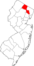 | |
| Boroughs | ||
| Townships | ||
| CDPs | ||
| Other unincorporated communities | ||