Guilford, Missouri
| Guilford, Missouri | |
|---|---|
| Village | |
 Location of Guilford, Missouri | |
| Coordinates: 40°10′8″N 94°44′7″W / 40.16889°N 94.73528°WCoordinates: 40°10′8″N 94°44′7″W / 40.16889°N 94.73528°W | |
| Country | United States |
| State | Missouri |
| County | Nodaway |
| Area[1] | |
| • Total | 0.09 sq mi (0.23 km2) |
| • Land | 0.09 sq mi (0.23 km2) |
| • Water | 0 sq mi (0 km2) |
| Elevation | 955 ft (291 m) |
| Population (2010)[2] | |
| • Total | 85 |
| • Estimate (2012[3]) | 85 |
| • Density | 944.4/sq mi (364.6/km2) |
| Time zone | Central (CST) (UTC-6) |
| • Summer (DST) | CDT (UTC-5) |
| ZIP code | 64457 |
| Area code(s) | 660 |
| FIPS code | 29-29692[4] |
| GNIS feature ID | 0718916[5] |
Guilford is a village in Nodaway County, Missouri, United States, near the Platte River. The population was 85 at the 2010 census.
History
Guilford was founded about 1856.[6] The community was named in commemoration of the Battle of Guilford Court House in the American Revolutionary War.[7] A post office called Guilford has been in operation since 1856.[8]
Geography
According to the United States Census Bureau, Guilford has a total area of 0.09 square miles (0.23 km2), all of it land.[1]
Demographics
| Historical population | |||
|---|---|---|---|
| Census | Pop. | %± | |
| 1880 | 67 | — | |
| 1900 | 235 | — | |
| 1910 | 207 | −11.9% | |
| 1920 | 273 | 31.9% | |
| 1930 | 201 | −26.4% | |
| 1940 | 227 | 12.9% | |
| 1950 | 164 | −27.8% | |
| 1960 | 125 | −23.8% | |
| 1970 | 105 | −16.0% | |
| 1980 | 87 | −17.1% | |
| 1990 | 93 | 6.9% | |
| 2000 | 87 | −6.5% | |
| 2010 | 85 | −2.3% | |
| Est. 2015 | 81 | [9] | −4.7% |
2010 census
As of the census[2] of 2010, there were 85 people, 36 households, and 23 families residing in the village. The population density was 944.4 inhabitants per square mile (364.6/km2). There were 49 housing units at an average density of 544.4 per square mile (210.2/km2). The racial makeup of the village was 100.0% White.
There were 36 households of which 25.0% had children under the age of 18 living with them, 41.7% were married couples living together, 8.3% had a female householder with no husband present, 13.9% had a male householder with no wife present, and 36.1% were non-families. 33.3% of all households were made up of individuals and 8.4% had someone living alone who was 65 years of age or older. The average household size was 2.36 and the average family size was 3.00.
The median age in the village was 38.5 years. 17.6% of residents were under the age of 18; 10.7% were between the ages of 18 and 24; 28.2% were from 25 to 44; 36.5% were from 45 to 64; and 7.1% were 65 years of age or older. The gender makeup of the village was 52.9% male and 47.1% female.
2000 census
As of the census[4] of 2000, there were 87 people, 34 households, and 21 families residing in the town. The population density was 1,130.5 people per square mile (419.9/km²). There were 41 housing units at an average density of 532.8 per square mile (197.9/km²). The racial makeup of the town was 100.00% White. Hispanic or Latino of any race were 4.60% of the population.
There were 34 households out of which 35.3% had children under the age of 18 living with them, 50.0% were married couples living together, 8.8% had a female householder with no husband present, and 35.3% were non-families. 32.4% of all households were made up of individuals and 23.5% had someone living alone who was 65 years of age or older. The average household size was 2.56 and the average family size was 3.27.
In the town the population was spread out with 26.4% under the age of 18, 12.6% from 18 to 24, 31.0% from 25 to 44, 11.5% from 45 to 64, and 18.4% who were 65 years of age or older. The median age was 37 years. For every 100 females there were 102.3 males. For every 100 females age 18 and over, there were 88.2 males.
The median income for a household in the town was $20,625, and the median income for a family was $28,750. Males had a median income of $25,750 versus $19,500 for females. The per capita income for the town was $9,391. There were 25.0% of families and 28.6% of the population living below the poverty line, including 40.0% of under eighteens and 25.0% of those over 64.
Education
Up until May, 2013 Guilford was served by the South Nodaway R-IV School District, and was home of the elementary school (grades Pre-K-6). The high school, grades 7-12, was in Barnard, MO, 5 miles west of town. In May, 2013 all grades were moved to the Barnard school and the school in Guilford was closed.
Notable native
- Jerry Wallace - Country and popular music singer. His hits included "Primrose Lane", "Shutters And Boards", "In The Misty Moonlight", and If You Leave Me Tonight I'll Cry.[11]
References
- 1 2 "US Gazetteer files 2010". United States Census Bureau. Retrieved 2012-07-08.
- 1 2 "American FactFinder". United States Census Bureau. Retrieved 2012-07-08.
- ↑ "Population Estimates". United States Census Bureau. Retrieved 2013-05-30.
- 1 2 "American FactFinder". United States Census Bureau. Retrieved 2008-01-31.
- ↑ "US Board on Geographic Names". United States Geological Survey. 2007-10-25. Retrieved 2008-01-31.
- ↑ Eaton, David Wolfe (1917). How Missouri Counties, Towns and Streams Were Named. The State Historical Society of Missouri. p. 336.
- ↑ "Nodaway County Place Names, 1928–1945". The State Historical Society of Missouri. Archived from the original on June 24, 2016. Retrieved November 24, 2016.
- ↑ "Post Offices". Jim Forte Postal History. Retrieved 24 November 2016.
- ↑ "Annual Estimates of the Resident Population for Incorporated Places: April 1, 2010 to July 1, 2015". Retrieved July 2, 2016.
- ↑ "Census of Population and Housing". Census.gov. Retrieved June 4, 2015.
- ↑ Oldies Bio
Municipalities and communities of Nodaway County, Missouri, United States | ||
|---|---|---|
| Cities | 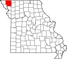 | |
| Villages | ||
| Townships | ||
| CDPs | ||
| Unincorporated communities | ||
| Ghost town | ||