Grez-Doiceau
| Grez-Doiceau Graven (Dutch) | ||
|---|---|---|
| Municipality | ||
.jpg) | ||
| ||
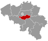
 Grez-Doiceau Location in Belgium | ||
|
The municipality of Grez-Doiceau in Walloon Brabant  | ||
| Coordinates: 50°44′N 04°42′E / 50.733°N 4.700°ECoordinates: 50°44′N 04°42′E / 50.733°N 4.700°E | ||
| Country | Belgium | |
| Community | French Community | |
| Region | Wallonia | |
| Province | Walloon Brabant | |
| Arrondissement | Nivelles | |
| Government | ||
| • Mayor | De Coster Bauchau Sybille (A.C.) | |
| • Governing party/ies | Alliance Communale - Equipe– | |
| Area | ||
| • Total | 55.44 km2 (21.41 sq mi) | |
| Population (1 January 2016)[1] | ||
| • Total | 13,088 | |
| • Density | 240/km2 (610/sq mi) | |
| Postal codes | 1390 | |
| Area codes | 010 | |
| Website | www.grez-doiceau.be | |

Grez-Doiceau is a Belgian municipality located in the province of Walloon Brabant. On January 1, 2006, Grez-Doiceau had a total population of 12,403. The total area is 55.44 km² which gives a population density of 224 inhabitants per km². Grez-Doiceay is watered by the Train, a tributary of the Dyle.
The municipality consists of the following sub-municipalities: Archennes (Eerken), Biez, Bossut-Gottechain, Grez-Doiceau proper, and Nethen.

Altar of Saint George's church, Grez-Doiceau
References
- ↑ Population per municipality as of 1 January 2016 (XLS; 397 KB)
External links
-
 Media related to Grez-Doiceau at Wikimedia Commons
 |
Huldenberg (VBR) | Oud-Heverlee (VBR) | Bierbeek (VBR) | |
| |
Beauvechain | |||
| ||||
| | ||||
| Wavre | Chaumont-Gistoux | Incourt |
This article is issued from Wikipedia - version of the 12/1/2016. The text is available under the Creative Commons Attribution/Share Alike but additional terms may apply for the media files.