Greipstad
| Greipstad herred | |
|---|---|
| Former Municipality | |
|
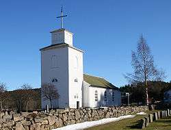
Greipstad church in Nodeland | |
| Coordinates: 58°09′14″N 07°49′29″E / 58.15389°N 7.82472°ECoordinates: 58°09′14″N 07°49′29″E / 58.15389°N 7.82472°E | |
| Country | Norway |
| County | Vest-Agder |
| District | Sørlandet |
| Municipality ID | NO-1017 |
| Adm. Center | Nodeland |
| Area[1] | |
| • Total | 104 km2 (40 sq mi) |
| Created from | Søgne in 1913 |
| Merged with | Songdalen in 1964 |
Greipstad is a former municipality in Vest-Agder county in Norway. It is located in the southeastern part of the present-day municipality of Songdalen.
Name
The municipality (originally the parish) is named after the old Greipstad farm (Old Norse: Greipsstaðir), which is the location of the church. The first element of the name comes from the male name, Greipr, and the last element stad means "place".[1][2]
History
The municipality of Greipstad was established on 1 July 1913 when it was separated from the municipality of Søgne to form a municipality of its own. Initially, the municipality had a population of 822 residents.
On 1 January 1964, Greipstad was merged with Finsland and a small part of Øvrebø to form the new municipality of Songdalen. Prior to the merger, the population of Greipstad was 2,061.[3]
References
- 1 2 "Greipstad – tidl. kommune" (in Norwegian). Store norske leksikon. Retrieved 2009-10-26.
- ↑ Rygh, Oluf (1912). Norske gaardnavne: Lister og Mandals amt (in Norwegian) (9 ed.). Kristiania, Norge: W. C. Fabritius & sønners bogtrikkeri. p. 58.
- ↑ Jukvam, Dag (1999). "Historisk oversikt over endringer i kommune- og fylkesinndelingen" (PDF) (in Norwegian). Statistisk sentralbyrå.
External links
- Weather information for Greipstad (Norwegian)