Greenville Township, LaMoure County, North Dakota
| Greenville Township, LaMoure County, North Dakota | |
|---|---|
| Township | |
 Greenville Township, LaMoure County, North Dakota Location within the state of North Dakota | |
| Coordinates: 46°24′23″N 98°5′13″W / 46.40639°N 98.08694°WCoordinates: 46°24′23″N 98°5′13″W / 46.40639°N 98.08694°W | |
| Country | United States |
| State | North Dakota |
| County | LaMoure |
| Area[1] | |
| • Total | 36.02 sq mi (93.3 km2) |
| • Land | 36.02 sq mi (93.3 km2) |
| • Water | 0.09 sq mi (0.2 km2) |
| Elevation | 1,486 ft (453 m) |
| Population (2000)[1][2] | |
| • Total | 80 |
| • Density | 2.2/sq mi (0.8/km2) |
| Time zone | Central (CST) (UTC-6) |
| • Summer (DST) | CDT (UTC-5) |
| Area code(s) | 701 |
| FIPS code | 38-33460[3] |
| GNIS feature ID | 1036894[4] |
Greenville Township is a township in LaMoure County in the U.S. state of North Dakota. Its population at the 2000 Census was 80,[2] with an estimated population of 67 as of 2009.[5]
References
- 1 2 U.S. Census Bureau. Census 2000, Summary File 1. "GCT-PH1. Population, Housing Units, Area, and Density: 2000 - County -- Subdivision and Place". American FactFinder. <http://factfinder2.census.gov>. Retrieved 2008-01-31.
- 1 2 U.S. Census Bureau. Census 2000. "Census Demographic Profiles, Greenville Township" (PDF). CenStats Databases. Retrieved 2009-01-31.
- ↑ "American FactFinder". United States Census Bureau. Retrieved 2008-01-31.
- ↑ "US Board on Geographic Names". United States Geological Survey. 2007-10-25. Retrieved 2008-01-31.
- ↑ U.S. Census Bureau (2010). "Incorporated Places and Minor Civil Divisions: North Dakota" (CSV). 2009 Population Estimates. Retrieved 2010-06-22.
Municipalities and communities of LaMoure County, North Dakota, United States | ||
|---|---|---|
| Cities | 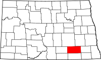 | |
| Townships |
| |
| Unincorporated communities |
| |
This article is issued from Wikipedia - version of the 6/12/2015. The text is available under the Creative Commons Attribution/Share Alike but additional terms may apply for the media files.