Greenacre, New South Wales
| Greenacre Sydney, New South Wales | |||||||||||||
|---|---|---|---|---|---|---|---|---|---|---|---|---|---|
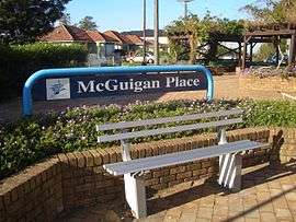 McGuigan Place, Greenacre | |||||||||||||
| Coordinates | 33°54′33″S 151°03′12″E / 33.90920°S 151.0534°ECoordinates: 33°54′33″S 151°03′12″E / 33.90920°S 151.0534°E | ||||||||||||
| Population | 23,213 (2011 census)[1] | ||||||||||||
| Postcode(s) | 2190 | ||||||||||||
| Location | 17 km (11 mi) south-west of Sydney CBD | ||||||||||||
| LGA(s) | |||||||||||||
| State electorate(s) | Lakemba | ||||||||||||
| Federal Division(s) | Watson | ||||||||||||
| |||||||||||||
Greenacre, a suburb of local government areas Canterbury-Bankstown Council and the Municipality of Strathfield, is located 17 kilometres south-west of the Sydney central business district in the state of New South Wales, Australia, and is a part of the South-western Sydney region.
History
This area was previously known as East Bankstown. When the first road went through the area, an acre of land was cleared for cultivation. The contrast to its surrounding area led to it being referred to as the 'Green Acre'. In 1909, Greenacre Park Estate became one of the first subdivisions in the area. Michael Ryan operated an inn called the Harp of Ould Erin on land he owned to the north of Liverpool Road.[2]
Population
At the 2011 census, there were 23,213 residents in Greenacre. The median age was 32 years old and 24.9% of the population was aged 14 years and under. Almost half of Greenacre residents were born outside of Australia, with top countries of birth being Lebanon 14.6% and Vietnam 2.3%. Three quarters of people spoke a language other than English at home. The most common languages spoken included Arabic 42.2%, Greek 4.0%, Vietnamese 3.0%, Italian 2.5% and Korean 2.4%. The top responses for religious affiliation were Islam, Catholic and Eastern Orthodox. The median household income of $959 was lower than the national figure of $1,234.[1]
Commercial area
The suburb is distinctly but unofficially split into the north and the south. The southern parts of Greenacre are serviced by a strip of local independent shops and outlets along Waterloo Road and around the intersection of Juno Parade and Boronia Road. The northern parts of Greenacre are serviced by the Chullora amenities such as Chullora Market Place. The major shopping centres close by are Bankstown Central Shopping Centre and Westfield Burwood.
Transport
As the suburb is not connected to a railway station, but is serviced by various bus and coach services that operate along the main roads and various smaller roads. Buses operate to and from Strathfield station, Burwood station, Punchbowl station, Lakemba station and Bankstown station.[3]
The eastern edge of Greenacre is defined by the Enfield Marshalling Yards and Punchbowl Road, the western limit is Rookwood Road and Stacey Street, the northern limit is Liverpool Road and Brunker Road, and the southern limit is Wattle Street. Other main roads through the suburb include Waterloo Road, Juno Parade, Boronia Road and Highview Avenue.
Churches
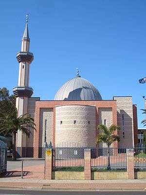
Good Shepherd Anglican Church (80 Pandora St), St John Vianney Catholic Church, Greenacre Uniting Church, Greenacre Baptist Church, Greenacre Church of Christ, Sydney Full Gospel Korean Church, St John's Melkite Catholic Church.
Schools
Greenacre is the site of three public primary schools, Chullora Public School, Banksia Road Primary School and Greenacre Public School. Greenacre also has various private schools such as Greenacre Baptist Christian Community School, St John Vianneys Primary School, Holy Saviour Catholic School, Al Noori Muslim School, Malek Fahd Islamic School, An-Nahyan Islamic School and Sydney Full Gospel Church School.

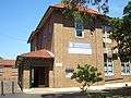 Greenacre Public School
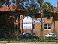 Greenacre Public School
Sport and recreation
- Greenacre's Rugby League club are known as the "Tigers". The Greenacre Tigers are based at Roberts Park.
- Greenacre has a Bowls Club on Roberts Road and an RSL Club.
- Greenacre Pools are located on Banksia Road.
- Greenacre has three soccer clubs which are Chullora Wolves, East Bankstown and Greenacre Eagles.
- Greenacre has a Civic Centre on the corner of Banksia Road and Waterloo Road. It includes a public library, youth centre and community centre.
- Greenacre YMCA located on Waterloo Rd - Recently closed down in 2016, due to lack of funding.
Parks
- Roberts Park, Allum Park, Lockwood Park, Gosling Park, Greenacre Heights Reserve, Bromley Reserve, Matthews Park, Lee Park, Parry Park
- Norfolk Reserve is bounded by Chullora Marketplace and Norfolk Village.
References
- 1 2 Australian Bureau of Statistics (31 October 2012). "Greenacre (State Suburb)". 2011 Census QuickStats. Retrieved 6 May 2013.
- ↑ The Book of Sydney Suburbs, Compiled by Frances Pollen, Angus & Robertson Publishers, 1990, Published in Australia ISBN 0-207-14495-8
- ↑ Suburb and Route Index Punchbowl Bus Co
External links
| Wikimedia Commons has media related to Greenacre, New South Wales. |