Grangelands and Pulpit Hill
| Site of Special Scientific Interest | |
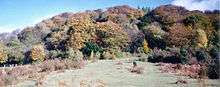 The woods on the side of Pulpit Hill | |
| Area of Search | Buckinghamshire |
|---|---|
| Grid reference | SP829050 |
| Interest | Biological |
| Area | 25.5 hectares |
| Notification | 1985 |
| Location map | Magic Map |
Grangelands and Pulpit Hill is a 25.5 hectare biological Site of Special Scientific Interest in Cadsden in Buckinghamshire. It lies within the Chilterns Area of Outstanding Natural Beauty, and the planning authorities are Wycombe District Council and Buckinghamshire County Council.[1][2] Pulpit Hill is a National Trust site,[3] and Grangelands was formerly owned by Buckinghamshire County Council and was transferred to the Berkshire, Buckinghamshire and Oxfordshire Wildlife Trust in 2014.[4][5]
The site has grassland and scrub, which support interesting breeding birds and invertebrates, such as glow-worms and marbled white and chalk hill blue butterflies. There are areas of mature beech woodland, with a sparse shrub layer of holly and elder.[1]
There is a small but well-preserved multivallate hill fort on the summit of Pulpit Hill, which dates to the late Bronze Age and Iron Age. It is a scheduled monument under the Ancient Monuments and Archaeological Areas Act 1979.[6][7]
The site is always open but accessiblity is difficult for anyone who is not able bodied, due to steep slopes and soft ground.[8]
See also
References
- 1 2 "Grangelands and Pulpit Hill citation" (PDF). Sites of Special Scientific Interest. Natural England. Retrieved 10 January 2015.
- ↑ "Map of Grangelands and Pulpit Hill". Sites of Special Scientific Interest. Natural England. Retrieved 10 January 2015.
- ↑ "Chilterns Countryside". National Trust. Retrieved 10 January 2015.
- ↑ "Green Spaces- Divestment of land at Grangelands, Great Kimble & Rifle Range - Great Kimble". Buckinghamshire County Council. 4 November 2014.
- ↑ "COMMUNITY WILDLIFE OFFICER (BUCKS)" (PDF). Berkshire, Buckinghamshire & Oxfordshire Wildlife Trust. Retrieved 28 September 2015.
- ↑ "Small multivallate hillfort on Pulpit Hill". English Heritage. Retrieved 10 January 2015.
- ↑ "Pulpit Hill". The Megalithic Portal. Retrieved 10 January 2015.
- ↑ "Grangelands and Pulpit Hill". Chilterns Conservation Board. Retrieved 10 January 2015.
Coordinates: 51°44′15″N 0°48′03″W / 51.7376°N 0.8009°W