Bolter End Sand Pit
| Site of Special Scientific Interest | |
 | |
| Area of Search | Buckinghamshire |
|---|---|
| Grid reference | SU799919 |
| Interest | Geological |
| Area | 0.33 hectares |
| Notification | 1988 |
| Location map | Magic Map |
Bolter End Sand Pit is a 0.33 hectare geological Site of Special Scientific Interest in Bolter End in Buckinghamshire.[1][2] It is a Geological Conservation Review site.[3]
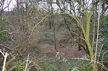
The site is a disused sand pit. It is part of the Reading Beds, and dates to 53 million years ago. It has an unusual pebble content for Reading Beds, and is important for palaeogeographical reconstructions as it appears to represent a riverine sequence with sources from Lower Cretaceous and Upper Jurassic sequences.[4]
The site is on private land with no public access.[4]
References
- ↑ "Bolter End Sand Pit citation" (PDF). Sites of Special Scientific Interest. Natural England. Retrieved 5 February 2016.
- ↑ "Map of Bolter End Sand Pit". Sites of Special Scientific Interest. Natural England. Retrieved 5 February 2016.
- ↑ "Bolter End (Palaeogene)". Joint Nature Conservation Committee. Retrieved 5 February 2016.
- 1 2 "Bolter End Sand Pit SSSI". Bucks Geology. Retrieved 5 February 2016.
Coordinates: 51°37′15″N 0°50′48″W / 51.620703°N 0.846554°W
This article is issued from Wikipedia - version of the 2/12/2016. The text is available under the Creative Commons Attribution/Share Alike but additional terms may apply for the media files.