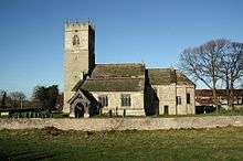
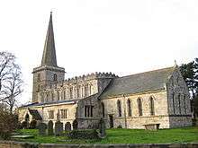
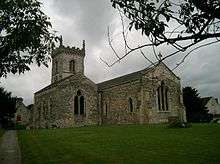
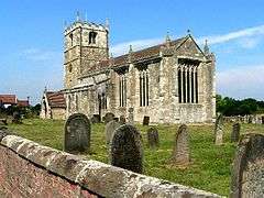
Grade I listed buildings in Selby (district)

There are over 9,000 Grade I listed buildings in England. This page is a list of these buildings in the district of Selby in North Yorkshire.

Selby

Name Location Type Completed [note 1]Date designated Grid ref.[note 2]
Geo-coordinates
Entry number [note 3]Image
Church of St Mary Birkin Church 12th century 11 December 1967 SE5303426511
53°43′56″N 1°11′51″W / 53.732304°N 1.197576°W / 53.732304; -1.197576 (Church of St Mary)
1316671
Church of All Saints Bolton Percy Church Early 14th century 3 February 1967 SE5317541275
53°51′54″N 1°11′34″W / 53.864975°N 1.192896°W / 53.864975; -1.192896 (Church of All Saints)
1296630
Church of St Wilfrid Brayton Church 12th century 17 November 1966 SE6041930997
53°46′19″N 1°05′05″W / 53.771818°N 1.084771°W / 53.771818; -1.084771 (Church of St Wilfrid)
1132537
Ferry Bridge Brotherton Bridge 1797 11 December 1967 SE4835224640
53°42′57″N 1°16′08″W / 53.715943°N 1.268832°W / 53.715943; -1.268832 (Ferry Bridge)
1167483
Cambleforth Hall Camblesforth House c.1700 17 November 1966 SE6467826140
53°43′40″N 1°01′16″W / 53.727659°N 1.021176°W / 53.727659; -1.021176 (Cambleforth Hall)
1173983
Carlton Towers Carlton Country House Early 17th century 17 November 1966 SE6497623798
53°42′24″N 1°01′02″W / 53.706575°N 1.017151°W / 53.706575; -1.017151 (Carlton Towers)
1295955
Cawood Castle gatehouse Cawood Castle 1426-1451 17 November 1966 SE5739437698
53°49′57″N 1°07′46″W / 53.832381°N 1.129416°W / 53.832381; -1.129416 (Cawood Castle gatehouse)
1132508
Banqueting Hall Adjoining East Side of Cawood Castle gatehouse Cawood Castle 1426-1451 17 November 1966 SE5740837687
53°49′56″N 1°07′45″W / 53.83228°N 1.129205°W / 53.83228; -1.129205 (Banqueting Hall Adjoining East Side of Cawood Castle gatehouse)
1174558
Church of All Saints Cawood Church C20 17 November 1966 SE5777937790
53°49′59″N 1°07′25″W / 53.833165°N 1.12355°W / 53.833165; -1.12355 (Church of All Saints)
1316657
Church of St Mary the Virgin Church Fenton Church 13th century 3 February 1967 SE5143136764
53°49′29″N 1°13′13″W / 53.82461°N 1.220166°W / 53.82461; -1.220166 (Church of St Mary the Virgin)
1148436
Church of St Peter and St Paul Drax Church 12th century 17 November 1986 SE6758726371
53°43′46″N 0°58′37″W / 53.729367°N 0.977043°W / 53.729367; -0.977043 (Church of St Peter and St Paul)
1148397
Church of St Mary the Virgin Hemingbrough Church Late 12th century 17 November 1966 SE6735130619
53°46′03″N 0°58′47″W / 53.767572°N 0.979695°W / 53.767572; -0.979695 (Church of St Mary the Virgin)
1148462
Church of St Edmund Kellington Church Norman 11 December 1967 SE5479224561
53°42′53″N 1°10′17″W / 53.714598°N 1.171275°W / 53.714598; -1.171275 (Church of St Edmund)
1148402
Church of St Wilfrid Monk Fryston Church 13th century 11 December 1967 SE5052429746
53°45′42″N 1°14′06″W / 53.761626°N 1.235092°W / 53.761626; -1.235092 (Church of St Wilfrid)
1296769
Church of St Andrew Newton Kyme Church 12th century 12 July 1985 SE4658044879
53°53′53″N 1°17′33″W / 53.897997°N 1.292625°W / 53.897997; -1.292625 (Church of St Andrew)
1132464
Church of St Mary Riccall Church Mid - Late 12th century 17 November 1966 SE6195937836
53°49′59″N 1°03′36″W / 53.833098°N 1.060036°W / 53.833098; -1.060036 (Church of St Mary)
1148464
Church of All Saints Ryther cum Ossendyke Church late Saxon/early Norman 3 February 1967 SE5550139409
53°50′53″N 1°09′28″W / 53.847962°N 1.157867°W / 53.847962; -1.157867 (Church of All Saints)
1148428
Church of All Saints Saxton Church 11th century 3 February 1967 SE4757536883
53°49′34″N 1°16′43″W / 53.826045°N 1.278721°W / 53.826045; -1.278721 (Church of All Saints)
1168016
Church of St Mary and St Germain (Selby Abbey) Selby Abbey 1069 16 December 1952 SE6156832376
53°47′03″N 1°04′01″W / 53.784076°N 1.067066°W / 53.784076; -1.067066 (Church of St Mary and St Germain (Selby Abbey))
1132591
Church of All Saints Sherburn-in-Elmet Church 15th century 3 February 1967 SE4880333525
53°47′45″N 1°15′38″W / 53.795753°N 1.260598°W / 53.795753; -1.260598 (Church of All Saints)
1148444
Church of Saint Helen Skipwith Church Anglo Saxon 17 November 1966 SE6572638504
53°50′19″N 1°00′10″W / 53.838639°N 1.002664°W / 53.838639; -1.002664 (Church of Saint Helen)
1148467
Gatehouse to Steeton Hall and Walls Adjoining South Milford Gatehouse Late 14th century 3 February 1967 SE4840331432
53°46′37″N 1°16′01″W / 53.77698°N 1.266998°W / 53.77698; -1.266998 (Gatehouse to Steeton Hall and Walls Adjoining)
1148546
Steeton Hall South Milford House Early 14th century 4 July 1952 SE4833831401
53°46′36″N 1°16′05″W / 53.776707°N 1.267989°W / 53.776707; -1.267989 (Steeton Hall)
1167763
Church of St Helen Stillingfleet Church c.1145 17 November 1966 SE5932541003
53°51′43″N 1°05′58″W / 53.861865°N 1.099442°W / 53.861865; -1.099442 (Church of St Helen)
1296904
Hazlewood Castle Hazlewood Castle Estate, Stutton with Hazlewood Castle Late 13th century 18 February 1958 SE4488339770
53°51′08″N 1°19′09″W / 53.85223°N 1.319194°W / 53.85223; -1.319194 (Hazlewood Castle)
1148386
Roman Catholic Chapel of St Leonard Hazlewood Castle Estate, Stutton with Hazlewood Chapel 1609 3 February 1967 SE4492139795
53°51′09″N 1°19′07″W / 53.852452°N 1.318613°W / 53.852452; -1.318613 (Roman Catholic Chapel of St Leonard)
1316353
Church of St Helen Thorganby Church 15th century 17 November 1966 SE6896341641
53°51′59″N 0°57′10″W / 53.86641°N 0.952778°W / 53.86641; -0.952778 (Church of St Helen)
1148469
Church of All Saints Wistow Church 13th century 17 November 1966 SE5923035655
53°48′50″N 1°06′07″W / 53.813815°N 1.101915°W / 53.813815; -1.101915 (Church of All Saints)
1174776
Church of St Martin Womersley Church 12th century 11 December 1967 SE5323118984
53°39′53″N 1°11′45″W / 53.664637°N 1.19588°W / 53.664637; -1.19588 (Church of St Martin)
1174486

Notes

  1. The date given is the date used by Historic England as significant for the initial building or that of an important part in the structure's description.
  2. Sometimes known as OSGB36, the grid reference is based on the British national grid reference system used by the Ordnance Survey.
  3. The "List Entry Number" is a unique number assigned to each listed building and scheduled monument by Historic England.

Media related to Grade I listed buildings in Selby (district) at Wikimedia Commons

This article is issued from Wikipedia - version of the 10/9/2016. The text is available under the Creative Commons Attribution/Share Alike but additional terms may apply for the media files.