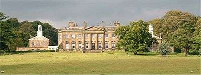
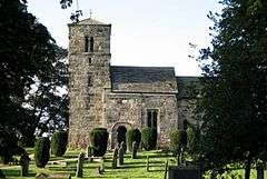
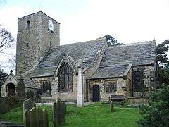
Grade I listed buildings in Harrogate (borough)

There are over 9,000 Grade I listed buildings in England. This page is a list of these buildings in the district of Harrogate in North Yorkshire.

Harrogate

Name Location TypeArchitect Completed [note 1]Date designated Grid ref.[note 2]
Geo-coordinates
Entry number [note 3]ImageRef.
Allerton Castle Allerton Park, Allerton Mauleverer with Hopperton House 1721 15 March 1966 SE4141658089
54°01′02″N 1°22′10″W / 54.017154°N 1.369418°W / 54.017154; -1.369418 (Allerton Castle)
1189430
Church of St James Baldersby St James, Baldersby Church 1856-58 26 May 1971 SE3662376957
54°11′14″N 1°26′25″W / 54.187084°N 1.440285°W / 54.187084; -1.440285 (Church of St James)
1296495
Lych Gate to Church of St James Baldersby St James, Baldersby Lych Gate 1856-8 26 May 1971 SE3660676919
54°11′12″N 1°26′26″W / 54.186743°N 1.44055°W / 54.186743; -1.44055 (Lych Gate to Church of St James)
1315555
Church of St Helen Bilton-in-Ainsty Church 12th century 30 March 1966 SE4760450382
53°56′50″N 1°16′34″W / 53.94736°N 1.276188°W / 53.94736; -1.276188 (Church of St Helen)
1315388
[1]
Syningthwaite Priory Farmhouse Bilton in Ainsty Farmhouse 12th century 2 September 1952 SE4615448686
53°55′56″N 1°17′55″W / 53.932249°N 1.298535°W / 53.932249; -1.298535 (Syningthwaite Priory Farmhouse)
1150361
Church of St Andrew Aldborough Church 16th century 15 March 1966 SE4059966430
54°05′32″N 1°22′51″W / 54.09218°N 1.380772°W / 54.09218; -1.380772 (Church of St Andrew)
1173835
Denton Hall and Attached Forecourt Walls and Railings Denton House 1778 6 February 1952 SE1476548694
53°56′03″N 1°46′36″W / 53.93416°N 1.776599°W / 53.93416; -1.776599 (Denton Hall and Attached Forecourt Walls and Railings)
1315354
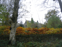
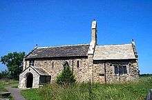
Church of St Oswald Farnham Church 12th century 15 March 1966 SE3481160584
54°02′24″N 1°28′12″W / 54.040064°N 1.46993°W / 54.040064; -1.46993 (Church of St Oswald)
1150301
[2]
Farnley Hall Farnley Country House John Carr 17th century 6 February 1952 SE2151947276
53°55′16″N 1°40′26″W / 53.92118°N 1.673828°W / 53.92118; -1.673828 (Farnley Hall)
1150040
[3]
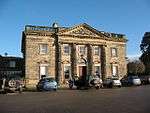
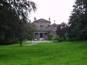
Rudding Park House Rudding Lane, Follifoot House 1805-24 8 March 1952 SE3341853164
53°58′24″N 1°29′31″W / 53.97347°N 1.492013°W / 53.97347; -1.492013 (Rudding Park House)
1188343
[4]
Brimham Lodge Brimham Road, Hartwith cum Winsley House 1661 3 March 1987 SE2271363298
54°03′54″N 1°39′16″W / 54.065127°N 1.654459°W / 54.065127; -1.654459 (Brimham Lodge)
1150538
[5]
Church of All Saints Kirby Hill Church 10th century 20 June 1966 SE3932268598
54°06′42″N 1°24′00″W / 54.111763°N 1.400014°W / 54.111763; -1.400014 (Church of All Saints)
1190293
Church of All Saints Kirk Deighton Church Early-mid 15th century 30 March 1966 SE3988250524
53°56′57″N 1°23′38″W / 53.949287°N 1.393815°W / 53.949287; -1.393815 (Church of All Saints)
1294634
[6]
Church of St John the Baptist Kirk Hammerton Church 11th century 15 March 1966 SE4652455525
53°59′37″N 1°17′31″W / 53.993678°N 1.291859°W / 53.993678; -1.291859 (Church of St John the Baptist)
1149932
Church of St Andrew Kirkby Malzeard Church 12th century 6 March 1967 SE2354774527
54°09′58″N 1°38′27″W / 54.166009°N 1.640846°W / 54.166009; -1.640846 (Church of St Andrew)
1173967
Chapel of Our Lady of the Crag Knaresborough Chapel Early 15th century 5 February 1952 SE3513556447
54°00′10″N 1°27′56″W / 54.002862°N 1.46546°W / 54.002862; -1.46546 (Chapel of Our Lady of the Crag)
1149913
Church of Saint John the Baptist Knaresborough Parish Church Late 12th century 5 February 1952 SE3471257185
54°00′34″N 1°28′19″W / 54.009523°N 1.471829°W / 54.009523; -1.471829 (Church of Saint John the Baptist)
1293930
Church of St Oswald Leathley Church 12th century 22 November 1966 SE2318847010
53°55′07″N 1°38′54″W / 53.918718°N 1.648436°W / 53.918718; -1.648436 (Church of St Oswald)
1174461
Banqueting House at Studley Royal Studley Park, Lindrick With Studley Royal And Fountains Banqueting House 1728–32 6 March 1967 SE2781268901
54°06′55″N 1°34′34″W / 54.115234°N 1.57604°W / 54.115234; -1.57604 (Banqueting House at Studley Royal)
1150608
[7]
Canal Approximately 500 Metres Long, with the Drum Falls and Weir Inlet Studley Park, Lindrick with Studley Royal and Fountains Canal c1718-1728 11 June 1986 SE2799068929
54°06′56″N 1°34′24″W / 54.115476°N 1.573315°W / 54.115476; -1.573315 (Canal Approximately 500 Metres Long, with the Drum Falls and Weir Inlet)
1173904
Temple of Piety on East Side of Moon Pond Studley Park, Lindrick with Studley Royal and Fountains Garden Building Completed 1742 6 March 1967 SE2808968786
54°06′51″N 1°34′19″W / 54.114186°N 1.571814°W / 54.114186; -1.571814 (Temple of Piety on East Side of Moon Pond)
1150613
Tunnel approximately 20 Metres West of the Octagon, with Flanking Wall attached to South Studley Park, Lindrick with Studley Royal and Fountains Tunnel c.1730 11 June 1986 SE2805468982
54°06′57″N 1°34′20″W / 54.115949°N 1.572331°W / 54.115949; -1.572331 (Tunnel approximately 20 Metres West of the Octagon, with Flanking Wall attached to South)
1150610
Church of St Mary Studley Park, Lindrick with Studley Royal and Fountains Church 1871-78 6 March 1967 SE2754169291
54°07′08″N 1°34′49″W / 54.118754°N 1.58015°W / 54.118754; -1.58015 (Church of St Mary)
1315267
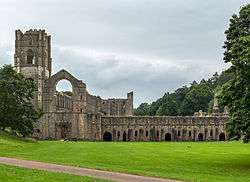
Fountains Abbey with ancillary buildings Lindrick with Studley Royal and Fountains Abbey Romanesque 11 June 1986 SE2749468282
54°06′35″N 1°34′51″W / 54.109688°N 1.580961°W / 54.109688; -1.580961 (Fountains Abbey with ancillary buildings)
1149811
Abbey Mill at Fountains Abbey Lindrick with Studley Royal and Fountains Mill Mid 12th century 11 June 1986 SE2725668193
54°06′32″N 1°35′05″W / 54.108901°N 1.584609°W / 54.108901; -1.584609 (Abbey Mill at Fountains Abbey)
1173325
Fountains Hall Lindrick with Studley Royal and Fountains Country House 1598-1611 23 April 1952 SE2713668289
54°06′35″N 1°35′11″W / 54.10977°N 1.586436°W / 54.10977; -1.586436 (Fountains Hall)
1149809
Church of the Holy Trinity, Little Ouseburn Little Ouseburn Church 11th century 15 March 1966 SE4523761139
54°02′39″N 1°18′38″W / 54.044245°N 1.310655°W / 54.044245; -1.310655 (Church of the Holy Trinity, Little Ouseburn)
1150296
[8]
Swinsty Hall Little Timble House Late C16-Early 17th century 14 July 1987 SE1936453197
53°58′28″N 1°42′23″W / 53.974481°N 1.706267°W / 53.974481; -1.706267 (Swinsty Hall)
1174496
Church of All Saints Long Marston Church c.1400 30 March 1966 SE5051750777
53°57′02″N 1°13′54″W / 53.950634°N 1.231745°W / 53.950634; -1.231745 (Church of All Saints)
1150327
[9]
Markenfield Hall Markingfield Hall Kitchen Early 15th century 23 April 1952 SE2945567395
54°06′06″N 1°33′04″W / 54.101608°N 1.551053°W / 54.101608; -1.551053 (Markenfield Hall)
1293954
Church of Christ the Consoler, with Eleanor Cross to east Skelton-on-Ure, Newby with Mulwith Church 1871-76 6 March 1967 SE3599567951
54°06′22″N 1°27′04″W / 54.106191°N 1.450979°W / 54.106191; -1.450979 (Church of Christ the Consoler, with Eleanor Cross to east)
1315406
Newby Hall Newby with Mulwith Country House c1695-1697 23 April 1952 SE3478667436
54°06′06″N 1°28′10″W / 54.101645°N 1.469528°W / 54.101645; -1.469528 (Newby Hall)
1150307
Skelton Lodges to Newby Hall with Attached Gates and Screen Walls Newby with Mulwith Gate c.1777 6 March 1967 SE3624167921
54°06′21″N 1°26′50″W / 54.105904°N 1.447221°W / 54.105904; -1.447221 (Skelton Lodges to Newby Hall with Attached Gates and Screen Walls)
1289365
Stables Approximately 150 Metres North of Newby Hall Newby with Mulwith Tack Room 19th century 23 April 1952 SE3479267524
54°06′09″N 1°28′10″W / 54.102436°N 1.469426°W / 54.102436; -1.469426 (Stables Approximately 150 Metres North of Newby Hall)
1150308
Church of St Mary Nun Monkton Church Late C12-Early 13th century 15 March 1966 SE5115357927
54°00′53″N 1°13′15″W / 54.014828°N 1.220857°W / 54.014828; -1.220857 (Church of St Mary)
1190942
[10]
Baldersby Park House Rainton with Newby House/School Coten Campbell 1718-21 10 July 1970 SE3878776282
54°10′51″N 1°24′26″W / 54.180859°N 1.407212°W / 54.180859; -1.407212 (Baldersby Park House)
1150028
[11]
Gatehouse approximately 80 metres south of Ripley Castle Ripley Gatehouse Medieval 8 March 1952 SE2826560529
54°02′24″N 1°34′12″W / 54.039968°N 1.569889°W / 54.039968; -1.569889 (Gatehouse approximately 80 metres south of Ripley Castle)
1174136
Ripley Castle Ripley Park, Ripley House Mid 16th century 8 March 1952 SE2822660557
54°02′25″N 1°34′14″W / 54.040222°N 1.570482°W / 54.040222; -1.570482 (Ripley Castle)
1315370
Chapel of the Hospital of St Mary Magdalene Ripon Chapel Medieval 27 May 1949 SE3172671779
54°08′27″N 1°30′57″W / 54.140874°N 1.515867°W / 54.140874; -1.515867 (Chapel of the Hospital of St Mary Magdalene)
1150194
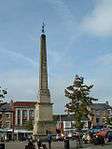
The Obelisk Ripon Obelisk Nicholas Hawksmoor 1702 27 May 1949 SE3121671270
54°08′11″N 1°31′25″W / 54.13633°N 1.523725°W / 54.13633; -1.523725 (The Obelisk)
1315492
[12]
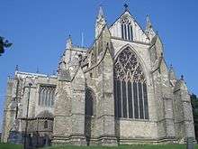
Ripon Minster (cathedral Church of St Peter and Wilfrid) Ripon Cathedral 14th century 27 May 1949 SE3144671129
54°08′06″N 1°31′13″W / 54.135049°N 1.52022°W / 54.135049; -1.52022 (Ripon Minster (cathedral Church of St Peter and Wilfrid))
1150164
Stockeld Park House Spofforth with Stockeld Country House James Paine 1758-63 2 September 1952 SE3720549075
53°56′11″N 1°26′05″W / 53.936463°N 1.434778°W / 53.936463; -1.434778 (Stockeld Park House)
1149986
[13]
Church of St Mary Stainburn Church 12th century 22 November 1966 SE2474648547
53°55′57″N 1°37′29″W / 53.93246°N 1.624591°W / 53.93246; -1.624591 (Church of St Mary)
1149989
Church of St Michael Cowthorpe, Tockwith Church (redundant) 1456-58 30 March 1966 SE4270052692
53°58′07″N 1°21′02″W / 53.968547°N 1.350578°W / 53.968547; -1.350578 (Church of St Michael)
1315417
[14]
Banqueting House Approximately 50 Metres East of Weston Hall Weston Park, Weston Banqueting House Late C16-Early 17th century 22 November 1966 SE1786146738
53°54′59″N 1°43′46″W / 53.916483°N 1.729557°W / 53.916483; -1.729557 (Banqueting House Approximately 50 Metres East of Weston Hall)
1150438
Church of All Saints Weston Park, Weston Church Anglo-Saxon 22 November 1966 SE1774346624
53°54′56″N 1°43′53″W / 53.915463°N 1.73136°W / 53.915463; -1.73136 (Church of All Saints)
1150440
Weston Hall Weston Park, Weston House Mid 18th century 6 February 1952 SE1779846711
53°54′58″N 1°43′50″W / 53.916243°N 1.730518°W / 53.916243; -1.730518 (Weston Hall)
1150437
Church of All Saints Wighill Church 15th century 30 March 1966 SE4736046577
53°54′47″N 1°16′50″W / 53.913186°N 1.280494°W / 53.913186; -1.280494 (Church of All Saints)
1315379
[15]
Church of St Wilfrid Duchy Road, Harrogate Church Temple Moore 1909-14 4 February 1975 SE2941255554
53°59′43″N 1°33′10″W / 53.995192°N 1.552854°W / 53.995192; -1.552854 (Church of St Wilfrid)
1189773
[16]

Notes

  1. The date given is the date used by Historic England as significant for the initial building or that of an important part in the structure's description.
  2. Sometimes known as OSGB36, the grid reference is based on the British national grid reference system used by the Ordnance Survey.
  3. The "List Entry Number" is a unique number assigned to each listed building and scheduled monument by Historic England.

References

  1. "Church Of St Helen:LBS Number 331703". heritagegateway. Retrieved 2009-02-09.
  2. "Church Of St Oswald:LBS Number 331771". heritagegateway. Retrieved 2009-02-03.
  3. "Farnley Hall:LBS Number 330482". heritagegateway. Retrieved 2009-01-24.
  4. "Rudding Park House:LBS Number 1188343". heritagegateway. Retrieved 2009-01-29.
  5. "Brimham Lodge:LBS Number 331216". heritagegateway. Retrieved 2009-01-29.
  6. "Church Of All Saints:LBS Number 331716". heritagegateway. Retrieved 2009-02-09.
  7. "Banqueting House Approximately 100 Metres To West Of The Canal:LBS Number 331073". heritagegateway. Retrieved 2009-01-29.
  8. "Church Of The Holy Trinity:LBS Number 331859". heritagegateway. Retrieved 2009-01-29.
  9. "Church Of All Saints:LBS Number 331726". heritagegateway. Retrieved 2009-02-09.
  10. "Church Of St Mary:LBS Number 331666". heritagegateway. Retrieved 2009-02-10.
  11. "Baldersby Park House:LBS Number 330444". heritagegateway. Retrieved 2009-01-24.
  12. "Obelisk:LBS Number 330147". heritagegateway. Retrieved 2009-01-24.
  13. "Stockeld Park House:LBS Number 1149986". heritagegateway. Retrieved 2009-01-24.
  14. "Church Of St Michael:LBS Number 331742". heritagegateway. Retrieved 2009-02-09.
  15. "Church Of All Saints:LBS Number 331752". heritagegateway. Retrieved 2009-02-09.
  16. "Church Of St Wilfrid:LBS Number 329866". heritagegateway. Retrieved 2009-02-03.

Media related to Grade I listed buildings in Harrogate (borough) at Wikimedia Commons

This article is issued from Wikipedia - version of the 9/14/2016. The text is available under the Creative Commons Attribution/Share Alike but additional terms may apply for the media files.