Goght
| Goght Գողթ | |
|---|---|
|
The village of Goght, October 2009 | |
 Goght Գողթ | |
| Coordinates: 40°8′22″N 44°46′46″E / 40.13944°N 44.77944°ECoordinates: 40°8′22″N 44°46′46″E / 40.13944°N 44.77944°E | |
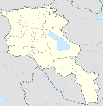
| Country |
|
| Marz | Kotayk |
| First mentioned | 13th-century |
| Government | |
| • Mayor | Artavazd Hakobyan |
| Area | |
| • Total | 12.38 km2 (4.78 sq mi) |
| Elevation | 1,600 m (5,200 ft) |
| Population (2008) | |
| • Total | 2,039 |
| • Density | 160/km2 (430/sq mi) |
| Time zone | GMT +4 (UTC+4) |

Goght (Armenian: Գողթ; formerly Goghot) is a village in the Kotayk Province of Armenia, located on the right bank of the upper-Azat River. It is known from 13th-century manuscripts as Goghot. It is located near Garni and sits along the road leading to Geghard Monastery. The village has a small ruined basilica from the 17th or 18th century located straight down a dirt road from the main square. Some khachkars are built into the exterior walls of the church, as well as at its altar. Goght sits overlooking a large gorge and upon a promontory on the other side is the 11th- to 13th-century monastery of Havuts Tar. It may be reached by foot from the town, but more easily from Garni via the Garni Gorge. The community has a school, kindergarten, house of culture, and a library. The local economy is heavily dependent on agriculture, based primarily on grain farming, orchard cultivation, and cattle-breeding.[1][2]
Gallery
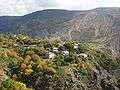 A portion of the village that sits along a ridge overlooking the gorge
 Goght as seen from Havuts Tar Monastery across the gorge
 Village church
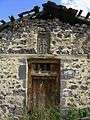 One of the doors leading into the village church
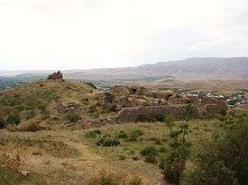 The Havuts Tar Monastic Complex located across the gorge from Goght
References
- ↑ "Goght (Kotayk)". CAA: Union of Communities of Armenia. Retrieved May 30, 2015.
- ↑ Kiesling, Brady; Kojian, Raffi (2005). Rediscovering Armenia: Guide (2nd ed.). Yerevan: Matit Graphic Design Studio. pp. 89–90. ISBN 99941-0-121-8.
- Kiesling, Brady (2005), Rediscovering Armenia: Guide, Yerevan, Armenia: Matit Graphic Design Studio
- Goght at GEOnet Names Server
- World Gazeteer: Armenia – World-Gazetteer.com
- Report of the results of the 2001 Armenian Census, National Statistical Service of the Republic of Armenia
External links
| Wikimedia Commons has media related to Goght. |
