Gabbs Valley Range
| Gabbs Valley Range | |
|---|---|
| Highest point | |
| Elevation | 2,209 m (7,247 ft) |
| Naming | |
| Etymology | Gabbs Valley, which was named for scientist William More Gabb |
| Geography | |
| Country | United States |
| State | Nevada |
| District | Mineral County |
| Range coordinates | 38°40′19″N 118°11′07″W / 38.6719°N 118.1854°WCoordinates: 38°40′19″N 118°11′07″W / 38.6719°N 118.1854°W |
| Topo map | USGS Mount Ferguson |
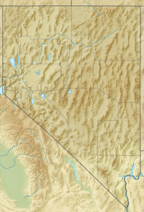
The Gabbs Valley Range is a mountain range in the west of the central Nevada desert in the Great Basin region. The range is within Mineral County, Nevada.
Gabbs Watershed
The Gabbs Watershed (USGS Huc 16060002) is a 2,060 sq mi (5,300 km2) area that includes the [2] Gabbs Valley and the slopes of the perimeter Great Basin mountain ranges within the watersheds' drainage divides, e.g., of the Gabbs Valley Range.
References
- ↑ "Gabbs Valley Range". Geographic Names Information System. United States Geological Survey. Retrieved 2009-05-04.
- ↑ Nevada Government Website
This article is issued from Wikipedia - version of the 1/1/2014. The text is available under the Creative Commons Attribution/Share Alike but additional terms may apply for the media files.