Frosolone
| Frosolone | ||
|---|---|---|
| Comune | ||
| Comune di Frosolone | ||
 | ||
| ||
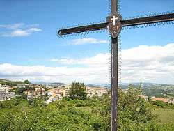
 Frosolone Location of Frosolone in Italy | ||
| Coordinates: 41°36′N 14°27′E / 41.600°N 14.450°ECoordinates: 41°36′N 14°27′E / 41.600°N 14.450°E | ||
| Country | Italy | |
| Region | Molise | |
| Province / Metropolitan city | Province of Isernia (IS) | |
| Government | ||
| • Mayor | Dott. Sabatino FARESE | |
| Area | ||
| • Total | 49.6 km2 (19.2 sq mi) | |
| Population (December 2004) | ||
| • Total | 3,330 | |
| • Density | 67/km2 (170/sq mi) | |
| Demonym(s) | Frosolonesi | |
| Time zone | CET (UTC+1) | |
| • Summer (DST) | CEST (UTC+2) | |
| Postal code | 86095 | |
| Dialing code | 0874 | |
| Website | Official website | |

Frosolone is a comune (municipality) in the Province of Isernia in the Italian region Molise, located about 20 kilometres (12 mi) west of Campobasso and about 20 kilometres (12 mi) east of Isernia. As of 31 December 2004, it had a population of 3,330 and an area of 49.6 square kilometres (19.2 sq mi).[1] Frosolone is well-known historically for the production of blades,[2] including knives and scissors, and is home to a museum dedicated to the craft.
Geography
Frosolone borders the following municipalities: Carpinone, Casalciprano, Civitanova del Sannio, Duronia, Macchiagodena, Molise, Sant'Elena Sannita, Sessano del Molise, Torella del Sannio.
History

The region surrounding Frosolone was inhabited by members of the Sanniti and Osci Italic tribes, which were conquered by the Romans during the Samnite Wars. There are remnants of cyclopean walls built by the Samnites, locally called "Civitelle." As the name implies, they were likely part of a small fortress destroyed by the Roman Army probably in 293 BC; the historian Livy describes in this area the march of two Roman armies, headed by Spurius Carvilius Maximus and Lucius Papirius Cursor.
The first mention of the town's name is in a "diploma" dated 1064, by the Count of Isernia.
The church of Santa Maria Assunta is of medieval origin. Its construction was completed probably in 1309, when it was cited for the first time in a notarial deed. On December 5, 1456, the church was totally destroyed by an earthquake that had as Frosolone as its epicenter. Reconstruction work ended in 1531, when it was consecrated.
Frosolone was victim to another earthquake on July 26, 1805, which destroyed most of the buildings in town and killed 518 people. In 1860, Frosolone was officially annexed by the Kingdom of Italy. In 1864 the Post Office was opened; in 1866 a kerosene public lighting system was installed at the then-large outlay of 4,000 lira.
Demographic evolution

References
- ↑ All demographics and other statistics: Italian statistical institute Istat.
- ↑ http://www.iserniaturismo.it/modules/smartsection/item.php?itemid=278&lang=english
External links
![]() Media related to Frosolone at Wikimedia Commons
Media related to Frosolone at Wikimedia Commons