Frant
| Frant | |
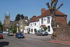 A view of Frant |
|
 Frant |
|
| Area | 31.9 km2 (12.3 sq mi) [1] |
|---|---|
| Population | 1,645 (2011)[2] |
| – density | 111/sq mi (43/km2) |
| OS grid reference | TQ590354 |
| – London | 33 miles (53 km) NNW |
| District | Wealden |
| Shire county | East Sussex |
| Region | South East |
| Country | England |
| Sovereign state | United Kingdom |
| Post town | TUNBRIDGE WELLS |
| Postcode district | TN3 |
| Dialling code | 01892 |
| Police | Sussex |
| Fire | East Sussex |
| Ambulance | South East Coast |
| EU Parliament | South East England |
| UK Parliament | Wealden |
| Website | http://www.frant.info/ |
|
|
Coordinates: 51°06′N 0°16′E / 51.10°N 0.27°E
Frant is a village and civil parish in the Wealden District of East Sussex, England. It is located on the Kentish border, about three miles (5 km) south of Tunbridge Wells. The settlements of Bells Yew Green and Eridge are both located within the parish.
When the Wealden iron industry was at its height, much of the village was owned by ironmasters. Smuggling occurred here in the 17th and 18th centuries; and one of the turnpike roads (now the A267) came through here at that time.[3]
Frant church is dedicated to St Alban;[4] and there is a church school.[5] St Alban's Frant was a major surveying point for the Anglo-French Survey (1784–1790) calculating the precise distance and relationship between the Paris Observatory and the Royal Greenwich Observatory, undertaken by General William Roy.
There are three public houses in the parish: The Abergavenny Arms on the A267 in Frant; and The George Inn in the High Street with The Brecknock Arms at Bells Yew Green.
Col. John By, Royal Engineer heading the Rideau Canal project, Ottawa, Ontario, Canada, 1826–1832, is buried here. He was also the builder of Bytown, which developed to become Ottawa, the capital of Canada.
History
Frant is an ancient village and some of its Old Victorian buildings (the old Frant Church of England Primary School and other High Street buildings) still stand strong for the eye to see. Although it was not mentioned in the Domesday Book, a settlement certainly predates the Norman Conquest; indeed, excavations in 1929 by S. E. Winbolt uncovered pottery fragments and ironworkings that indicated the presence of a settlement dating back to 100 BC.[6] There is also evidence that a pre-Norman road, with military posts, ran from Frant to Crowborough.[7]
The first mention of an area within the parish was in 742, when the Saxon chief Æðelberht granted the manor of Ridrefelde (Rotherfield) and Ramslye to the Abbey of St Denis in France; though part of Tunbridge Wells today, Ramslye was at the time part of the parish of Frant.[7]
The village fell under the Rape of Pevensey and the hundred of Rotherfield.[8]
Toponymy
From the 12th century onwards Frant appears in charters and records, in as diverse spellings as Fernet, Fernthe, Fernth, Ferthe, Ferring, Vernthe, Franthe, Fraunte, Feruthe, Frenthe and Fant; these variations notwithstanding, the etymology of the name has its roots in the Anglo-Saxon meaning "place of the fern" or "place of the bracken", a reflection of the verdant countryside around the settlement.[6]
Governance
Frant is part of Wealden District Council and, along with Withyham, makes up one of the District's 35 wards. The population of this ward (called Frant/Withyham) at the 2011 census was 5,274.[9] The ward contributes two of the District's 55 Councillors.[10]
The Member of Parliament for Wealden is the Conservative Charles Hendry.[11] He was elected in 2005 with a majority of 15,921.[12]
Geography
Frant is located at 51°05′46″N 0°16′16″E / 51.09611°N 0.27111°E, just inside the border of East Sussex with Kent, about three miles (5 km) south of Tunbridge Wells and 36 miles (58 km) south of London.
The village is situated at the northern edge of the High Weald, a ridge of hard sandstone that runs across southern England from Hampshire along the borders of Surrey, West Sussex, East Sussex and Kent. The River Teise, a tributary of the Medway, runs through the parish.
There are a number of Sites of Special Scientific Interest within the parish. Eridge Park is a site of biological interest, consisting of park and ancient woodland, hosting a wide variety of flora and fauna.[13] The site encloses the National Trust reserve known as Nap Wood. Eridge Green is an area of ancient woodland with outcrops of sandstone that hosts some unusual fauna.[14] Another site is High Rocks, an area of geological interest due to the weathering patterns of the local sandstone.[15]

 |
Langton Green (village) | Tunbridge Wells (town) | Bells Yew Green (hamlet) | |
| Eridge (hamlet) | |
Bayham Abbey (ruined abbey) | ||
| ||||
| | ||||
| Crowborough (town) | Mark Cross (village) | Wadhurst (village) |
Demography
The population of Frant rose steadily from just under 1,100 in 1801 to a peak in 1891 of around 3,500.[16] The records show a marked drop to 1,692 in 1901, but this is due to the transfer of the Broadwater Down parish to Tunbridge Wells that took place in 1894.[8] Over the course of the 20th century the number of people living in the parish has declined slowly, and a 2007 estimate by East Sussex County Council put the population of Frant at 1,367.[17]
|
Transport
Frant is situated on the A267, which runs south from Tunbridge Wells to Hailsham. The B2099, which branches off the A267 just south of the village, runs south east to Wadhurst.
Frant railway station, actually located at Bells Yew Green, is on Southeastern's Hastings Line. Around 2–3 trains per hour each way.
References
- ↑ "East Sussex in Figures". East Sussex County Council. Retrieved 26 April 2008.
- ↑ "Civil Parish population 2011". Retrieved 9 October 2015.
- ↑ Frant history
- ↑ St Albans church
- ↑ Frant CE Primary School
- 1 2 Eeles, Henry S. (1947). Frant – A Parish History. Tunbridge Wells: Courier Co., Ltd.
- 1 2 Pearce, Luke (1912). Historical Associations of Frant. Tunbridge Wells: Pearce & Co. p. 4.
- 1 2 "Frant". The Weald. 15 July 2008. Retrieved 27 August 2008.
- ↑ "Frant/Withyham ward population 2011". Retrieved 9 October 2015.
- ↑ "Your Councillors". Wealden District Council. Retrieved 27 August 2008.
- ↑ "Members of Parliament". Wealden District Council. Archived from the original on 24 November 2007. Retrieved 27 August 2008.
- ↑ "Result: Wealden". BBC. 6 May 2005. Archived from the original on 21 February 2006. Retrieved 27 August 2008.
- ↑ "Natural England – SSSI (Eridge Park)". English Nature. Retrieved 28 September 2008.
- ↑ "Natural England – SSSI (Eridge Green)". English Nature. Retrieved 28 September 2008.
- ↑ "Natural England – SSSI (High Rocks)". English Nature. Retrieved 26 September 2008.
- 1 2 "Frant CP/AP: Total Population". Great Britain Historical GIS Project. University of Portsmouth. 2008. Retrieved 29 August 2008.
- 1 2 "Population and households profile for Frant (parish) – Wealden". East Sussex in Figures. East Sussex County Council. 2008. Retrieved 29 August 2008.
- ↑ Wealden District Council Policy and Review team. "Population and Demographic Data for Wealden" (PDF). Wealden District Council. Retrieved 29 August 2008.
External links
![]() Media related to Frant at Wikimedia Commons
Media related to Frant at Wikimedia Commons