Franklin Street Commercial Historic District
|
Franklin Street Commercial Historic District | |
|
Franklin Street, downtown Michigan City, November 2013 | |
  | |
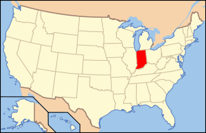
| Location | Bounded by Pine, 4th, and 11th Sts., and the alley between Franklin and Washington Sts., Michigan City, Indiana |
|---|---|
| Coordinates | 41°42′51″N 86°54′01″W / 41.71417°N 86.90028°WCoordinates: 41°42′51″N 86°54′01″W / 41.71417°N 86.90028°W |
| Area | 43.4 acres (17.6 ha) |
| Architect | Taylor, James Knox; Boonstra, Samuel; Nichol, Sholer, and Hoffman; Starbuck, Henry F. |
| Architectural style | Italianate, Gothic Revival, Queen Anne, Classical Revival, Tudor Revival |
| NRHP Reference # | 13001013[1] |
| Added to NRHP | December 31, 2013 |

Franklin Street Commercial Historic District is a national historic district located at Michigan City, LaPorte County, Indiana. The district encompasses 73 contributing buildings and 1 contributing object in the central business district and surrounding residential section of Michigan City. It developed between about 1875 and 1955, and includes examples of Italianate, Gothic Revival, Queen Anne, Classical Revival, and Tudor Revival style architecture. Located in the district is the separately listed Michigan City Post Office (1909-1910). Other notable buildings include the Staiger House (c. 1908), Earl House (c. 1890, 1917), M & M Diner (1955), Zorn Building (1907), St. Paul's Lutheran Church (1876) and rectory (1888), First Federal Savings Bank (c. 1950), Aicher Block (1914), Brinkman Building (c. 1917), Trinity Episcopal Church (1889), Merchants National Bank Building (1926), Ledbetter Building (1908), Rodenbeck Saloon (c. 1894), First Methodist Episcopal Church (1922), Barker Hall (1929), Masonic Temple (1922-1923), and the Salvation Army Building (1925).[2]
It was listed in the National Register of Historic Places in 2013.[1]
References
- 1 2 "National Register of Historic Places Listings". Weekly List of Actions Taken on Properties: 12/30/13 through 1/03/14. National Park Service. 2014-01-10.
- ↑ "Indiana State Historic Architectural and Archaeological Research Database (SHAARD)" (Searchable database). Department of Natural Resources, Division of Historic Preservation and Archaeology. Retrieved 2016-05-01. Note: This includes Kurt West Garner (September 2012). "National Register of Historic Places Inventory Nomination Form: Franklin Street Commercial Historic District" (PDF). Retrieved 2016-05-01., Site map, Quad map, and Accompanying photographs.