Fort Abercrombie State Historical Park
|
Fort Abercrombie State Historical Park | |
|
Miller Point gun emplacement | |
 | |
| Location | Miller Point, 5 mi. from Kodiak, Kodiak Island, Alaska |
|---|---|
| Built | 1941 |
| Architect | Unknown |
| NRHP Reference # | 70000917[1] |
| Significant dates | |
| Added to NRHP | October 27, 1970 |
| Designated NHL | February 4, 1985 |
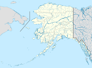
Fort Abercrombie State Historical Park is an Alaska state park on Kodiak Island, Alaska. It includes 182 acres (74 ha) of land at the end of Miller Point, located on the eastern shore of Kodiak Island northeast of the city of Kodiak. The park, established in 1969, is noted for its historical World War II fortifications and its scenery, which includes bluffs overlooking the ocean, spruce forests, and meadows. The site was named in honor of the early Alaska explorer and United States Army officer Lt. Col. William R. Abercrombie. The fortifications, whose surviving elements include gun emplacements, underground magazines, and foundational remnants of buildings, were built in 1941 and abandoned after the war ended, having seen no action.[2][3]
The park was listed on the National Register of Historic Places in 1970,[1] and was included in the National Historic Landmark designation of the Kodiak Naval Operating Base and Forts Greely and Abercrombie in 1985.
Park facilities include a campground (best suited for tent camping as the park's narrow and winding roads make RV access difficult), a group camping area, a picnic area, and hiking trails.
Kodiak Military History Museum
The Kodiak Military History Museum is a private military museum located in Fort Abercrombie State Historical Park. The museum is located in the restored Ready Ammunition bunker on Miller Point.
See also
References
- 1 2 National Park Service (2007-01-23). "National Register Information System". National Register of Historic Places. National Park Service.
- ↑ "NRHP nomination for Fort Abercrombie State Historical Park" (PDF). National Park Service. Retrieved 2015-01-15.
- ↑ "Fort Abercrombie's Historical Significance". Alaska DNR. Retrieved 2015-01-15.
External links
- Fort Abercrombie State Historical Park (official site)
- Fort Abercrombie, at Crusty old Joe's Kodiak Alaska Military History
- Kodiak Military History Museum
Coordinates: 57°49′51″N 152°21′20″W / 57.83083°N 152.35556°W

