Forestville, Michigan
| Forestville, Michigan | |
|---|---|
| Village | |
 Location of Forestville, Michigan | |
| Coordinates: 43°39′41″N 82°36′35″W / 43.66139°N 82.60972°WCoordinates: 43°39′41″N 82°36′35″W / 43.66139°N 82.60972°W | |
| Country | United States |
| State | Michigan |
| County | Sanilac |
| Area[1] | |
| • Total | 0.79 sq mi (2.05 km2) |
| • Land | 0.79 sq mi (2.05 km2) |
| • Water | 0 sq mi (0 km2) |
| Elevation | 633 ft (193 m) |
| Population (2010)[2] | |
| • Total | 136 |
| • Estimate (2012[3]) | 134 |
| • Density | 172.2/sq mi (66.5/km2) |
| Time zone | Eastern (EST) (UTC-5) |
| • Summer (DST) | EDT (UTC-4) |
| ZIP code | 48434 |
| Area code(s) | 989 |
| FIPS code | 26-29660[4] |
| GNIS feature ID | 0626287[5] |
Forestville is a village in Sanilac County in the U.S. state of Michigan. The population was 136 at the 2010 census. It does not have a true harbor onto Lake Huron, but the village does have a boat launch site. Forestville receives city water from nearby Harbor Beach. The village is within Delaware Township.
Geography
According to the United States Census Bureau, the village has a total area of 0.79 square miles (2.05 km2), all land.[1]
History
Forestville began with the building of a sawmill here in 1854. Its post office first opened in 1856. It was incorporated as a village in 1895.[6]
Demographics
| Historical population | |||
|---|---|---|---|
| Census | Pop. | %± | |
| 1870 | 121 | — | |
| 1880 | 192 | 58.7% | |
| 1900 | 282 | — | |
| 1910 | 234 | −17.0% | |
| 1920 | 140 | −40.2% | |
| 1930 | 74 | −47.1% | |
| 1940 | 156 | 110.8% | |
| 1950 | 124 | −20.5% | |
| 1960 | 121 | −2.4% | |
| 1970 | 110 | −9.1% | |
| 1980 | 159 | 44.5% | |
| 1990 | 153 | −3.8% | |
| 2000 | 127 | −17.0% | |
| 2010 | 136 | 7.1% | |
| Est. 2015 | 132 | [7] | −2.9% |
2010 census
As of the census[2] of 2010, there were 136 people, 58 households, and 36 families residing in the village. The population density was 172.2 inhabitants per square mile (66.5/km2). There were 164 housing units at an average density of 207.6 per square mile (80.2/km2). The racial makeup of the village was 97.1% White, 1.5% Native American, 0.7% from other races, and 0.7% from two or more races. Hispanic or Latino of any race were 5.1% of the population.
There were 58 households of which 17.2% had children under the age of 18 living with them, 58.6% were married couples living together, 3.4% had a female householder with no husband present, and 37.9% were non-families. 37.9% of all households were made up of individuals and 15.5% had someone living alone who was 65 years of age or older. The average household size was 2.34 and the average family size was 3.11.
The median age in the village was 55.5 years. 17.6% of residents were under the age of 18; 2.9% were between the ages of 18 and 24; 16.2% were from 25 to 44; 38.1% were from 45 to 64; and 25% were 65 years of age or older. The gender makeup of the village was 50.7% male and 49.3% female.
2000 census
As of the census[4] of 2000, there were 127 people, 56 households, and 36 families residing in the village. The population density was 153.2 per square mile (59.1/km²). There were 147 housing units at an average density of 177.4 per square mile (68.4/km²). The racial makeup of the village was 95.28% White, 0.79% Native American, and 3.94% from two or more races. Hispanic or Latino of any race were 2.36% of the population.
There were 56 households out of which 25.0% had children under the age of 18 living with them, 48.2% were married couples living together, 14.3% had a female householder with no husband present, and 35.7% were non-families. 35.7% of all households were made up of individuals and 23.2% had someone living alone who was 65 years of age or older. The average household size was 2.27 and the average family size was 2.94.
In the village the population was spread out with 24.4% under the age of 18, 6.3% from 18 to 24, 17.3% from 25 to 44, 26.0% from 45 to 64, and 26.0% who were 65 years of age or older. The median age was 46 years. For every 100 females there were 111.7 males. For every 100 females age 18 and over, there were 108.7 males.
The median income for a household in the village was $45,625, and the median income for a family was $62,917. Males had a median income of $29,375 versus $17,321 for females. The per capita income for the village was $21,130. There were 6.9% of families and 10.0% of the population living below the poverty line, including 6.3% of under eighteens and 24.2% of those over 64.
References
Notes
- 1 2 "US Gazetteer files 2010". United States Census Bureau. Retrieved 2012-11-25.
- 1 2 "American FactFinder". United States Census Bureau. Retrieved 2012-11-25.
- ↑ "Population Estimates". United States Census Bureau. Retrieved 2013-06-03.
- 1 2 "American FactFinder". United States Census Bureau. Retrieved 2008-01-31.
- ↑ "US Board on Geographic Names". United States Geological Survey. 2007-10-25. Retrieved 2008-01-31.
- ↑ Romig 1986, p. 203.
- ↑ "Annual Estimates of the Resident Population for Incorporated Places: April 1, 2010 to July 1, 2015". Retrieved July 2, 2016.
- ↑ "Census of Population and Housing". Census.gov. Retrieved June 4, 2015.
Sources
- Romig, Walter (October 1, 1986) [1973]. Michigan Place Names: The History of the Founding and the Naming of More Than Five Thousand Past and Present Michigan Communities. Great Lakes Books Series (Paperback). Detroit, Michigan: Wayne State University Press. ISBN 0-8143-1838-X. ISBN 978-0814318386.
Municipalities and communities of Sanilac County, Michigan, United States | ||
|---|---|---|
| Cities | 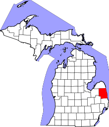 | |
| Villages | ||
| Townships | ||
| CDP | ||
| Other unincorporated communities | ||
| Footnotes | ‡This populated place also has portions in an adjacent county or counties | |