Flower, West Virginia
| Flower, West Virginia | |
|---|---|
| Unincorporated community | |
 Flower, West Virginia  Flower, West Virginia | |
| Coordinates: 38°49′53″N 80°46′23″W / 38.83139°N 80.77306°WCoordinates: 38°49′53″N 80°46′23″W / 38.83139°N 80.77306°W | |
| Country | United States |
| State | West Virginia |
| County | Braxton |
| Elevation | 843 ft (257 m) |
| Time zone | Eastern (EST) (UTC-5) |
| • Summer (DST) | EDT (UTC-4) |
| ZIP code | 26622 |
| Area code(s) | 304 & 681 |
| GNIS feature ID | 1549687[1] |
Flower is an unincorporated community in Braxton County, West Virginia, United States. Flower is 6.5 miles (10.5 km) west-southwest of Burnsville.
The community was formerly known as Waldeck.[2]
References
- ↑ "US Board on Geographic Names". United States Geological Survey. 2007-10-25. Retrieved 2008-01-31.
- ↑ Kenny, Hamill (1945). West Virginia Place Names: Their Origin and Meaning, Including the Nomenclature of the Streams and Mountains. Piedmont, WV: The Place Name Press. p. 245.
Municipalities and communities of Braxton County, West Virginia, United States | ||
|---|---|---|
| Towns | 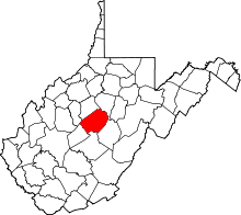 | |
| Unincorporated communities |
| |
| Ghost towns | ||
| Footnotes | ‡This populated place also has portions in an adjacent county or counties | |
This article is issued from Wikipedia - version of the 7/28/2016. The text is available under the Creative Commons Attribution/Share Alike but additional terms may apply for the media files.