Florida, Ohio
| Florida, Ohio | |
|---|---|
| Village | |
|
High Street east of Henry Street | |
 Location of Florida, Ohio | |
 Location of Florida in Henry County | |
| Coordinates: 41°19′22″N 84°12′6″W / 41.32278°N 84.20167°WCoordinates: 41°19′22″N 84°12′6″W / 41.32278°N 84.20167°W | |
| Country | United States |
| State | Ohio |
| County | Henry |
| Government | |
| • Mayor | Jeff Nulton |
| Area[1] | |
| • Total | 0.23 sq mi (0.60 km2) |
| • Land | 0.23 sq mi (0.60 km2) |
| • Water | 0 sq mi (0 km2) |
| Elevation[2] | 673 ft (205 m) |
| Population (2010)[3] | |
| • Total | 232 |
| • Estimate (2012[4]) | 231 |
| • Density | 1,008.7/sq mi (389.5/km2) |
| Time zone | Eastern (EST) (UTC-5) |
| • Summer (DST) | EDT (UTC-4) |
| FIPS code | 39-27538[5] |
| GNIS feature ID | 1064660[2] |

Florida is a village in Henry County, Ohio, United States, along the Maumee River. The population was 232 at the 2010 census.
History
Florida had its start in the 1840s when the Miami and Erie Canal was extended to that point.[6] The village was named after the state of Florida.[7] A post office was established at Florida in 1843, and remained in operation until 1919.[8]
Geography
Florida is located at 41°19′22″N 84°12′6″W / 41.32278°N 84.20167°W (41.322751, -84.201653).[9]
According to the United States Census Bureau, the village has a total area of 0.23 square miles (0.60 km2), all land.[1]
Demographics
| Historical population | |||
|---|---|---|---|
| Census | Pop. | %± | |
| 1880 | 245 | — | |
| 1890 | 288 | 17.6% | |
| 1900 | 276 | −4.2% | |
| 1910 | 234 | −15.2% | |
| 1920 | 159 | −32.1% | |
| 1930 | 173 | 8.8% | |
| 1940 | 216 | 24.9% | |
| 1950 | 227 | 5.1% | |
| 1960 | 290 | 27.8% | |
| 1970 | 285 | −1.7% | |
| 1980 | 294 | 3.2% | |
| 1990 | 304 | 3.4% | |
| 2000 | 246 | −19.1% | |
| 2010 | 232 | −5.7% | |
| Est. 2015 | 230 | [10] | −0.9% |
2010 census
As of the census[3] of 2010, there were 232 people, 94 households, and 67 families residing in the village. The population density was 1,008.7 inhabitants per square mile (389.5/km2). There were 106 housing units at an average density of 460.9 per square mile (178.0/km2). The racial makeup of the village was 96.6% White, 0.4% Asian, 1.7% from other races, and 1.3% from two or more races. Hispanic or Latino of any race were 6.0% of the population.
There were 94 households of which 29.8% had children under the age of 18 living with them, 58.5% were married couples living together, 7.4% had a female householder with no husband present, 5.3% had a male householder with no wife present, and 28.7% were non-families. 23.4% of all households were made up of individuals and 12.8% had someone living alone who was 65 years of age or older. The average household size was 2.47 and the average family size was 2.88.
The median age in the village was 42.7 years. 22.8% of residents were under the age of 18; 7.8% were between the ages of 18 and 24; 23.6% were from 25 to 44; 26.2% were from 45 to 64; and 19.4% were 65 years of age or older. The gender makeup of the village was 46.1% male and 53.9% female.
2000 census
As of the census[5] of 2000, there were 246 people, 98 households, and 76 families residing in the village. The population density was 1,082.5 people per square mile (413.0/km²). There were 107 housing units at an average density of 470.8 per square mile (179.6/km²). The racial makeup of the village was 95.93% White, 0.41% Asian, 2.85% from other races, and 0.81% from two or more races. Hispanic or Latino of any race were 6.50% of the population.
There were 98 households out of which 32.7% had children under the age of 18 living with them, 63.3% were married couples living together, 13.3% had a female householder with no husband present, and 22.4% were non-families. 19.4% of all households were made up of individuals and 8.2% had someone living alone who was 65 years of age or older. The average household size was 2.51 and the average family size was 2.83.
In the village the population was spread out with 24.8% under the age of 18, 7.3% from 18 to 24, 28.5% from 25 to 44, 24.4% from 45 to 64, and 15.0% who were 65 years of age or older. The median age was 39 years. For every 100 females there were 93.7 males. For every 100 females age 18 and over, there were 90.7 males.
The median income for a household in the village was $39,583, and the median income for a family was $44,375. Males had a median income of $30,208 versus $21,667 for females. The per capita income for the village was $16,094. About 6.7% of families and 9.0% of the population were below the poverty line, including 15.5% of those under the age of eighteen and none of those sixty five or over.
References
- 1 2 "US Gazetteer files 2010". United States Census Bureau. Retrieved 2013-01-06.
- 1 2 "US Board on Geographic Names". United States Geological Survey. 2007-10-25. Retrieved 2008-01-31.
- 1 2 "American FactFinder". United States Census Bureau. Retrieved 2013-01-06.
- ↑ "Population Estimates". United States Census Bureau. Retrieved 2013-06-17.
- 1 2 "American FactFinder". United States Census Bureau. Retrieved 2008-01-31.
- ↑ Aldrich, Lewis Cass (1888). History of Henry and Fulton Counties, Ohio. D. Mason & Company. p. 219.
- ↑ "Towns named after states". Reading Eagle. Jul 2, 1897. p. 3. Retrieved 14 October 2015.
- ↑ "Henry County". Jim Forte Postal History. Retrieved 12 December 2015.
- ↑ "US Gazetteer files: 2010, 2000, and 1990". United States Census Bureau. 2011-02-12. Retrieved 2011-04-23.
- ↑ "Annual Estimates of the Resident Population for Incorporated Places: April 1, 2010 to July 1, 2015". Retrieved July 2, 2016.
- ↑ "Census of Population and Housing". Census.gov. Retrieved June 4, 2015.
Municipalities and communities of Henry County, Ohio, United States | ||
|---|---|---|
| City | 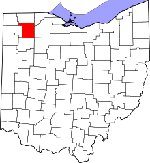 | |
| Villages | ||
| Townships | ||
| CDP | ||
| Unincorporated communities | ||
| Footnotes | ‡This populated place also has portions in an adjacent county or counties | |