Fishers Island, New York
| Fishers Island, New York | |
|---|---|
| Census-designated place | |
|
Linderman House | |
 | |
 | |
| Coordinates: 41°15′43″N 72°0′26″W / 41.26194°N 72.00722°WCoordinates: 41°15′43″N 72°0′26″W / 41.26194°N 72.00722°W | |
| Country | United States |
| State | New York |
| County | Suffolk |
| Town | Southold |
| Area | |
| • Total | 4.2 sq mi (10.9 km2) |
| • Land | 4.1 sq mi (10.6 km2) |
| • Water | 0.2 sq mi (0.4 km2) |
| Elevation | 16 ft (5 m) |
| Population (2010)[1] | |
| • Total | 236 |
| • Density | 56/sq mi (22/km2) |
| Time zone | Eastern (EST) (UTC-5) |
| • Summer (DST) | EDT (UTC-4) |
| ZIP code | 06390 |
| Area code(s) | 631 - Exchange: 788 |
| FIPS code | 36-25923 |
| GNIS feature ID | 950166 (populated place) 950165 (island) |

Fishers Island is located at the eastern end of Long Island Sound, 2 miles (3 km) off the southeastern coast of Connecticut across Fishers Island Sound, about 9 miles (14 km) long and 1 mile (1.6 km) wide. It is about 11 miles (18 km) from the tip of Long Island at Orient Point, 2 miles (3 km) from both Napatree Point at the southwestern tip of Rhode Island and Groton Long Point in Connecticut, and about 7 miles (11 km) southeast of New London, Connecticut, from which it is accessible by plane or regular ferry service.
The island is part of the town of Southold in Suffolk County, New York. It is a census-designated place (CDP). As of the 2010 census, there were 236 people living year-round on 4.1 square miles (10.6 km2) of land;[2] however, the population rises to about 2,000 during peak summer weekends as throngs from Connecticut disembark on the island.
Geography
According to the United States Census Bureau, the CDP has a total area of 4.2 square miles (10.9 km2), of which 4.1 square miles (10.6 km2) is land and 0.15 square miles (0.4 km2), or 3.48%, is water.[2]
Fishers Island represents a section of the same terminal moraine that formed the North Fork of Long Island, which comes ashore at Watch Hill, Rhode Island. During the late phase of the Wisconsin glaciation, glacial Lake Connecticut formed at the retreating fore edge of the ice sheet, over what is now Long Island Sound; it formed an outlet in its moraine dam at The Race, famous for rip currents, which still separates Fishers Island from the North Fork. Fishers Island is essentially a long barrow of rocky till scoured from the surface of southern Connecticut.
Neighboring islands
Wicopesset Island is a small, unoccupied island just off East Point on Fisher's Island, closer to the water boundary with Rhode Island and Connecticut than to Montauk Point. However, Montauk gets the title of New York's easternmost land point because it is 2.9 miles (4.7 km) farther east. Wicopesset Island is the northernmost area of Suffolk County, New York, and previously the southernmost area of New London County, Connecticut.
Mason's Island (Algonquin: Chippachaug, meaning a separated place) is an inhabited island at the mouth of the Mystic River in Stonington, Connecticut. The island was named after Major John Mason who was granted the island in recognition of his military services in the 1637 Pequot War in nearby Mystic. [3]
Enders Island is an inhabited island located in Stonington, Connecticut, used as a Catholic retreat center, owned and operated by the Society of Saint Edmund. The island is connected to neighboring Mason's Island by a causeway, and Mason's island is connected to the mainland by another causeway. Enders Island is home to the biannual ten-day residency portion of Fairfield University's low residency Master of Fine Arts in Creative Writing Program.
Goat Island is in Wequetequock Cove.
Ram Island is close in proximity to Fishers Island. However, Ram Island still remains within the political jurisdiction of Connecticut.
Elihu Island of Stonington, Connecticut is also close to Fishers Island.[4] It is just south of Goat Island in Wequetequock Cove.
Climate
Fishers Island's weather is influenced by the proximity of Long Island Sound and the ocean, and prevailing winds that generally blow offshore. The climate is one of only a few locations on an east coast in the Northern Hemisphere that is oceanic (Koppen Cfb). Because the ocean stays warm during the fall and winter months, Fishers Island stays warmer than the mainland (Connecticut) during this time. Summers can still be hot on Fishers Island, but July and August average in the mid and upper 70s instead of low and mid 80s that mainland Connecticut and New England often encounter.
History
The island was called Munnawtawkit by the Pequot Indians. Adriaen Block, the first recorded European visitor, named it Visher's Island in 1614 after one of his companions. For the next 25 years, it remained a wilderness, visited occasionally by Dutch traders.
John Winthrop the Younger the son of the famous Governor Winthrop, the founder of Boston, obtained a grant of Fisher's Island in 1640 from the Massachusetts Bay Colony, so far as it was theirs to grant, "reserving the right of Connecticut if it should be decided to be theirs." Winthrop simultaneously applied to the Connecticut General Court for a similar grant in order that there might be no flaw in his title. The title was given to him in the following words, which are copied from the records of a General Court held at Hartford, Connecticut, April 9, 1641:
- "Upon Mr. Winthrop's motion to the court for Fisher's Island, it is the mind of the court that so far as it hinders not the public good of the country, either for fortifying for defense, or setting up a trade for fishing or salt and such like, he shall have liberty to proceed therein."[5]
Winthrop lived only one winter on the island. He was named governor of the Connecticut Colony 1657-1658 and 1659-1676, and he used the island to raise sheep for food and wool. He died in 1676 and his son Fitz-John installed a lessee farmer from England on the island named William Walworth. Walworth brought with him a system of cultivation which was continued on the island for nearly 200 years. He established farmland out of the heavily forested island. Walworth and his family vacated the island nine years later due to the threat of pirates. Fishers Island remained in the Winthrop family of Connecticut until 1863, when ownership passed to Robert R. Fox, and then to Edmund and Walton Ferguson, also of Connecticut.
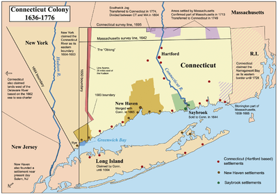
The island was the subject of a border dispute between New York and Connecticut. Present-day New York state, Connecticut, and Rhode Island meet in the waters east of Fishers Island. Before the British took possession of New York City from the Dutch in 1664, all of present-day Suffolk County was claimed by Connecticut, with British settlers there accepting its jurisdiction. John Winthrop had included Fishers Island where he owned land when he became governor of Connecticut in 1657. A 1664 land patent granted to the Duke of York included all islands in Long Island Sound, apparently thus granting Fishers Island also to the Province of New York. The Duke of York held a grudge against Connecticut, as New Haven had hidden three of the judges who sentenced his father King Charles I to death in 1649. Settlers throughout Suffolk County pressed to stay part of Connecticut, but Governor Sir Edmund Andros threatened to eliminate the settlers' rights to land if they did not yield, which they did by 1676.[6] A joint commission from Connecticut and New York in 1879 reiterated that New York would have legal title to Fishers Island.
The island was a target of British soldiers during the Revolutionary War, who raided islands in Long Island sound for supplies. Many of the residents of Fishers Island took their herds to the relative safety of Connecticut in 1776. The raids continued, though, and the British burned many of the island's homes in 1779.
In 1783, brickmaking was established as the island's only industry, using the vast amounts of available clay. This business was discontinued in 1889. In 1870, a lifesaving station was erected at the western end of the island by the State of Connecticut, which overlooked the waters between Fishers Island and Little Gull Island. The Race Rock Light was constructed in 1878 as a navigational aid for travel in the Race, located approximately 1 mile (1.6 km) west of Fishers Island. In the early 1900s, a permanent Coast Guard station was built on the west end of the island. In 1898, the Fergusons sold 216 acres (0.9 km2) on the western end of the island to the federal government. This land was developed as Fort H. G. Wright, which was named after the Civil War Union commander who was born in Clinton, Connecticut.[7] The fort was established as part of the Endicott Program, a large coastal defense project. Following World War II, the fort was largely abandoned. Over the years, Fort Wright drew a large number of residents to the island. The 1890s brought a growing summer population and the construction of the Fishers Island Yacht Club.
The E.W. & W. Ferguson business was established which managed the Mansion House Hotel and Cottages, a ferry service, and the electricity, water, and telephone enterprises. This business was renamed Fishers Island Farms in 1918. It was purchased and became the Fishers Island Utility Company following the death of the Fishers Island Farms president in 1965, which continues to own and operate the water, telephone service (Area Code 631 Exchange: 788), and electrical utilities. The ferry is operated by the Fishers Island Ferry District, a public entity financed through a special tax district. The town contracts with the Ferry District to operate Elizabeth Field airport and to manage other structures in the town's ownership that were part of Fort Wright.
Hurricanes have played an important role in the island's history, with the Great September Gale of 1815 and the New England Hurricane of 1938 both causing widespread damage. The 1815 storm resulted in substantially all of the island trees being destroyed by a combination of the powerful winds and by the 17-foot (5.2 m) storm surge that flooded coastal towns with seawater. The consequences for Fishers Island were visible for almost a century and a half. A panoramic photograph taken from one vantage point on the island in 1910 shows more boats in Hay and West harbors than there are mature trees. Until the 1950s, Fishers Island had the look of Ireland: stone walls, few trees, and windswept moors.
The 1938 storm blew in seeds, returning Fishers to its pre-1815 foliage. It was less severe, with only a few local residences destroyed, primarily by wind. (Most Fishers Island residences have sitings above sea level that protect them from storm surge.) Winds in excess of 120 mph (190 km/h) ripped the roof off John Nicholas Brown's ultra-modern residence "Windshield", designed by Richard Neutra, which had only recently been completed. The Browns rebuilt "Windshield", but it was destroyed by fire in the early 1970s.
Culture

Despite being a part of New York, in many ways the island has closer links with Connecticut, 2 miles (3 km) to its north, than with the rest of New York, 10 miles (16 km) to the southwest. Fishers Island's zip code is 06390, corresponding to Connecticut zip codes that begin with "06", while other residential zip codes in New York State begin with "1". The island is the only point in Suffolk County to which telephone calls placed from the greater New York City area are classified as long distance rather than regional. The island is also part of the Boy Scouts of America's Connecticut Rivers Council. The island is part of the Roman Catholic Diocese of Norwich (Connecticut), while the remainder of Suffolk County is included in the Diocese of Rockville Centre.
The only way for New York state troopers to get to Fishers Island is to travel through Connecticut and take the ferry from New London.[8] Every athletic team at Fishers Island School plays against Connecticut teams. In fact, none of the teams from the school played against any New York team in 2011-2012.[9] Trash from the island is sent to Wallingford, Connecticut. Residents also closely adhere to Connecticut's state laws regarding recycling.[10]
The island's more notable residents include former Governor Thomas Kean of New Jersey; former CIA Director Porter Goss; filmmaker Albert Maysles; former Whitney Museum director Tom Armstrong; former Kidder, Peabody & Co. Chairman Albert Gordon; Scudder Sinclair, president of the Sinclair Pharmacal Co. Inc. (based on Fishers Island); author Rick Moody, who wrote The Ice Storm; and the heirs to IBM. Efrem Zimbalist, violinist and his wife, the opera singer, Alma Gluck, owned and used the G. B. Linderman summer mansion on Fishers Island in the 1920s and 30s. There, they held house parties for eminent musicians of their day.[11]
Most of the island's year-round residents reside on the western end of the island. The island offers all the necessities for small-town life, including a grade school, bowling alley, movie theater, liquor store, grocery store, two gas stations, volunteer fire department, and post office. The west end also has a small air strip, a museum, an ice cream shop (Toppers), a cafe (the News Cafe), two boutiques (The Beach Plum and The Pickett Fence), and a restaurant/bar (The Pequot). One of the main streets on Fishers Island is named after Connecticut's John Winthrop the Younger.
The seaside scenes in the movie The World According to Garp, starring Robin Williams and Glenn Close, were shot on Fishers Island on and about the grounds of the mansion originally built by Bethlehem Steel heir Robert Linderman. Many other movies have also been filmed here.
Recreation
The island has two country clubs and a yacht club as well as several beaches and a harbor.
Fishers Island Club, usually called "The Big Club," is at the island's eastern tip and is home to a Seth Raynor-designed, world-class links golf course that is rated ninth on Golf Digest's 2009 list of America's 100 greatest golf courses.[12] Historically, it was referred to as a "real course" in a July 1957 letter from President Dwight D. Eisenhower to John Hay Whitney.[13] The club also has four tennis courts, a beach club, and a members-only beachfront. The main clubhouse has two dining rooms capable of seating 250 people. There are also housing facilities for over forty employees on the island.
Hay Harbor is a smaller club on the west part of the island with a nine-hole links-style golf course with a second hole that runs along the ocean. Its tennis club has eleven clay tennis courts, a swimming pool, and a salt water swimming area affectionately called the Shark Tank. Lessons for kids and adults include tennis, golf, swimming, sailing, windsurfing and kayaking. Hay Harbor also maintains a sailing club. With the magnificent winds that swirl all around the island, sailing is a popular pastime for people summering at the island. Currently the general manager of the Hay Harbor Club is Richard Duggan.
Fishers Island Yacht Club (FIYC) holds races every Saturday during the summer. There are two active racing fleets: the International One Designs (IODs), which is composed of 33-foot (10 m) boats designed in 1936 by Bjarne Aas of Norway, and the Bullseyes, a fleet of 16-foot (4.9 m) boats designed by Nathanael Herreshoff in 1916. The club has two small buildings and is casual. It hosts several parties during the summer, as well as weekly picnic barbecues.
West Harbor, a large harbor that is used mainly by the FIYC, is home to Dock Beach. The smallest beach on the island, it hosts barbecues and family events. It is also a prime location from which to view the Dupont fireworks display, administered by FIOA (Fishers Island's Own Army), on the Fourth of July.
The most well-known beaches include South Beach, Isabella Beach, and Chocomount Beach.
Demographics
As of the census[1] of 2000, there were 289 people, 138 households, and 77 families residing in the CDP. The population density was 71.3 per square mile (27.6/km2). There were 625 housing units at an average density of 154.2/sq mi (59.6/km2). The racial makeup of the community was 95.50% White, 1.04% African American, 1.04% Asian, and 2.42% from two or more races. Hispanic or Latino of any race were 1.38% of the population. Over 53% of inhabitants of the island have mainland homes in Connecticut.
There were 138 households out of which 26.1% had children under the age of 18 living with them, 44.2% were married couples living together, 5.1% had a female householder with no husband present, and 43.5% were non-families. 34.8% of all households were made up of individuals and 10.1% had someone living alone who was 65 years of age or older. The average household size was 2.09 and the average family size was 2.72.
In the CDP the population was spread out with 21.8% under the age of 18, 2.1% from 18 to 24, 30.8% from 25 to 44, 27.3% from 45 to 64, and 18.0% who were 65 years of age or older. The median age was 43 years. For every 100 females there were 105.0 males. For every 100 females age 18 and over, there were 98.2 males.
The median income for a household in the community was $50,521, and the median income for a family was $59,583. Males had a median income of $47,917 versus $26,250 for females. The per capita income for the CDP was $31,652. About 4.5% of families and 9.0% of the population were below the poverty line, including 9.8% of those under the age of eighteen and 7.9% of those sixty five or over.
Home owners currently pay New York sales tax, property tax, etc.
Fishers Island Union Free School District is located at 19 Greenwood Road and consists of one school that serves 68 students in grades PK through 12. The district spends $36,811 per pupil in current expenditures. The district spends 71% on instruction, and 29% on support services. The district's student-teacher ratio is five students for every full-time equivalent teacher.[14]
In popular culture
In Mad Men season 1, Pete Campbell reveals his family has a house on Fishers Island.
In Wes Anderson's Moonrise Kingdom, the map of the island of New Penzance is based on Fisher's Island.
The 1982 feature film The World According to Garp, starring Robin Williams and Glenn Close was filmed in part on Fishers Island at a home across from Hay Harbor.
References
- 1 2 "American FactFinder". United States Census Bureau. Archived from the original on September 11, 2013. Retrieved 2008-01-31.
- 1 2 "Geographic Identifiers: 2010 Demographic Profile Data (G001): Fishers Island CDP, New York". U.S. Census Bureau, American Factfinder. Retrieved 2012-12-28.
- ↑ Haynes, Williams (1976). A Stonington Chronology. Essex, Conn.: Pequot Press. ISBN 0-87106-059-0.
- ↑ "Elihu Island in New London County CT". Connecticut.hometownlocator.com. Retrieved 26 December 2014.
- ↑ Archived April 6, 2010, at the Wayback Machine.
- ↑ Bayles, Richard Mather (1874). Sketches of Suffolk County, Historical and Descriptive, with a Historical Outline of Long Island. Books.google.ca. Retrieved 26 December 2014.
- ↑ "General H. G. Wright - Life and Times". Spiderzweb.net. Retrieved 26 December 2014.
- ↑ "Fishers Island Ferry website". Fiferry.com. Retrieved 26 December 2014.
- ↑ "Report: Boys Basketball Game Schedule". Fisherisland.intand.com. Retrieved 26 December 2014.
- ↑ "Fishers Island Waste Management District". Fishers Island Waste Management District. Retrieved 26 December 2014.
- ↑ Jane Ahrens. "HLF Museum Files: G.B. Linderman Mansion". FishersIsland.net. Retrieved 26 December 2014.
- ↑ "Golf - SBNation.com". SBNation.com. Retrieved 26 December 2014.
- ↑
- ↑ "Fishers Island Union Free School District". Education.com. Retrieved 26 December 2014.
External links
| Wikimedia Commons has media related to Fishers Island, New York. |
- FishersIsland.net, includes history, directories and ferry schedules
- Fishers Island School
- Fishers Island Ferry District
 "Fisher's Island". New International Encyclopedia. 1905.