Evrymenes, Ioannina
For other uses, see Evrymenes (disambiguation).
| Evrymenes Ευρυμενές | |
|---|---|
 Evrymenes | |
|
Location within the regional unit 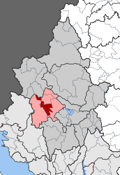 | |
| Coordinates: 39°42′N 20°40′E / 39.700°N 20.667°ECoordinates: 39°42′N 20°40′E / 39.700°N 20.667°E | |
| Country | Greece |
| Administrative region | Epirus |
| Regional unit | Ioannina |
| Municipality | Zitsa |
| • Municipal unit | 74.0 km2 (28.6 sq mi) |
| Population (2011)[1] | |
| • Municipal unit | 1,009 |
| • Municipal unit density | 14/km2 (35/sq mi) |
| Time zone | EET (UTC+2) |
| • Summer (DST) | EEST (UTC+3) |
| Vehicle registration | ΙΝ |
Evrymenes (Greek: Ευρυμενές) was a short-lived municipality (1996–2010) in the Ioannina Prefecture, Greece. Following the massive mergers that took place in accordance to Kallikratis Plan, since 2011 it holds the status of "municipal entity" (subdivision) within the Municipality of Zitsa.[2] The municipal unit has an area of 73.958 km2.[3] In 2011 its population was 1,009. The seat of the entity was in Klimatia. It is situated in the mountainous western part of the Ioannina regional unit.
Communities
Evrymenes is subdivided into 8 communities, consisting of a total number of 11 villages.
- Delvinakopoulo (Delvinakopoulo, Spilaio)
- Klimatia
- Kokkinochoma
- Lefkothea
- Paliouri
- Raiko
- Soulopoulo (Soulopoulo, Mikro Soulopoulo)
- Vasilopoulo (Vasilopoulo, Kastri)
Population
| Year | Population |
|---|---|
| 1991 | 1,437 |
| 2001 | 1,525 |
| 2011 | 1,009 |
External links
- Evrymenes on GTP Travel Pages
- Ex-municipality of Evrymenes at the Ministry of Statistics homepage
- Information about Evrymenes at Epirus Connection
References
- ↑ "Απογραφή Πληθυσμού - Κατοικιών 2011. ΜΟΝΙΜΟΣ Πληθυσμός" (in Greek). Hellenic Statistical Authority.
- ↑ Kallikratis law Greece Ministry of Interior (Greek)
- ↑ "Population & housing census 2001 (incl. area and average elevation)" (PDF) (in Greek). National Statistical Service of Greece.
 |
Ano Kalamas | Zitsa | | |
| Molossoi | |
Pasaronas | ||
| ||||
| | ||||
| Molossoi | Pasaronas |
This article is issued from Wikipedia - version of the 12/1/2016. The text is available under the Creative Commons Attribution/Share Alike but additional terms may apply for the media files.