Elko, New York
Coordinates: 42°03′25″N 78°52′52″W / 42.057°N 78.881°W
Elko was a town in Cattaraugus County, New York, that existed from 1890 to 1965. It was forcibly evacuated in 1965 due to the construction of the Kinzua Dam on the Allegheny River in Warren County, Pennsylvania, one of the largest dams in the United States east of the Mississippi. The dam was authorized by the United States Congress as a flood control measure in the Flood Control Acts of 1936 and 1938, and was built by the U. S. Army Corps of Engineers beginning in 1960. Other benefits from the dam include drought control, hydroelectric power production, and recreation.[1][2]
As of the 1940 United States Census, the most recent for which census data for the town is available online, 125 people were resident in Elko.
History
Elko was one of the first areas in Cattaraugus County to be settled by Europeans. The Quakers, with the blessing of Seneca diplomat Cornplanter, established a mission on the Allegany Indian Reservation beginning in 1798.
The Town of Elko was founded in 1890 from territory previously belonging to South Valley. Its creation (Elko was the last township to be created in Cattaraugus County) was allegedly a political maneuver to move the balance of power in the county southward and get the county seat moved to Salamanca, an effort that failed (the county seat was, and remains, situated in Little Valley). Oil magnate Amasa Stone built a large portion of his estate in the town, and it was an agent of his that suggested the town's name. The town's formation came at a time when the lumber industry in southwestern Cattaraugus County was briefly booming; over 2,000 people were resident in the towns of Elko, South Valley and Red House in 1890, ten times as many residents as there are in the area as of 2010. Most of its usable land was located on the Allegany Indian Reservation, which complicated the town's development. The establishment of Allegany State Park further restricted growth.
Elko was forcibly evacuated in spring 1965 as part of the Kinzua Dam construction. In September of that year, the remaining residents voted 13–1 to dissolve the town and give its remaining equipment and land to the neighboring town of Coldspring. The landmark Quaker Bridge was demolished and replaced with one several miles upstream, near Steamburg, when the Southern Tier Expressway was built, and the highways serving Elko were all reconfigured to eliminate most of the town's infrastructure.
William Smallback, a Democrat, was the town's last supervisor, serving from 1960 to 1965 and breaking a string in which the town had almost universally voted for Republicans. His wife served as town clerk. Smallback's son has speculated that the state's frequent personal disputes with Smallback had played a role in the government's handling of the Elko evictions; Smallback defied the eviction order and returned with his family to Elko to participate in the dissolution vote.
Geography
Elko was situated in the southern portion of the county. Coldspring bordered it to the north, South Valley to the west, Corydon, Pennsylvania to the south, and Red House to the east.
Elko straddled the Allegheny River and the Allegany Indian Reservation, with the majority of the town's land situated southeast of the river and the population mostly centered in the northwest. In all, 14,393 acres of territory were within Elko's bounds.
New York State Route 280, in its original configuration, was the primary road through the town's population centers. Prior to this, the Western New York & Pennsylvania Railroad served Elko.
Communities and locations in Elko
- Quaker Bridge, also known as Tunesassa, was the center of government and most heavily populated place in Elko; most people knew of the territory by "Quaker Bridge" and not "Elko." It was the site of a large bridge across the Allegheny River and a Quaker school dating to the days of Cornplanter. Of Elko's territory, Quaker Bridge was most directly affected by the Kinzua Dam construction and was made uninhabitable by the flooding. The Friends Boat Launch (named for the Society of Friends, the official name of the Quaker church) is located in the general vicinity of where the hamlet used to be.
- Elko, also known as Wolf Run, was a relatively minor hamlet in the central/southern portion of the town. Built mainly as a lumber road, its only major developments were a rail station and a small hotel. Already mostly abandoned by the time the dam was constructed, it was mostly unaffected by the flooding, but nothing remains; it is within the bounds of Allegany State Park but has not been developed.
- Frecks straddled the border between Red House and Elko. In homage to the Quakers' settling of the territory, the former hamlet of Frecks is now the center of the Quaker area of Allegany State Park.
References
Notes
Bibliography
- Place, Rich (September 24, 2015). "50 years later, Elko remembered". The Salamanca Press. Retrieved September 23, 2015.
- Carnahan, Frank (October 1955). "Former Resident Recalls Wolf Run of Long Ago". Randolph Register. Retrieved May 19, 2016.
- History of the Town of Elko from the Historical Gazetteer of Cattaraugus County, 1893
Municipalities and communities of Cattaraugus County, New York, United States | ||
|---|---|---|
| Cities | 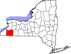 | |
| Towns |
| |
| Villages | ||
| CDPs | ||
| Other hamlets | ||
| Indian reservations | ||
| Footnotes |
| |