El Capitan, Arizona
| El Capitan, Arizona | |
|---|---|
| Census-designated place | |
 El Capitan  El Capitan | |
| Coordinates: 33°14′18″N 110°47′00″W / 33.23833°N 110.78333°WCoordinates: 33°14′18″N 110°47′00″W / 33.23833°N 110.78333°W | |
| Country | United States |
| State | Arizona |
| County | Gila |
| Area[1] | |
| • Total | 6.080 sq mi (15.75 km2) |
| • Land | 6.080 sq mi (15.75 km2) |
| • Water | 0 sq mi (0 km2) |
| Elevation | 4,764 ft (1,452 m) |
| Population (2010) | |
| • Total | 37 |
| • Density | 6.1/sq mi (2.3/km2) |
| Time zone | Mountain (MST) (UTC-7) |
| Area code(s) | 928 |
| GNIS feature ID | 2582779[2] |
El Capitan is a census-designated place in Gila County in the state of Arizona. El Capitan is located approximately 13 miles (21 km) south of the city of Globe. The population as of the 2010 U.S. Census was 37.[3]
Geography
El Capitan is located at 33°14′18″N 110°47′00″W / 33.238343°N 110.783288°W.
According to the U.S. Census Bureau, the community has an area of 6.080 square miles (15.75 km2), all of it land.[1]
References
Municipalities and communities of Gila County, Arizona, United States | ||
|---|---|---|
| City | 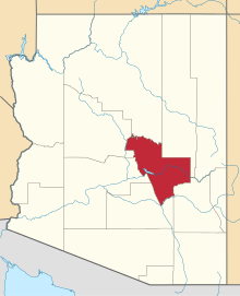 | |
| Towns | ||
| CDPs |
| |
| Unincorporated communities | ||
| Indian reservations | ||
| Ghost towns | ||
| Footnotes | ‡This populated place also has portions in an adjacent county or counties | |
This article is issued from Wikipedia - version of the 10/31/2016. The text is available under the Creative Commons Attribution/Share Alike but additional terms may apply for the media files.