Ekwok, Alaska
| Ekwok, Alaska Iquaq | |
|---|---|
| City | |
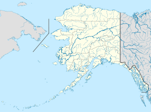 Ekwok Location in Alaska | |
| Coordinates: 59°20′57″N 157°29′7″W / 59.34917°N 157.48528°W | |
| Country | United States |
| State | Alaska |
| Census Area | Dillingham |
| Incorporated | 1974[1] |
| Government | |
| • Mayor | Luki Akelkok, Sr.[2] |
| • State senator | Lyman Hoffman (D) |
| • State rep. | Bryce Edgmon (D) |
| Area | |
| • Total | 17.5 sq mi (45.4 km2) |
| • Land | 16.3 sq mi (42.1 km2) |
| • Water | 1.2 sq mi (3.2 km2) |
| Elevation | 98 ft (30 m) |
| Population (2010) | |
| • Total | 115 |
| • Density | 7/sq mi (2.7/km2) |
| Time zone | Alaska (AKST) (UTC-9) |
| • Summer (DST) | AKDT (UTC-8) |
| ZIP codes | 99580 |
| Area code | 907 |
| FIPS code | 02-21810 |
Ekwok (Iquaq in Central Alaskan Yup'ik) is a city in Dillingham Census Area, Alaska, United States. At the 2010 census the population was 115.[3]
History
Ekwok means "end of the bluff" in Yupik. It is the oldest continuously occupied Yupik village on the Nushagak River. During the 1800s, the settlement was used in the spring and summer as a fish camp, and in the fall as a base camp for picking berries. By 1923, it was the largest settlement along the river.
From the early 1900s until 1941, mail was delivered by dog sled from Dillingham. In 1941 a post office opened in Ekwok. Before 1960, most of the buildings in Ekwok were located in a low area near the river. After a flood in the early 1960s, the village was relocated to its current location.
Geography
Ekwok is located at 59°20′57″N 157°29′7″W / 59.34917°N 157.48528°W (59.349260, -157.485404).[4]
Ekwok is on the Nushagak River in southwestern Alaska, 43 miles (69 km) northeast of Dillingham.
According to the United States Census Bureau, Ekwok has a total area of 17.5 square miles (45.4 km2), of which 16.3 square miles (42.1 km2) is land and 1.2 square miles (3.2 km2), or 7.10%, is water.[3]
Demographics
| Historical population | |||
|---|---|---|---|
| Census | Pop. | %± | |
| 1980 | 77 | — | |
| 1990 | 77 | 0.0% | |
| 2000 | 130 | 68.8% | |
| 2010 | 115 | −11.5% | |
| Est. 2015 | 118 | [5] | 2.6% |
As of the census[7] of 2000, there were 130 people, 42 households, and 29 families residing in the city. The population density was 8.1 people per square mile (3.1/km²). There were 56 housing units at an average density of 3.5 per square mile (1.4/km²). The racial makeup of the city was 6.15% White, 91.54% Native American, and 2.31% from two or more races.
There were 42 households out of which 47.6% had children under the age of 18 living with them, 61.9% were married couples living together, 7.1% had a female householder with no husband present, and 28.6% were non-families. 28.6% of all households were made up of individuals and 4.8% had someone living alone who was 65 years of age or older. The average household size was 3.10 and the average family size was 3.93.
In the city the age distribution of the population shows 43.8% under the age of 18, 3.8% from 18 to 24, 26.2% from 25 to 44, 19.2% from 45 to 64, and 6.9% who were 65 years of age or older. The median age was 32 years. For every 100 females there were 113.1 males. For every 100 females age 18 and over, there were 114.7 males.
The median income for a household in the city was $16,250, and the median income for a family was $20,000. Males had a median income of $38,750 versus $35,750 for females. The per capita income for the city was $11,079. There were 29.2% of families and 32.1% of the population living below the poverty line, including 24.4% of under eighteens and 40.0% of those over 64.
References
- ↑ 1996 Alaska Municipal Officials Directory. Juneau: Alaska Municipal League/Alaska Department of Community and Regional Affairs. January 1996. p. 52.
- ↑ 2015 Alaska Municipal Officials Directory. Juneau: Alaska Municipal League. 2015. p. 58.
- 1 2 "Geographic Identifiers: 2010 Demographic Profile Data (G001): Ekwok city, Alaska". U.S. Census Bureau, American Factfinder. Retrieved October 8, 2015.
- ↑ "US Gazetteer files: 2010, 2000, and 1990". United States Census Bureau. 2011-02-12. Retrieved 2011-04-23.
- ↑ "Annual Estimates of the Resident Population for Incorporated Places: April 1, 2010 to July 1, 2015". Retrieved July 2, 2016.
- ↑ "Census of Population and Housing". Census.gov. Retrieved June 4, 2015.
- ↑ "American FactFinder". United States Census Bureau. Retrieved 2008-01-31.
Coordinates: 59°20′57″N 157°29′07″W / 59.34926°N 157.485404°W
Municipalities and communities of Dillingham Census Area, Alaska, United States | ||
|---|---|---|
| Cities | 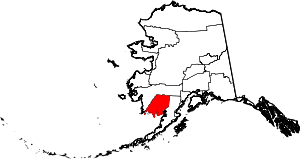 | |
| CDPs | ||
| Unincorporated communities | ||