East Galena Township, Jo Daviess County, Illinois
| East Galena Township | |
|---|---|
| Township | |
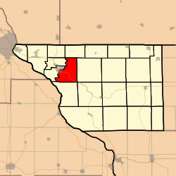 Location in Jo Daviess County | |
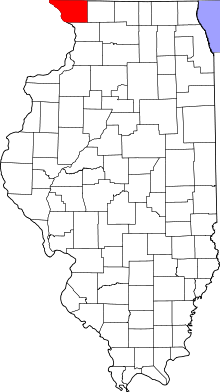 Jo Daviess County's location in Illinois | |
| Coordinates: 42°24′41″N 90°23′30″W / 42.41139°N 90.39167°WCoordinates: 42°24′41″N 90°23′30″W / 42.41139°N 90.39167°W | |
| Country | United States |
| State | Illinois |
| County | Jo Daviess |
| Established | November 2, 1852 |
| Government | |
| • Supervisor | Carlene H. Stephenson |
| Area | |
| • Total | 23.38 sq mi (60.6 km2) |
| • Land | 23.22 sq mi (60.1 km2) |
| • Water | 0.16 sq mi (0.4 km2) 0.68% |
| Elevation | 738 ft (225 m) |
| Population (2010) | |
| • Total | 1,283 |
| • Density | 55.2/sq mi (21.3/km2) |
| Time zone | CST (UTC-6) |
| • Summer (DST) | CDT (UTC-5) |
| ZIP codes | 61036, 61075 |
| GNIS feature ID | 0428933 |
East Galena Township is one of twenty-three townships in Jo Daviess County, Illinois, USA. As of the 2010 census, its population was 1,283 and it contained 917 housing units.[1]
Geography
According to the 2010 census, the township has a total area of 23.38 square miles (60.6 km2), of which 23.22 square miles (60.1 km2) (or 99.32%) is land and 0.16 square miles (0.41 km2) (or 0.68%) is water.[1]
Cities, towns, villages
Adjacent townships
- Council Hill Township (northeast)
- Guilford Township (east)
- Elizabeth Township (southeast)
- Rice Township (south)
- West Galena Township (west)
- Rawlins Township (northwest)
Cemeteries
The township contains these two cemeteries: Miners Chapel and Saint Michaels.
Major highways
Airports and landing strips
- Heller Airport
Landmarks
- Grant Park
- The Galena Territory
School districts
- Galena Unit School District 120
- Scales Mound Community Unit School District 211
Political districts
- Illinois' 16th congressional district
- State House District 89
- State Senate District 45
References
- "East Galena Township, Jo Daviess County, Illinois". Geographic Names Information System. United States Geological Survey. Retrieved 2010-01-17.
- United States Census Bureau 2007 TIGER/Line Shapefiles
- United States National Atlas
- 1 2 "Population, Housing Units, Area, and Density: 2010 - County -- County Subdivision and Place -- 2010 Census Summary File 1". United States Census. Retrieved 2013-05-28.
External links
- Jo Daviess County official site
- City-Data.com
- Illinois State Archives
- Township Officials of Illinois
Municipalities and communities of Jo Daviess County, Illinois, United States | ||
|---|---|---|
| Cities | ||
| Villages | ||
| Townships | ||
| CDPs | ||
| Other unincorporated communities | ||
| Ghost town | ||
This article is issued from Wikipedia - version of the 7/16/2016. The text is available under the Creative Commons Attribution/Share Alike but additional terms may apply for the media files.