Earlton, Kansas
| Earlton, Kansas | |
|---|---|
| City | |
 Location within Neosho County and Kansas | |
 KDOT map of Neosho County (legend) | |
| Coordinates: 37°35′15″N 95°28′10″W / 37.58750°N 95.46944°WCoordinates: 37°35′15″N 95°28′10″W / 37.58750°N 95.46944°W | |
| Country | United States |
| State | Kansas |
| County | Neosho |
| Area[1] | |
| • Total | 0.15 sq mi (0.39 km2) |
| • Land | 0.15 sq mi (0.39 km2) |
| • Water | 0 sq mi (0 km2) |
| Elevation | 958 ft (292 m) |
| Population (2010)[2] | |
| • Total | 55 |
| • Estimate (2012[3]) | 54 |
| • Density | 366.7/sq mi (141.6/km2) |
| Time zone | Central (CST) (UTC-6) |
| • Summer (DST) | CDT (UTC-5) |
| ZIP code | 66720 |
| Area code(s) | 620 |
| FIPS code | 20-19275[4] |
| GNIS feature ID | 0475107[5] |
Earlton is a city in Neosho County, Kansas, United States. As of the 2010 census, the city population was 55.[6]
History
Earlton (or Earleton) was founded in 1870. Not much progress in the village was made until about 1876 when a railroad depot was built there.[7]
A post office was opened in Earlton (at first called Earleton) in 1871, and remained in operation until it was discontinued in 1976.[8]
Geography
Earlton is located at 37°35′15″N 95°28′10″W / 37.58750°N 95.46944°W (37.587366, -95.469472),[9] placing it in the south east of Kansas. According to the United States Census Bureau, the city has a total area of 0.15 square miles (0.39 km2), all of it land.[1]
Demographics
| Historical population | |||
|---|---|---|---|
| Census | Pop. | %± | |
| 1880 | 43 | — | |
| 1920 | 381 | — | |
| 1930 | 166 | −56.4% | |
| 1940 | 174 | 4.8% | |
| 1950 | 141 | −19.0% | |
| 1960 | 104 | −26.2% | |
| 1970 | 102 | −1.9% | |
| 1980 | 79 | −22.5% | |
| 1990 | 69 | −12.7% | |
| 2000 | 80 | 15.9% | |
| 2010 | 55 | −31.2% | |
| Est. 2015 | 53 | [10] | −3.6% |
| U.S. Decennial Census | |||
2010 census
As of the census[2] of 2010, there were 55 people, 23 households, and 17 families residing in the city. The population density was 366.7 inhabitants per square mile (141.6/km2). There were 35 housing units at an average density of 233.3 per square mile (90.1/km2). The racial makeup of the city was 96.4% White, 1.8% Native American, and 1.8% from two or more races.
There were 23 households of which 30.4% had children under the age of 18 living with them, 65.2% were married couples living together, 8.7% had a male householder with no wife present, and 26.1% were non-families. 21.7% of all households were made up of individuals and 17.4% had someone living alone who was 65 years of age or older. The average household size was 2.39 and the average family size was 2.82.
The median age in the city was 46.5 years. 21.8% of residents were under the age of 18; 1.8% were between the ages of 18 and 24; 25.6% were from 25 to 44; 29.2% were from 45 to 64; and 21.8% were 65 years of age or older. The gender makeup of the city was 45.5% male and 54.5% female.
2000 census
As of the census[4] of 2000, there were 80 people, 32 households, and 23 families residing in the city. The population density was 565.3 people per square mile (220.6/km²). There were 34 housing units at an average density of 240.2 per square mile (93.8/km²). The racial makeup of the city was 95.00% White and 5.00% Native American.
There were 32 households out of which 31.3% had children under the age of 18 living with them, 62.5% were married couples living together, 6.3% had a female householder with no husband present, and 28.1% were non-families. 21.9% of all households were made up of individuals and 12.5% had someone living alone who was 65 years of age or older. The average household size was 2.50 and the average family size was 2.96.
In the city the population was spread out with 22.5% under the age of 18, 12.5% from 18 to 24, 26.3% from 25 to 44, 20.0% from 45 to 64, and 18.8% who were 65 years of age or older. The median age was 36 years. For every 100 females there were 90.5 males. For every 100 females age 18 and over, there were 100.0 males.
The median income for a household in the city was $46,250, and the median income for a family was $70,625. Males had a median income of $27,083 versus $28,750 for females. The per capita income for the city was $19,421. There were no families and 7.0% of the population living below the poverty line, including no under eighteens and none of those over 64.
References
- 1 2 "US Gazetteer files 2010". United States Census Bureau. Retrieved 2012-07-06.
- 1 2 "American FactFinder". United States Census Bureau. Retrieved 2012-07-06.
- ↑ "Population Estimates". United States Census Bureau. Retrieved 2013-05-29.
- 1 2 "American FactFinder". United States Census Bureau. Retrieved 2008-01-31.
- ↑ "US Board on Geographic Names". United States Geological Survey. 2007-10-25. Retrieved 2008-01-31.
- ↑ "2010 City Population and Housing Occupancy Status". U.S. Census Bureau. Retrieved March 19, 2012.
- ↑ Blackmar, Frank Wilson (1912). Kansas: A Cyclopedia of State History, Embracing Events, Institutions, Industries, Counties, Cities, Towns, Prominent Persons, Etc. Standard Publishing Company. p. 557.
- ↑ "Kansas Post Offices, 1828-1961 (archived)". Kansas Historical Society. Archived from the original on October 9, 2013. Retrieved 20 June 2014.
- ↑ "US Gazetteer files: 2010, 2000, and 1990". United States Census Bureau. 2011-02-12. Retrieved 2011-04-23.
- ↑ "Annual Estimates of the Resident Population for Incorporated Places: April 1, 2010 to July 1, 2015". Retrieved July 2, 2016.
External links
| Wikimedia Commons has media related to Earlton, Kansas. |
- City
- Schools
- USD 413, local school district
- Maps
- Earlton City Map, KDOT
Municipalities and communities of Neosho County, Kansas, United States | ||
|---|---|---|
| Cities | 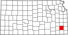 | |
| Unincorporated communities | ||
| Civil townships | ||