Drysdale, Arizona
| Drysdale, Arizona | |
|---|---|
| CDP | |
 Drysdale  Drysdale Location within the state of Arizona | |
| Coordinates: 32°38′43″N 114°42′24″W / 32.64528°N 114.70667°WCoordinates: 32°38′43″N 114°42′24″W / 32.64528°N 114.70667°W | |
| Country | United States |
| State | Arizona |
| County | Yuma |
| Area | |
| • Total | 0.16 sq mi (0.41 km2) |
| • Land | 0.16 sq mi (0.41 km2) |
| • Water | 0.0 sq mi (0.0 km2) |
| Elevation[1] | 108 ft (33 m) |
| Population (2010) | |
| • Total | 272 |
| • Density | 1,700/sq mi (663.4/km2) |
| Time zone | MST (UTC-7) |
| Area code(s) | 928 |
| FIPS code | 04-20570 |
| GNIS feature ID | 2582776 |
Drysdale is a census-designated place (CDP) in Yuma County, Arizona, United States. The population was 14 at the 2010 census.
Geography
Drysdale is located at 32°38′43″N 114°42′24″W / 32.64528°N 114.70667°W (32.645234, -114.706782). According to the United States Geological Survey, the CDP has a total area of 0.16 square miles (0.41 km2), all of it land.[1][2]
Demographics
As of the 2010 census, there were 272 people residing in the CDP: 130 male and 142 female. 98 were 19 years old or younger, 50 were ages 20-34, 43 were between the ages of 35 and 49, 50 were between 50 and 64, and the remaining 31 were aged 65 and above. The median age was 59.0 years.
The racial makeup of the CDP was 55.9% White, 1.8% American Indian, and 42.3% Other. 90.8% of the population were Hispanic or Latino of any race.
There were 74 households in the CDP, 62 family households (83.8%) and 12 non-family households (16.2%), with an average household size of 3.68. Of the family households, all 50 were married couples living together, while the non-family households included 10 adults living alone: 7 male and 3 female.
The CDP contained 84 housing units, of which 74 were occupied and 10 were vacant. [3]
References
- 1 2 "Feature Detail Report for: Drysdale Census Designated Place". Geographic Names Information System. United States Geological Survey.
- ↑ "Drysdale CDP, Arizona - Basic Facts". AZ Hometown Locator. Retrieved November 14, 2016.
- ↑ "American FactFinder: Drysdale CDP, Arizona". United States Census Bureau. Retrieved November 14, 2016.
Municipalities and communities of Yuma County, Arizona, United States | ||
|---|---|---|
| Cities | 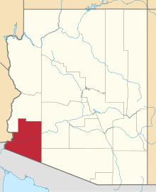 | |
| Town | ||
| CDPs |
| |
| Unincorporated communities | ||
| Indian reservations | ||
| Ghost towns | ||
| Footnotes | ‡This populated place also has portions in an adjacent county or counties | |