Drayton, North Dakota
| Drayton, North Dakota | |
|---|---|
| City | |
|
Drayton Drug in Downtown Drayton | |
|
Nickname(s): "Baseball Capital of North Dakota" "Catfish Capital of the North"[1] | |
 Location of Drayton, North Dakota | |
| Coordinates: 48°33′40″N 97°10′46″W / 48.56111°N 97.17944°WCoordinates: 48°33′40″N 97°10′46″W / 48.56111°N 97.17944°W | |
| Country | United States |
| State | North Dakota |
| County | Pembina |
| Founded | 1878 |
| Area[2] | |
| • Total | 0.65 sq mi (1.68 km2) |
| • Land | 0.65 sq mi (1.68 km2) |
| • Water | 0 sq mi (0 km2) |
| Elevation | 801 ft (244 m) |
| Population (2010)[3] | |
| • Total | 824 |
| • Estimate (2015)[4] | 785 |
| • Density | 1,267.7/sq mi (489.5/km2) |
| Time zone | Central (CST) (UTC-6) |
| • Summer (DST) | CDT (UTC-5) |
| ZIP code | 58225 |
| Area code(s) | 701 |
| FIPS code | 38-20340 |
| GNIS feature ID | 1028722[5] |
| Website | www.draytonnd.com |

Drayton is a city in Pembina County, North Dakota, United States. The population was 824 at the 2010 census.[6] Drayton was founded in 1878.
Geography
Drayton is located at 48°33′40″N 97°10′46″W / 48.56111°N 97.17944°W (48.561091, -97.179414).[7]
According to the United States Census Bureau, the city has a total area of 0.65 square miles (1.68 km2), all of it land.[2]
History
Drayton was originally called Hastings Landing. It was given its present name by Canadian settlers from Drayton, Ontario. A drawbridge, built in anticipation of riverboat traffic returning to the upper Red River, was built in 1911 to connect Drayton to Minnesota. Because of low river levels the riverboats never materialized, with the result that the drawbridge never needed to be raised.[8]
Economy
The main employer in the area is American Crystal Sugar, which operates a sugar refinery on the outskirts of town, providing 140 year round and 75 seasonal jobs.[9]
Demographics
| Historical population | |||
|---|---|---|---|
| Census | Pop. | %± | |
| 1880 | 62 | — | |
| 1890 | 318 | 412.9% | |
| 1900 | 688 | 116.4% | |
| 1910 | 587 | −14.7% | |
| 1920 | 637 | 8.5% | |
| 1930 | 502 | −21.2% | |
| 1940 | 688 | 37.1% | |
| 1950 | 875 | 27.2% | |
| 1960 | 940 | 7.4% | |
| 1970 | 1,095 | 16.5% | |
| 1980 | 1,082 | −1.2% | |
| 1990 | 961 | −11.2% | |
| 2000 | 913 | −5.0% | |
| 2010 | 824 | −9.7% | |
| Est. 2015 | 785 | [10] | −4.7% |
| U.S. Decennial Census[11] 2015 Estimate[4] | |||
2010 census
As of the census[3] of 2010, there were 824 people, 389 households, and 225 families residing in the city. The population density was 1,267.7 inhabitants per square mile (489.5/km2). There were 422 housing units at an average density of 649.2 per square mile (250.7/km2). The racial makeup of the city was 98.3% White, 0.4% African American, 0.6% Native American, 0.1% from other races, and 0.6% from two or more races. Hispanic or Latino of any race were 1.5% of the population.
There were 389 households of which 22.9% had children under the age of 18 living with them, 48.6% were married couples living together, 5.7% had a female householder with no husband present, 3.6% had a male householder with no wife present, and 42.2% were non-families. 35.0% of all households were made up of individuals and 16.5% had someone living alone who was 65 years of age or older. The average household size was 2.12 and the average family size was 2.72.
The median age in the city was 45.9 years. 20.5% of residents were under the age of 18; 5.4% were between the ages of 18 and 24; 22.7% were from 25 to 44; 32% were from 45 to 64; and 19.5% were 65 years of age or older. The gender makeup of the city was 53.4% male and 46.6% female.
2000 census
As of the census of 2000, there were 913 people, 401 households, and 249 families residing in the city. The population density was 1,548.9 people per square mile (597.5/km²). There were 440 housing units at an average density of 746.5 per square mile (287.9/km²). The racial makeup of the city was 97.81% White, 0.22% Native American, 0.66% from other races, and 1.31% from two or more races. Hispanic or Latino of any race were 2.08% of the population.
There were 401 households out of which 29.4% had children under the age of 18 living with them, 52.6% were married couples living together, 5.5% had a female householder with no husband present, and 37.9% were non-families. 35.2% of all households were made up of individuals and 18.7% had someone living alone who was 65 years of age or older. The average household size was 2.28 and the average family size was 2.95.
In the city the population was spread out with 25.4% under the age of 18, 5.4% from 18 to 24, 27.3% from 25 to 44, 22.3% from 45 to 64, and 19.6% who were 65 years of age or older. The median age was 40 years. For every 100 females there were 103.3 males. For every 100 females age 18 and over, there were 103.3 males.
According to the 2000 census, the median income for a household in the city was $37,344, and the median income for a family was $46,484. Males had a median income of $35,543 versus $18,750 for females. The per capita income for the city was $17,211. About 8.5% of families and 10.6% of the population were below the poverty line, including 12.9% of those under age 18 and 12.1% of those age 65 or over.
Baseball Capital of North Dakota
In 1958, Governor John Davis declared Drayton the baseball capital of North Dakota. Drayton won the state High School baseball championship every year from 1958 to 1963. In 1958 and 1962, Drayton also won the American Legion class A championship. After winning the state title in 1958, they went on to win the multi-state regional championship. These wins made Drayton the smallest town to win both the state and regional class A titles.[1]
Climate
This climatic region is typified by large seasonal temperature differences, with warm to hot (and often humid) summers and cold (sometimes severely cold) winters. According to the Köppen Climate Classification system, Drayton has a humid continental climate, abbreviated "Dfb" on climate maps.[12]
References
- 1 2 "Baseball Capital of ND". City of Drayton, North Dakota. Retrieved 4 March 2011.
- 1 2 "US Gazetteer files 2010". United States Census Bureau. Retrieved 2012-06-14.
- 1 2 "American FactFinder". United States Census Bureau. Retrieved 2012-06-14.
- 1 2 "Population Estimates". United States Census Bureau. Retrieved June 26, 2016.
- ↑ "US Board on Geographic Names". United States Geological Survey. 2007-10-25. Retrieved 2008-01-31.
- ↑ "2010 Census Redistricting Data (Public Law 94-171) Summary File". American FactFinder. United States Census Bureau. Retrieved 2 May 2011.
- ↑ "US Gazetteer files: 2010, 2000, and 1990". United States Census Bureau. 2011-02-12. Retrieved 2011-04-23.
- ↑ Federal Writer's Project of the Works Progress Administration for the State of North Dakota (1977). The WPA Guide To 1930s North Dakota (2nd ed.). State Historical Society of North Dakota. p. 188. ISBN 1891419145.
- ↑ "Drayton Factory Specs". Cooperative Profile. American Crystal Sugar Company. Retrieved 4 March 2011.
- ↑ "Annual Estimates of the Resident Population for Incorporated Places: April 1, 2010 to July 1, 2015". Retrieved July 2, 2016.
- ↑ United States Census Bureau. "Census of Population and Housing". Retrieved August 30, 2013.
- ↑ Climate Summary for Drayton, North Dakota
External links
- Pioneer Women's Histories: Drayton and Bowesmont from the Digital Horizons website
- Drayton, North Dakota: community fact survey (1965) from the Digital Horizons website
Municipalities and communities of Pembina County, North Dakota, United States | ||
|---|---|---|
| Cities | 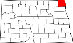 | |
| Townships |
| |
| Unincorporated communities | ||